Good morning everyone!
This weather headlines for this week include…the continuation of the unsettled pattern through tomorrow and a pattern change timed perfectly with the arrival of summer!
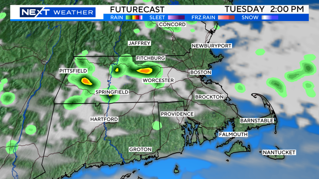
Still trying to shake the unsettled pattern we have been in…we will see periods of clouds and a few showers today and again on Tuesday. Temperatures will remain below average as well in that time frame.
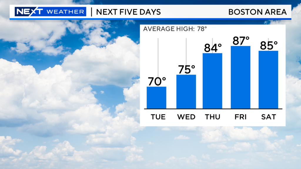
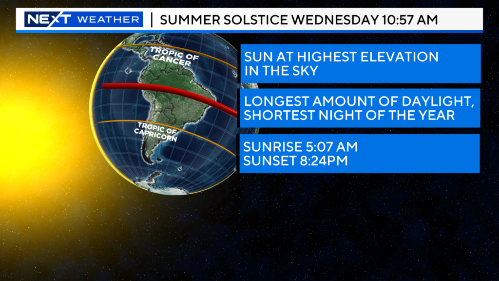
Wouldn’t you know, just as the summer solstice arrives on Wednesday, the temperatures will begin to rise! Check out the forecast highs for the end of the week!
Something else you will be hearing about in the coming days…a rare, developing tropical system tracking across the Atlantic.
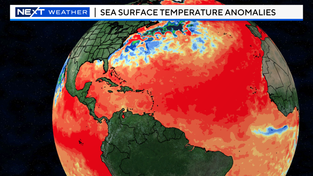
We typically don’t see tropical systems developing off the African Coast and making the long trek towards the Caribbean in the month of June. However, the Atlantic Ocean sea surface temperatures are so warm compared to average, the “fuel” is already there for these storms to develop.
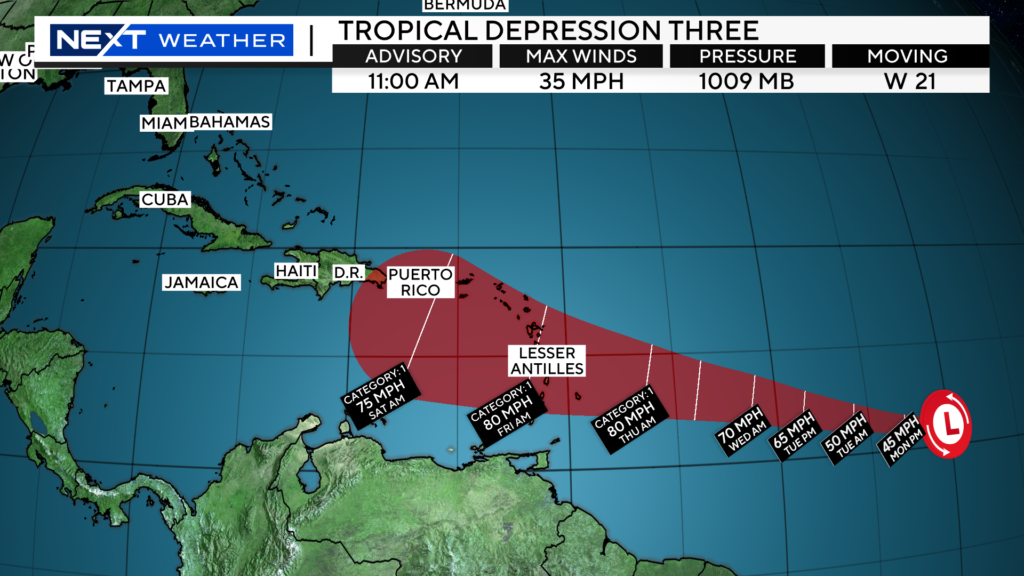
And, as of 11am today we now have a tropical depression. It is forecast to become a hurricane (Bret) and be near the Caribbean Island chain later this week
Click here for Westford snow storm data and past totals or select “Winter Snowfall“ under “Pages” on the left hand side.
For more up to date forecast information follow me on Twitter (@terrywbz) or follow the WBZ weather team on Facebook, search WBZWeather


Reader Comments