Happy World Oceans Day!
Also, today, the National Weather Service has officially declared the start of El Nino…more on that below…
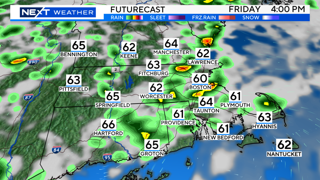
I guess this is where I have to talk about our weather, something I would rather avoid at this point. This gloomy stretch is getting old! Today, much like yesterday and the day before and the day before, will be mainly cloudy, cool and showery. Highs generally in the 60s. Not expecting any severe weather, but certainly another day watching radar with additional showers and a few downpours popping this afternoon and evening.
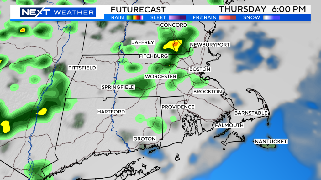
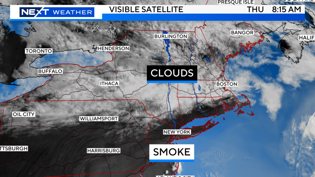
At least most of the wildfire smoke has been pushed south of New England. While there could be a little bit of haze around here and there through tomorrow, the weather story will be more about the clouds. There are still air quality alerts up for portions of western MA.
Ditto on tomorrow…lots of clouds and actually more numerous showers popping in the PM.
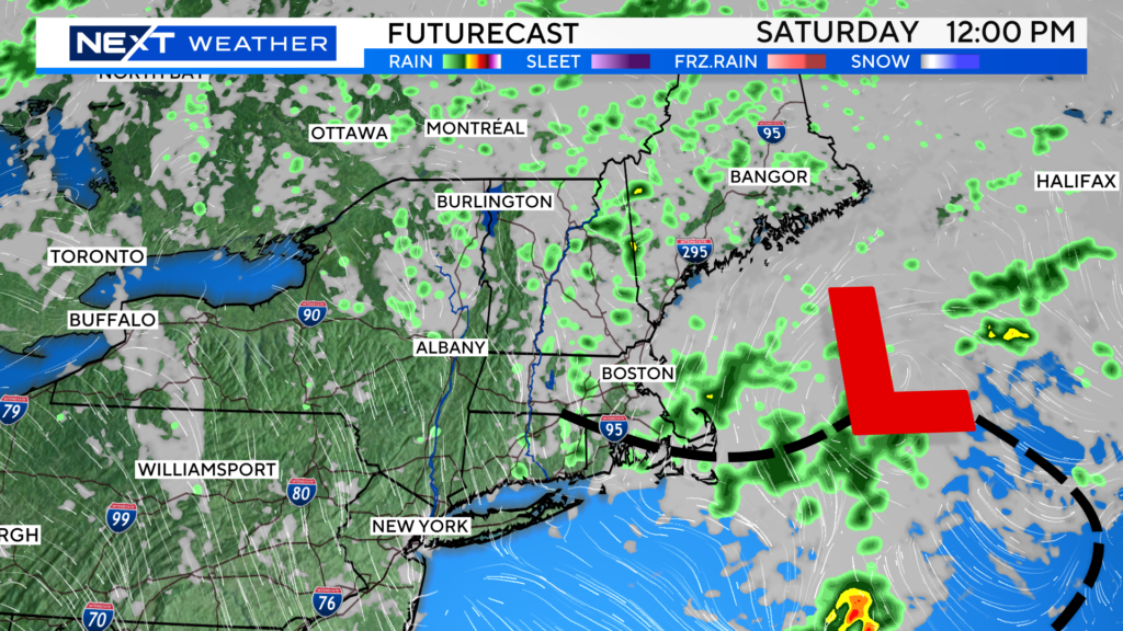
On Saturday, we get one final spoke of moisture as the area of unsettled weather finally starts to move away. I think any showers that pop Saturday will be centered along the Coastline and in eastern MA.
SUNDAY SUNDAY SUNDAY!!!!
Let’s go! Finally, we should get a sunny and warm day!
Temperatures will approach 80 degrees Sunday afternoon. Even if it is just for 1 day, it sure will be nice!
Yup I said it…next week looks like we may slip back into another unsettled, wet pattern…at least through the first half of the week. Blah.
EL Nino Blog…
It’s baaaack…..
Are you ready for this summer’s weather “buzz” word? Today, NOAA has officially declared that El Nino has emerged.
El Nino is a naturally occurring, climate phenomenon that typically occurs on a cycle of about 7 years of so.
It is most noticeable off the coast of South America by the emergence of warmer than average sea-surface temperatures.
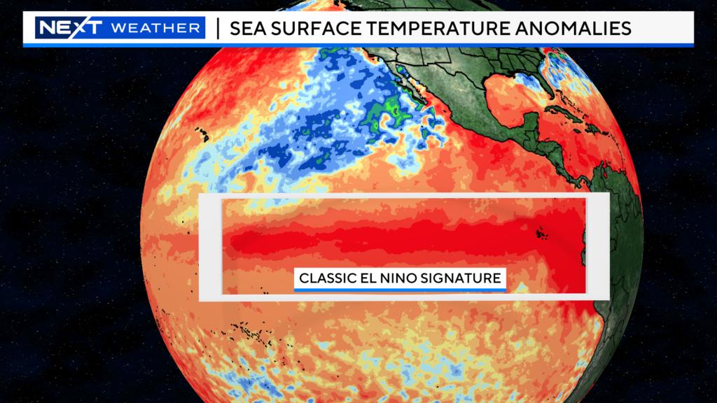
So, what does this mean? El Nino often has major weather implications around the world from floods in some areas to droughts in others. It also tends to raise the average global temperatures as well, often leading to record-setting high temperatures in many areas.
It’s impacts locally in the summer are hard to quantify, but most times, El Nino’s tend to suppress the Atlantic hurricane season.
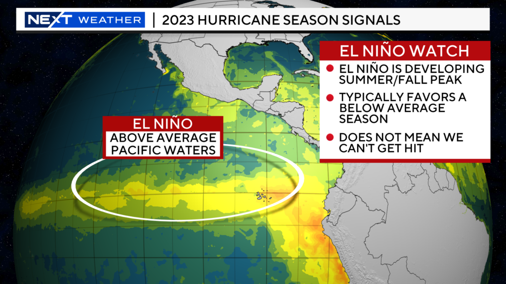
El Nino’s cause a lot more wind shear in regions like the Gulf of Mexico and Caribbean, the regions where many of our hurricanes tend to form or strengthen. So, taken alone, this COULD mean a quieter hurricane season in 2023. However, the sea surface temperatures in the Caribbean and much of the Atlantic are also quite warm right now compared to averages. This warm water is the main driver and fuel for developing tropical systems. Hence, most experts have called for a near normal hurricane season, taking a balance of the two opposing signals.
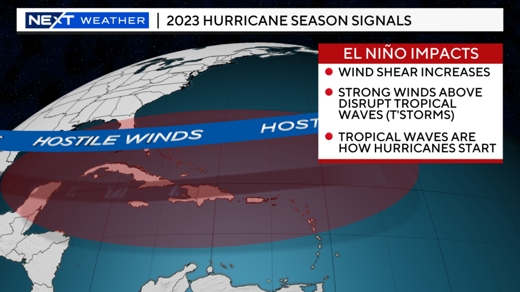
The forecast is for a weak/developing El Nino this summer and for a moderate to strong El Nino by this fall and winter. Historically, strong El Nino’s have had major impacts on our winters here in New England. Unfortunately, it is not a simple correlation.
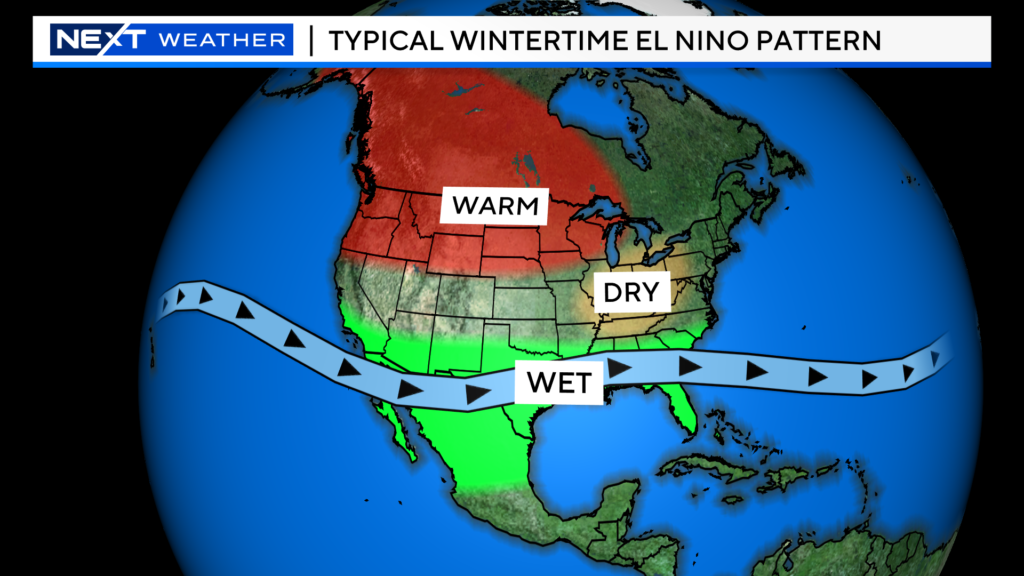
Below, you can see what a typical El Nino winter looks like in the United States…warmer across much of the northern-tier and wetter to the south. In New England, it often depends on the strength and location of the El Nino.
In general, New England winters during an El Nino tend to be warmer and wetter than average. Some of our least snowy winters have correlated with strong El Nino’s.
If you are a snow lover or skier, don’t go home yet…A strong El Nino does not always mean a paltry snow year for us. A lot will depend on the precise location and strength of the El Nino, something we will be watching over the next several months.
One thing is for sure, you will hear a LOT more about El Nino in the weeks and months to come, locally and globally. It is always a headline maker.
Click here for Westford snow storm data and past totals or select “Winter Snowfall“ under “Pages” on the left hand side.
For more up to date forecast information follow me on Twitter (@terrywbz) or follow the WBZ weather team on Facebook, search WBZWeather


Reader Comments