


Happy Wednesday! Halfway through the week!
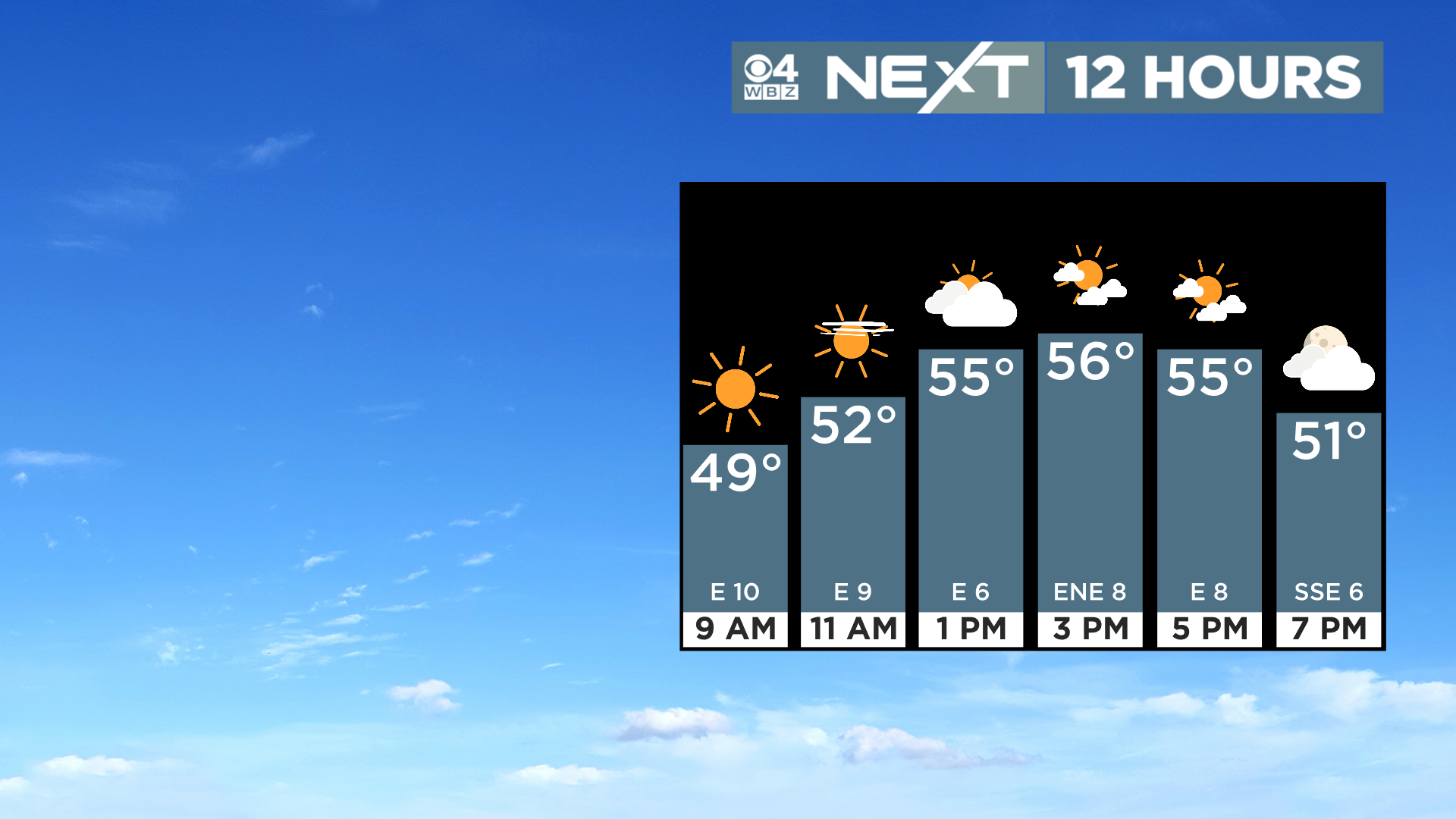
We have another pretty nice March day on tap today, albeit a tad cooler and cloudier than yesterday’s beauty. Highs this afternoon will reach the mid 50s in most areas with a gradual increase in cloudiness.
We cloud up tonight and a few sprinkles arrive very late.
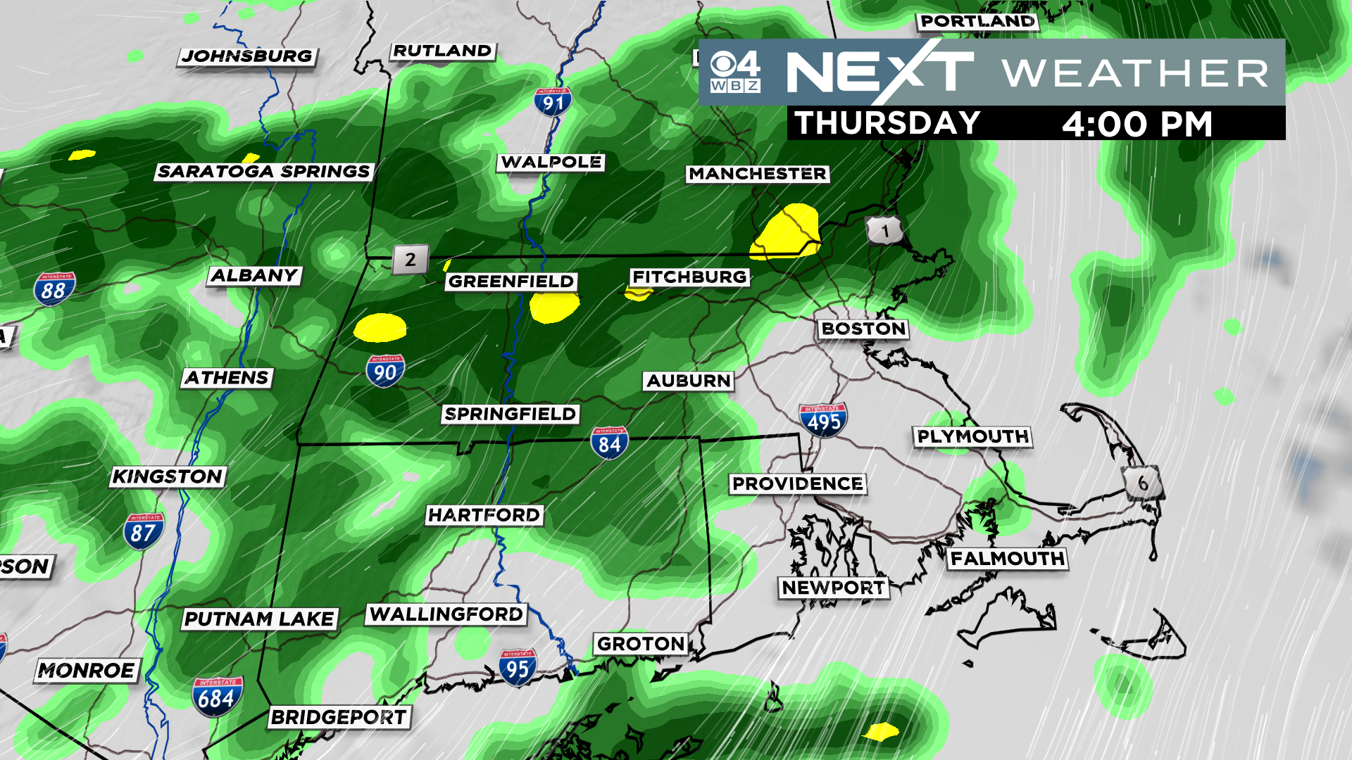
Thursday will be a grey day with off and on rain showers. Very low impact, just kind of a gloomy day.
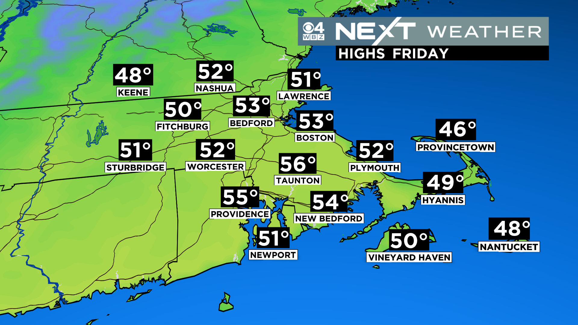
We get a break on Friday, between storms…Partly sunny skies with highs a bit above the average in the low 50s
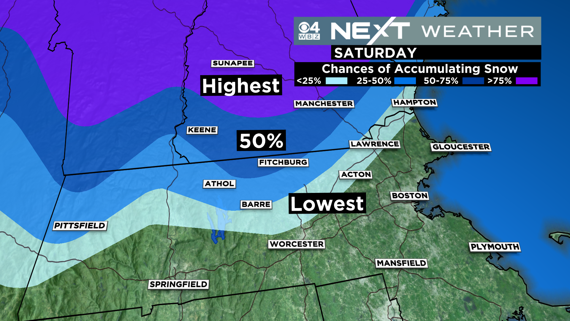
Saturday will be stormy…rain/mix arrives midday/afternoon and contonues through the first half of the night. Looks like mostly a chilly rain in eastern MA with some mixing with sleet and wet snow well northwest, mainly in the Worcester hills and Berkshires.
There is a chance of a small snow accumulation in those areas.
Some clouds will likely linger on Sunday and temperatures will be on the cooler side between 45-50.
Click here for Westford snow storm data and past totals or select “Winter Snowfall“ under “Pages” on the left hand side.
For more up to date forecast information follow me on Twitter (@terrywbz) or follow the WBZ weather team on Facebook, search WBZWeather
Reader Comments