


Friday looks pretty good! There will be a mix of sun and clouds and temperatures will generally be a few degrees above the average for this time of year.
Yep, the rumors are true…winter is NOT done with us just yet. The sun is getting higher in the sky, the sunsets are now after 7pm BUT, there is still snow in the forecast.
This will NOT be a major winter storm, but there will likely be some snow and sleet in parts of southern New England on Saturday.
TIMELINE:
Saturday morning…clouds thicken up, few flakes or drops in western MA.
Saturday afternoon…The storm moves in…light rain arrives in eastern MA and a mix of sleet and snow begins in the higher elevations of Worcester county and the Berkshires.
Saturday evening…if you have plans to go out Saturday night, be advised that it will be rather miserable out. For much of eastern MA, a cold rain will be falling, perhaps mixing with some sleet pellets at times. In the elevated areas it will be a mix of sleet and rain. Temperatures will be near or a few degrees above freezing so we are not expecting any significant accumulation or travel issues.
Saturday night into Sunday AM…Steadiest rain and sleet taper off after midnight. By Sunday morning there will just be a few leftover sprinkles.

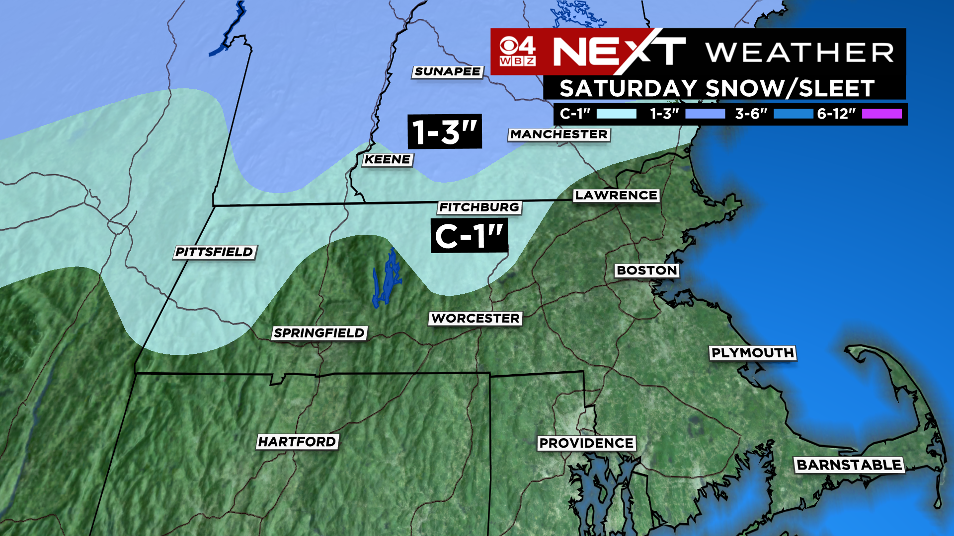
SNOW/SLEET AMOUNTS:
Best chance of a light coating, up to an inch, is in the Berkshires and highest elevations in northern Worcester county and southwestern New Hampshire. I don’t think there will be much snow in these areas, likely more sleet. To see an inch or more of snow, you would have to head farther north into the Greens and Whites.
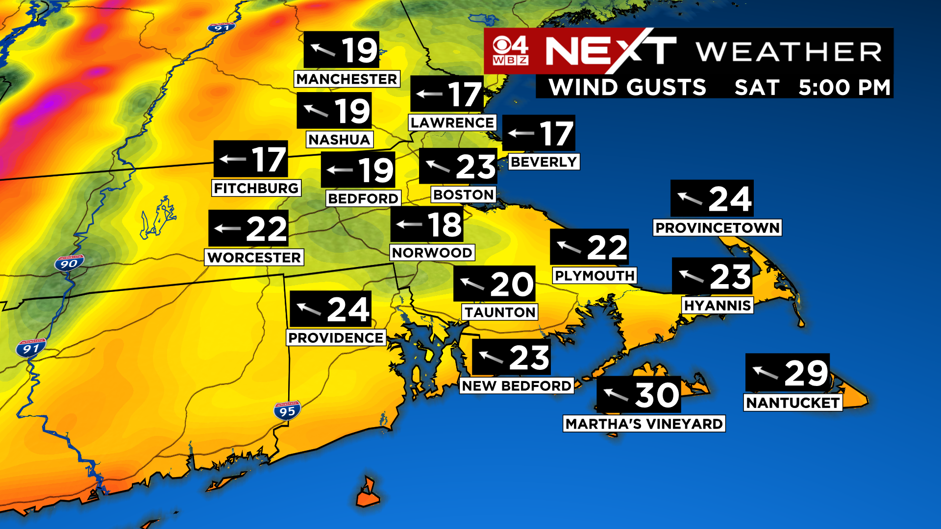
It will also be a bit gusty Saturday afternoon and night. East-southeast winds will peak out between 20-35 mph. Not concerned about any wind damage, but enough to add to the misery level if you are out and about.
Looking farther ahead, the stormy pattern will likely continue. It appears we will have at a least a few more chances for wintry-mix events, the first one coming around Wednesday of next week. Not ready to stick a fork in winter just yet.
Click here for Westford snow storm data and past totals or select “Winter Snowfall“ under “Pages” on the left hand side.
For more up to date forecast information follow me on Twitter (@terrywbz) or follow the WBZ weather team on Facebook, search WBZWeather
Reader Comments