The March Nor’easter is heading out to sea, another one in the books.
Wanna be a meteorologist? In my mind there is no place more challenging, humbling and rewarding than New England. Take yesterday’s storm…Within about 40 miles you have two completely different experiences.
In Boston, a soaking rain for most of the day, ending with a snow squall just before midnight…total of 0.5″ of snow.
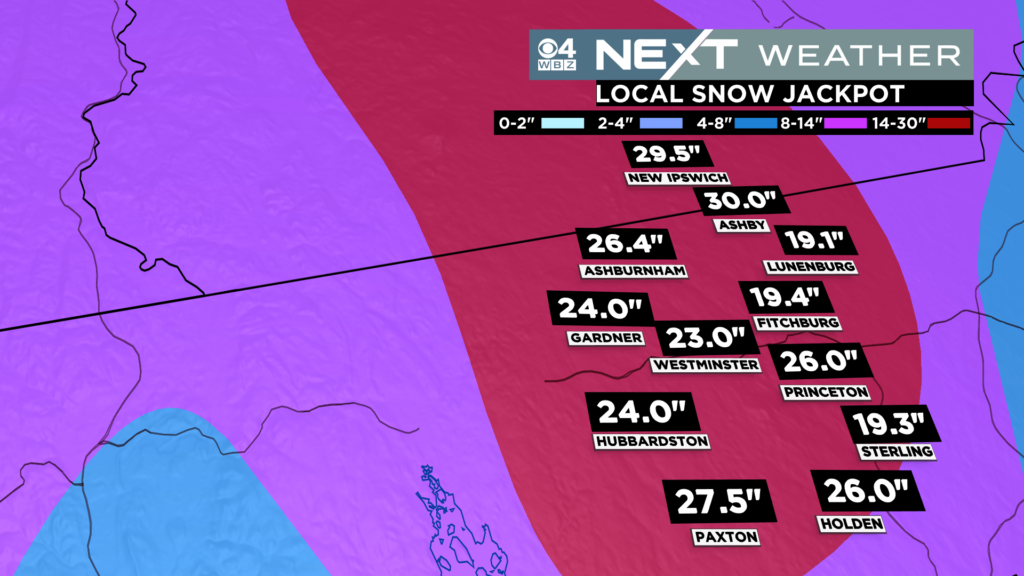
In Ashby, an historic snowstorm, 30″ of heavy, wet snow, and a town-wide loss of power
In-between, a little of everything
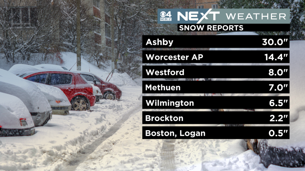
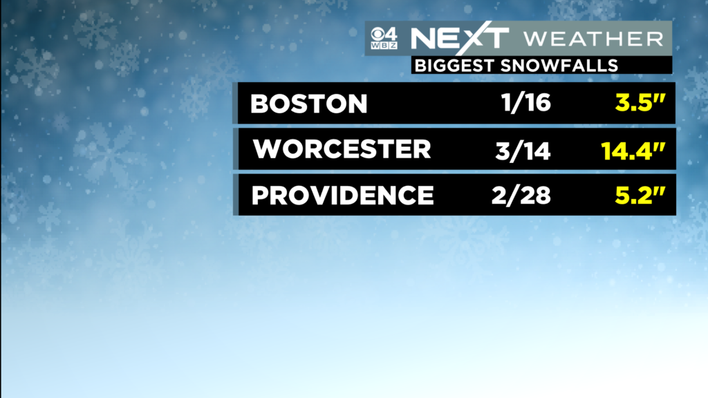
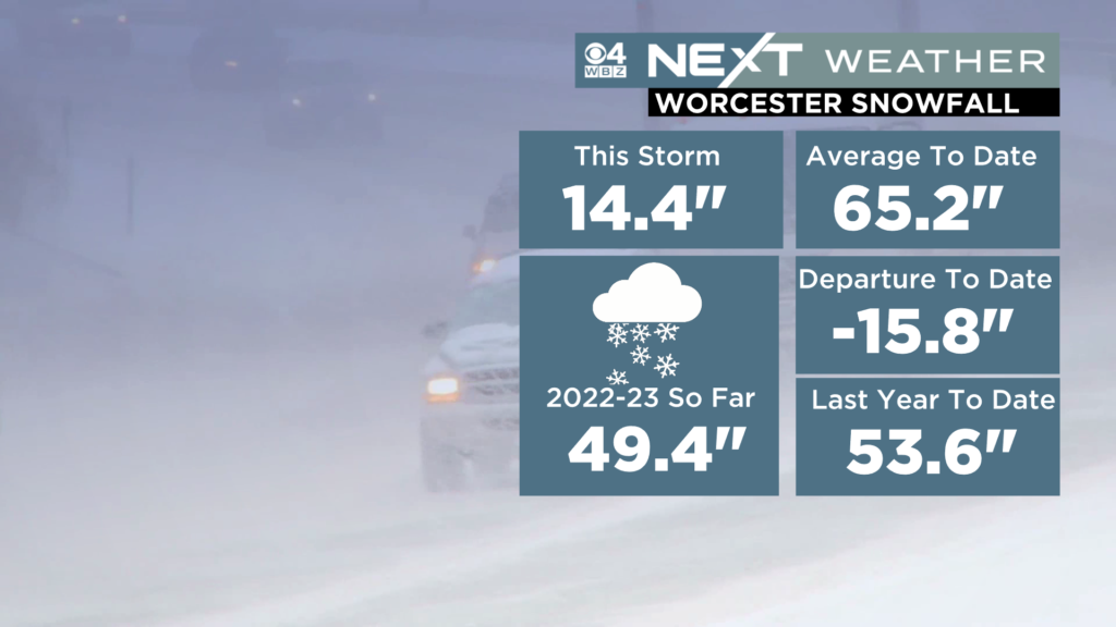
This was the biggest snowstorm of the winter in Worcester but barely made a blip in Boston, where the “biggest” storm of the winter remains the 3.5″ on January 16th.
Check out these snow totals from our local jackpot area, northern Worcester county…
Again, the reason for this, elevation. This is a very hilly portion of our state with several towns cresting near or over 1,000 feet. With easterly winds you get an upslope component in a storm like yesterday, which helps to “wring out” more moisture. Also, the temperatures typically get colder with height in our atmosphere and on a day like yesterday, every degree counts!
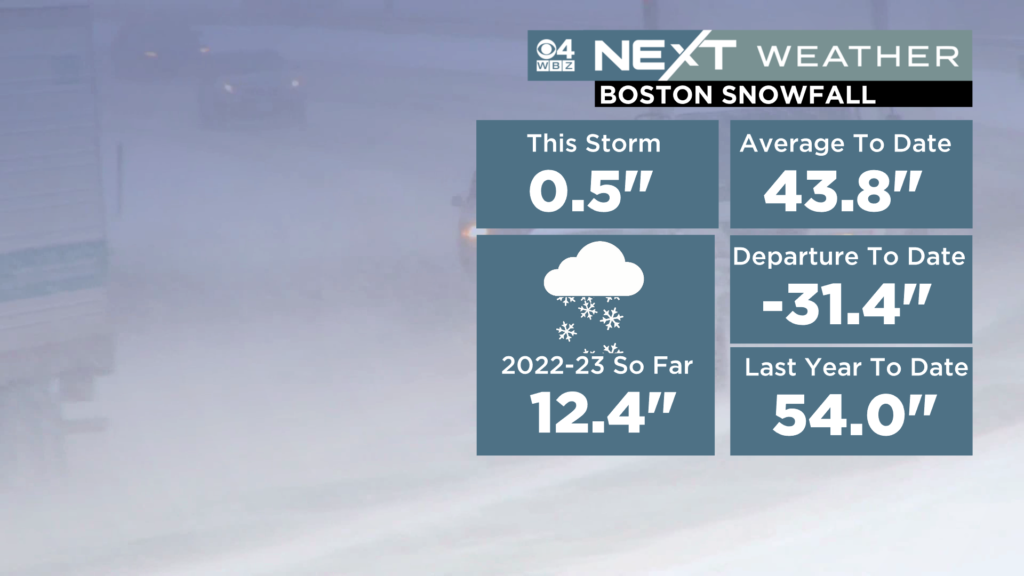
So where are we at for the winter as a whole? You may recall an oddity to last winter when Boston actually got more snow than Worcester. That certainly is not happening this winter.
Boston stands well over 2 feet below the average to date and, in fact, the 12.4″ of total snow is the 7th least on record to date in the City’s recorded history.
Worcester has a more respectable total, nearing 50″ for the season and is just a little more than a foot under the average to date.
The obvious question on March 15th after a snowstorm, are we done? Is it time to stick a fork in winter?
The simple, short, to the point answer…
NO.
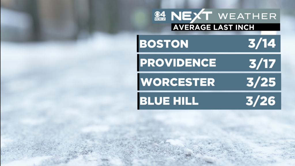
Looking at the averages…Boston’s typical last inch of snow, oddly enough, is on March 14th (yesterday)!
For the last measurable snow overall (0.1″ or higher), Boston averages March 29th.
These dates are obviously a few weeks later in Worcester and points north and west.
Having said that, many years we wrap things up early, including last year when our last snow in Boston was on March 12th.
This does NOT feel like one of those years.
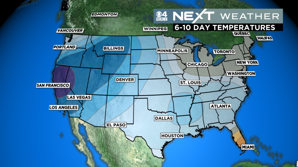
Temperatures for the remainder of the month look about average.
There is not a lot of warmth in the forecast for the northeast or for anywhere in the U.S. for that matter.
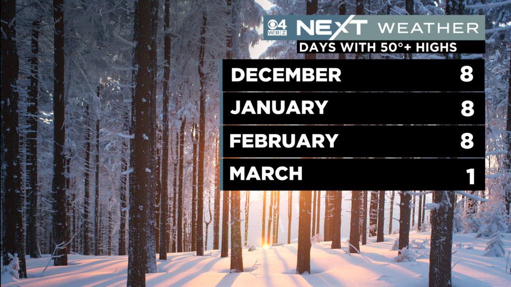
Classic New England March right? Just when you think spring has sprung, Mother Nature pulls the rug out from underneath. In fact, we have had just 1 day with high temperatures 50+ in the first half of March, 2023…WAY behind where we were in December, January and February this winter.
Outdoor spring sports are going to have a hard time getting going, unless you play on turf. Even after the snow melts, all this precipitation is going to make for a longer than normal “mud season”.
Next week will be crucial to those hoping to get out on the grass before April.
We still have an active pattern across the Country and right now, it looks like we have two chances for storms…one in the midweek timeframe and one later in the week. Too early to know whether they may miss or hit or whether we are talking more snow or plain rain. But, if we get another “juiced up” storm or two, that will set us back even farther.
Long story short, if you have lived in this area for any length of time, you know the deal. It ain’t over till it’s over. And, while there are sure to be sign’s of spring popping up in the coming days and weeks, I for one am not ready to call an end to winter.
Click here for Westford snow storm data and past totals or select “Winter Snowfall“ under “Pages” on the left hand side.
For more up to date forecast information follow me on Twitter (@terrywbz) or follow the WBZ weather team on Facebook, search WBZWeather


Reader Comments