


Here we go…
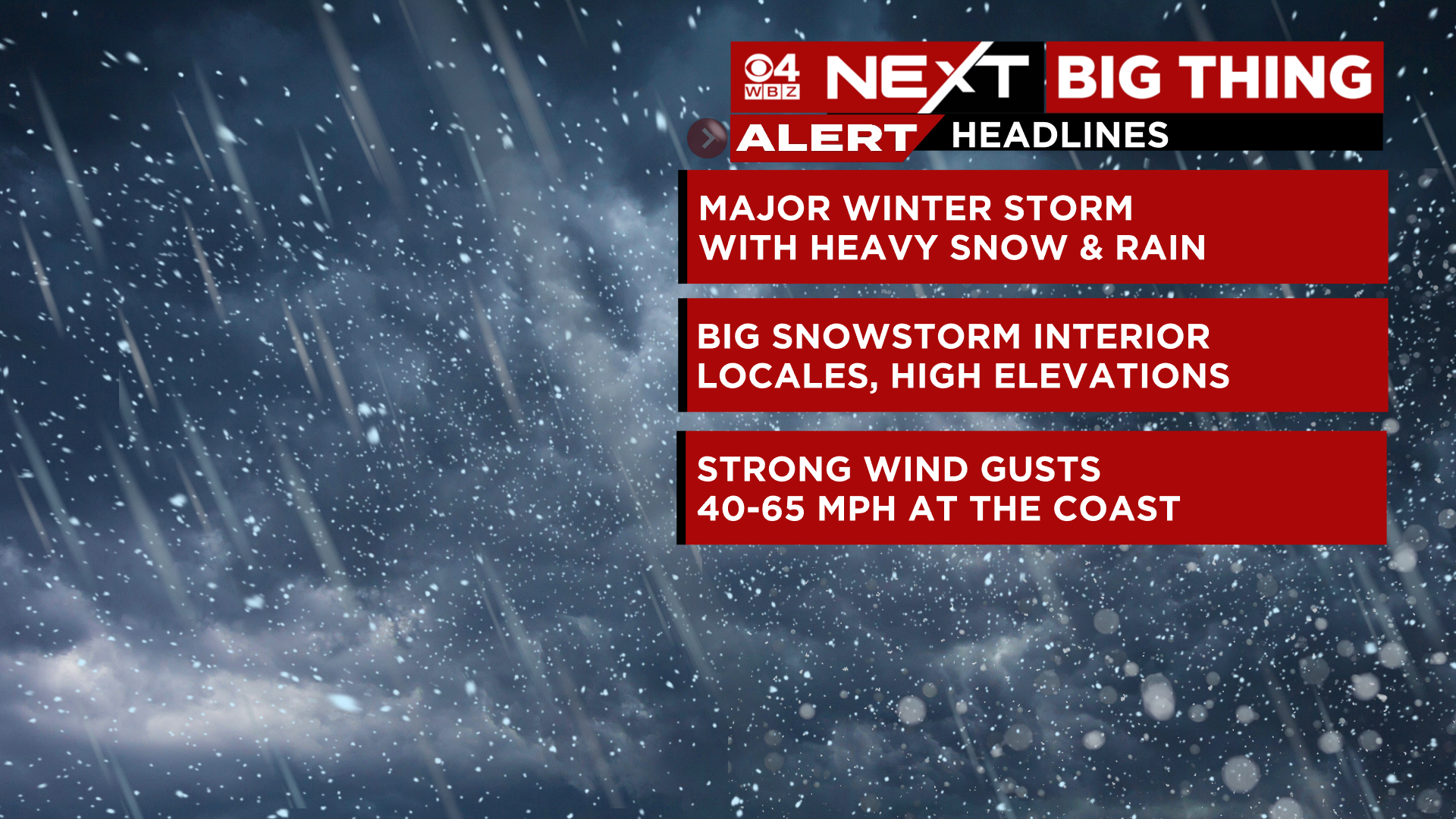
The biggest and most impactful storm since the January 2022 Blizzard is on our doorstep.
This will be a classic nor’easter, battering our Coastline with powerful winds and burying some towns with nearly a foot of heavy, wet snow. The combination of the two, a classic recipe for widespread tree damage and numerous power outages.
LATEST TIMELINE:
Monday Night- Rain, heavy at times across all of eastern MA. Mix of rain and wet snow near and just west of 495. Mainly wet snow in northern Worcester county, southern New Hampshire and western MA. We expect several inches of snow to accumulate in these areas overnight. Travel will become very difficult, in central MA late tonight heading into early Tuesday.
Winds will not be a concern overnight.

Tuesday Morning- Rain continues in eastern MA, around and east of 495. Snow continues in central and western MA as well as southern New Hampshire. The rain/snow line will begin to collapse and push eastward late in the morning, heading towards 128 before noon.
The winds will begin ramping up each hour mid to late morning. Gusts will be topping 40mph frequently along the Coast by late morning.
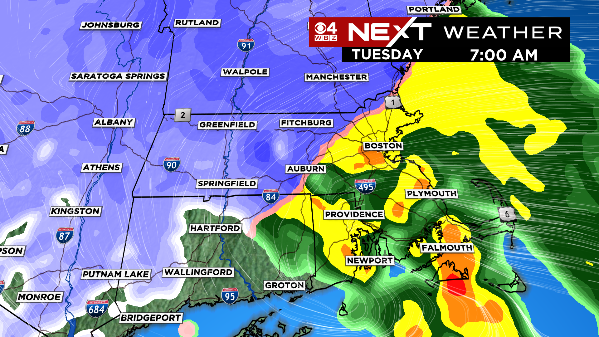
Tuesday Afternoon- The rain changes to snow, from west to east, across the remainder of southern New England. There will be times of very heavy snow with near zero visibility in some areas. Roads will initially remain wet but could become snow covered under heavier bands with snowfall rates over 1″ per hour.
Winds will whip in out of the north-northeast, gusting 50-65mph along the Coast and up to 50mph inland.
Heavy, wet snow will start to pile up and weigh down tree branches.
Travel will become treacherous across most of southern New England.

Tuesday Evening through Midnight- The snow continues, heavy at times after dark pinwheeling in from the north-northeast. It will likely arrive in bands, alternating from heavy/intense to lulls.
This time of year, snow accumulates much more readily at night, so, we expect most of the snow accumulation in eastern MA and near the Coastline to occur in this timeframe.
Travel may be near impossible in some of the heavier snow bands, in fact, there could be blizzard-like conditions at times.
Winds will be at their peak up and down the Coastline as well as inland.
There will be numerous downed trees and power outages.

After Midnight, through early Wednesday- The storm will finally begin to wobble away to the east. Snow will break up and become scattered. Very little additional accumulation occurs after midnight. There will be leftover bands of light to moderate snow near the Coast…the Cape will likely be the last to taper off midday/early afternoon on Wednesday.
Winds will remain gusty but will slowly decrease through the morning and veer to the northwest.

SNOW ACCUMULATION:
8″-14″ The snowfall jackpot will be in the higher elevations in northern Worcester country and the Berkshires, as well as southwest New Hampshire. Figure about 8″ around the northwestern fringes of 495 to near a foot in the hills north of Worcester.
There may be some isolated areas with slightly more than 14″ in the highest elevations.
4″-8″ From 495 (NW) down through 128…higher totals (around 8″) around 495 from Marlboro to Westford and Lowell to around 4″ in the 128 loop, near Burlington and Woburn.
2-4″ From Cape Ann, down the Coast to Boston to the Shore of northern Plymouth county.
0-2″ From Plymouth down through the Upper Cape


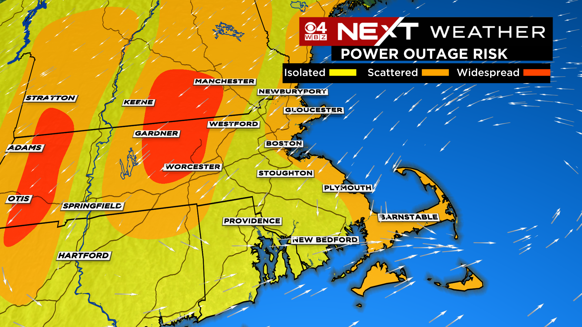
POWER OUTAGES:
Our entire region is at risk for outages Tuesday.
A slightly higher risk exists in two areas:
Along the Immediate Coastline…this is where winds will be strongest
But especially in the higher elevations in Worcester county, SW NH and the Berkshires where more than a foot of cement-like snow will weigh down on everything
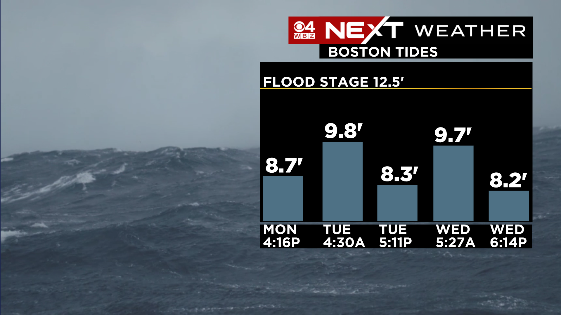
COASTAL FLOODING:
The saving grace for this storm, tides are NOT astronomically high. Therefore, we expect mainly minor coastal flooding with a few pockets of moderate during the high tide times.
There are three high tides that we will be watching…
Early Tuesday morning, around 3-5am…storm just arriving, winds just picking up…not expecting many issues
Tuesday evening, between 4-6pm…Storm just about at peak, winds will be cranking off the water, widespread minor flooding expected
Wednesday morning between 4-6am…storm exiting, winds veering more northwesterly, however there is a concern that the water won’t have completely exited from the prior high tide…so we expect widespread minor flooding again.
This will be the defining storm of the winter season for many folks in southern New England. Thankfully, after the storm passes Wednesday, things will quiet down for a stretch. No major storms in the pipeline for a while…
Click here for Westford snow storm data and past totals or select “Winter Snowfall“ under “Pages” on the left hand side.
For more up to date forecast information follow me on Twitter (@terrywbz) or follow the WBZ weather team on Facebook, search WBZWeather
Reader Comments