


Happy Groundhog Day!
In case you missed it, Punxsutawney Phil saw his shadow this morning, thereby predicting 6 more weeks of winter. Perhaps he heard the rumors of the Arctic blast headed our way tomorrow?
Locally, here in Massachusetts, we have our own State Groundhog, Ms. G. She has been predicting winter now since 2008, and, doing it nearly 20% more accurately than her furry friend down in Pennsylvania. Ms. G did NOT see her shadow at Drumlin Farms this morning. So, we have ourselves a forecast conundrum! Personally, I am sticking with the local team…bring on spring!
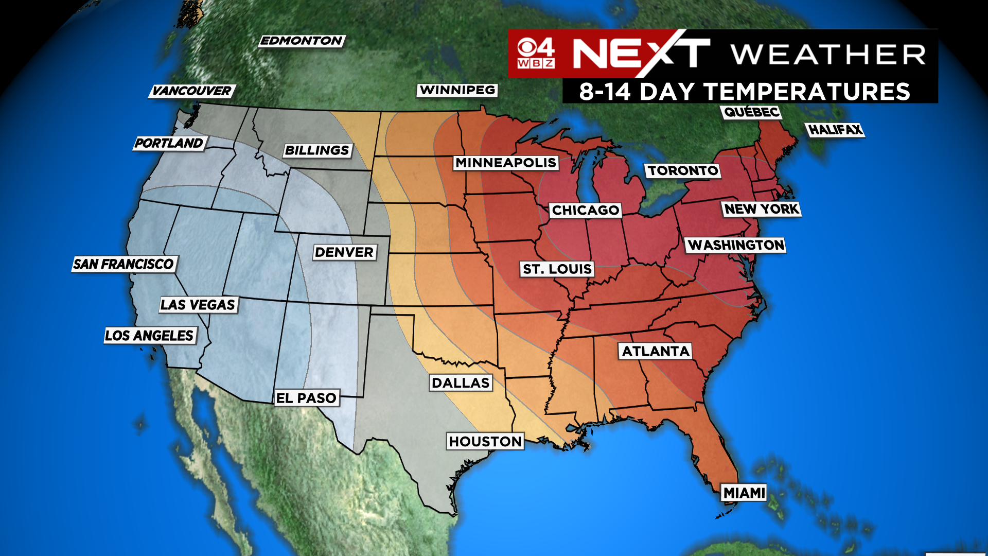
Looking past this weekend, it certainly looks like the next few weeks will be milder than average. Beyond that, it is a bit more uncertain. But, given the state of our winter thus far, I would be surprised if we were able to sustain any long-lasting, significantly below average temperatures. (Famous last words)
Back to reality…
We are currently in a NEXT Weather Alert as we track a dangerous, quick hitting blast of Arctic cold headed straight for New England.
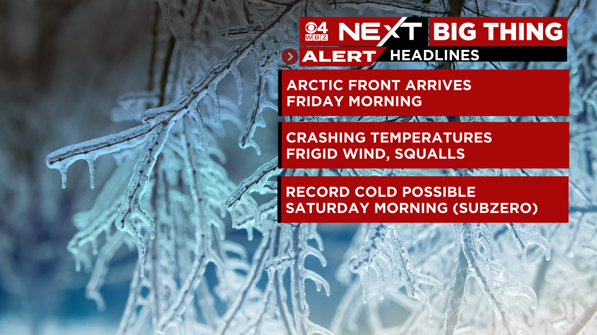
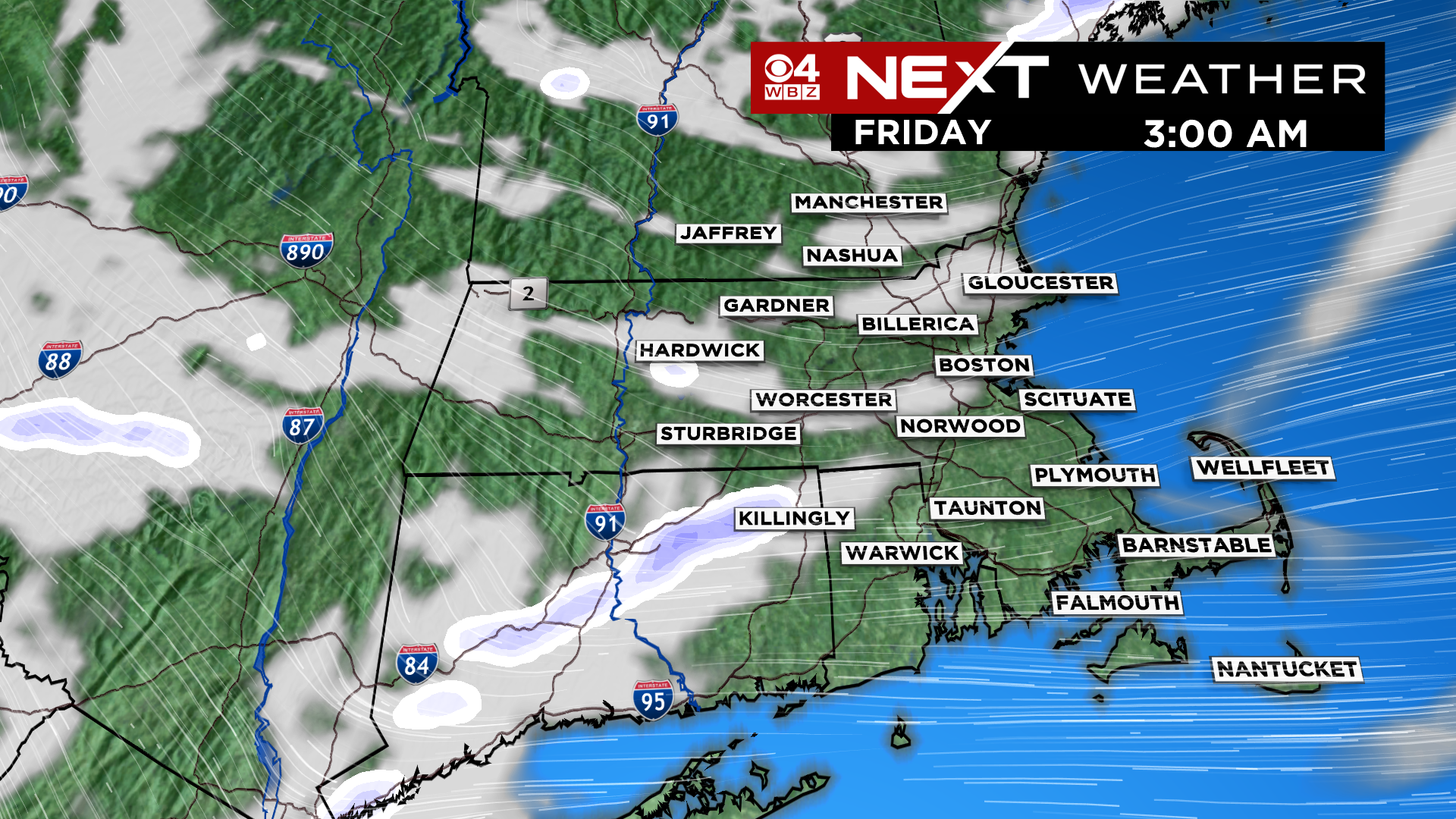
The bitterly cold air will arrive behind a cold front which is set to pass through New England overnight tonight. When that front arrives, sometime after midnight, there could even be a few isolated snow squalls.
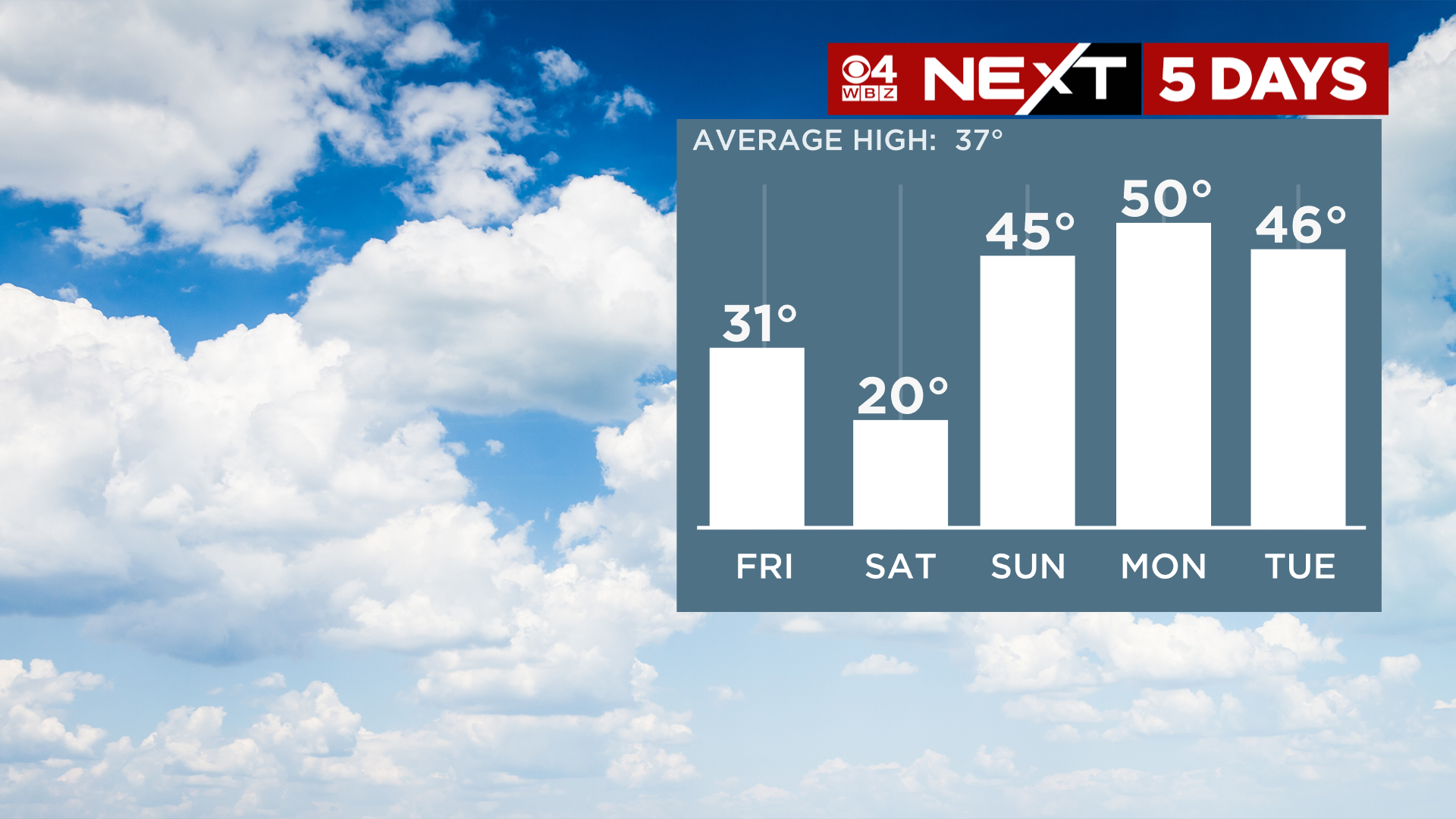
Temperatures on Friday will be in freefall…
By midday, most of the area will be in the teens
By the evening commute, temperatures will largely be in the single digits
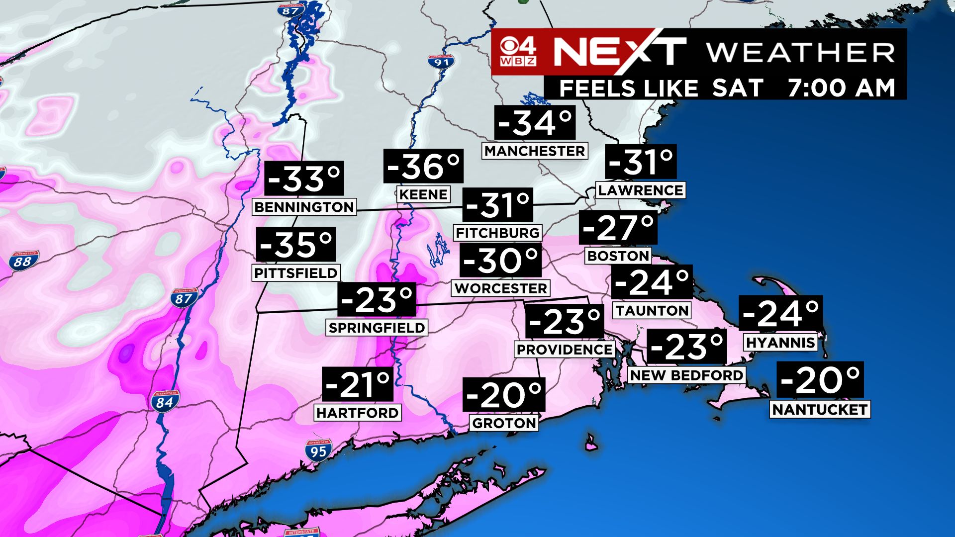
By Saturday morning, the core of the cold will be over top of us and temperatures will be well below zero for most of the area. Most towns should bottom out between -5 and -15 degrees!
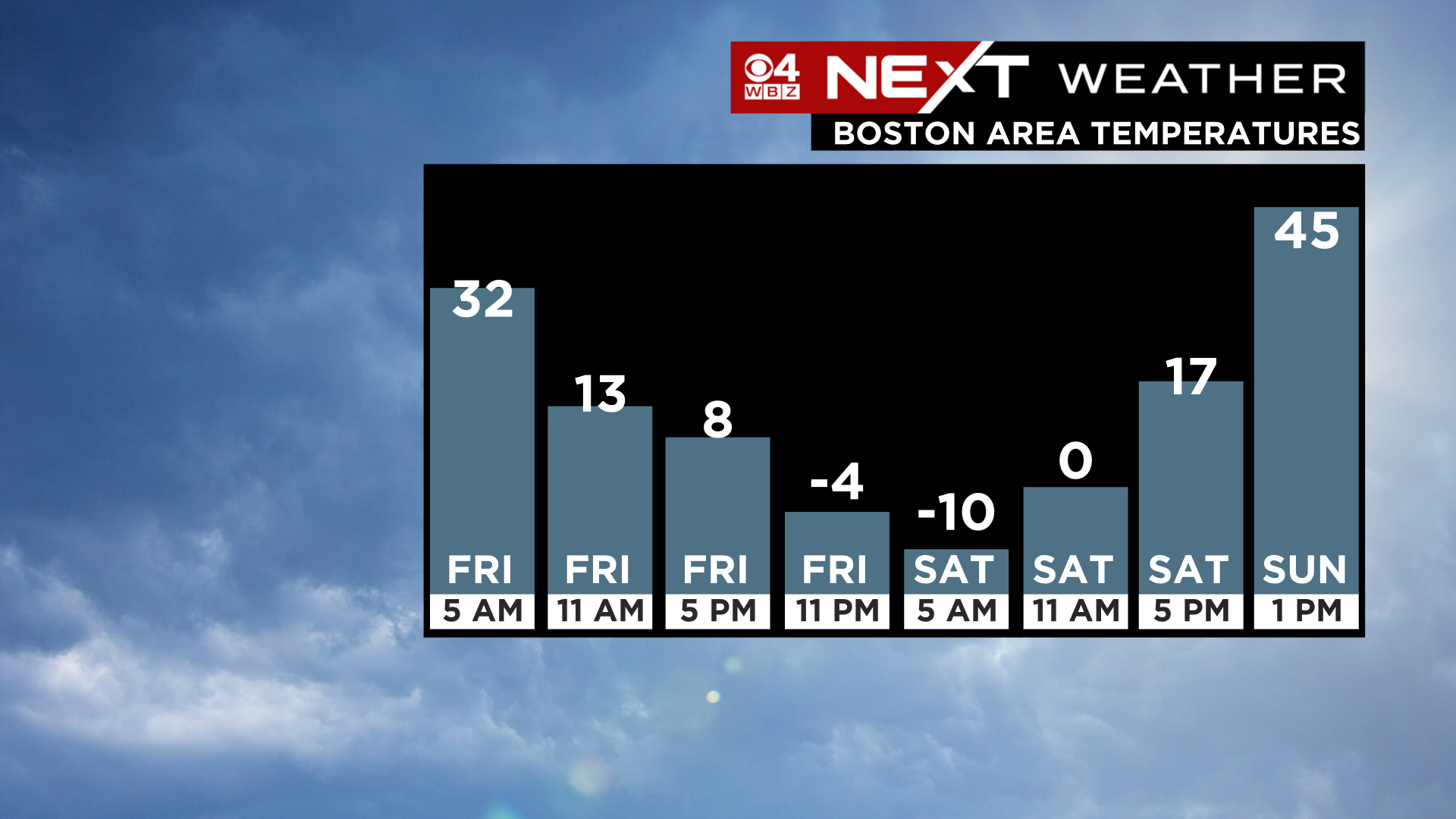
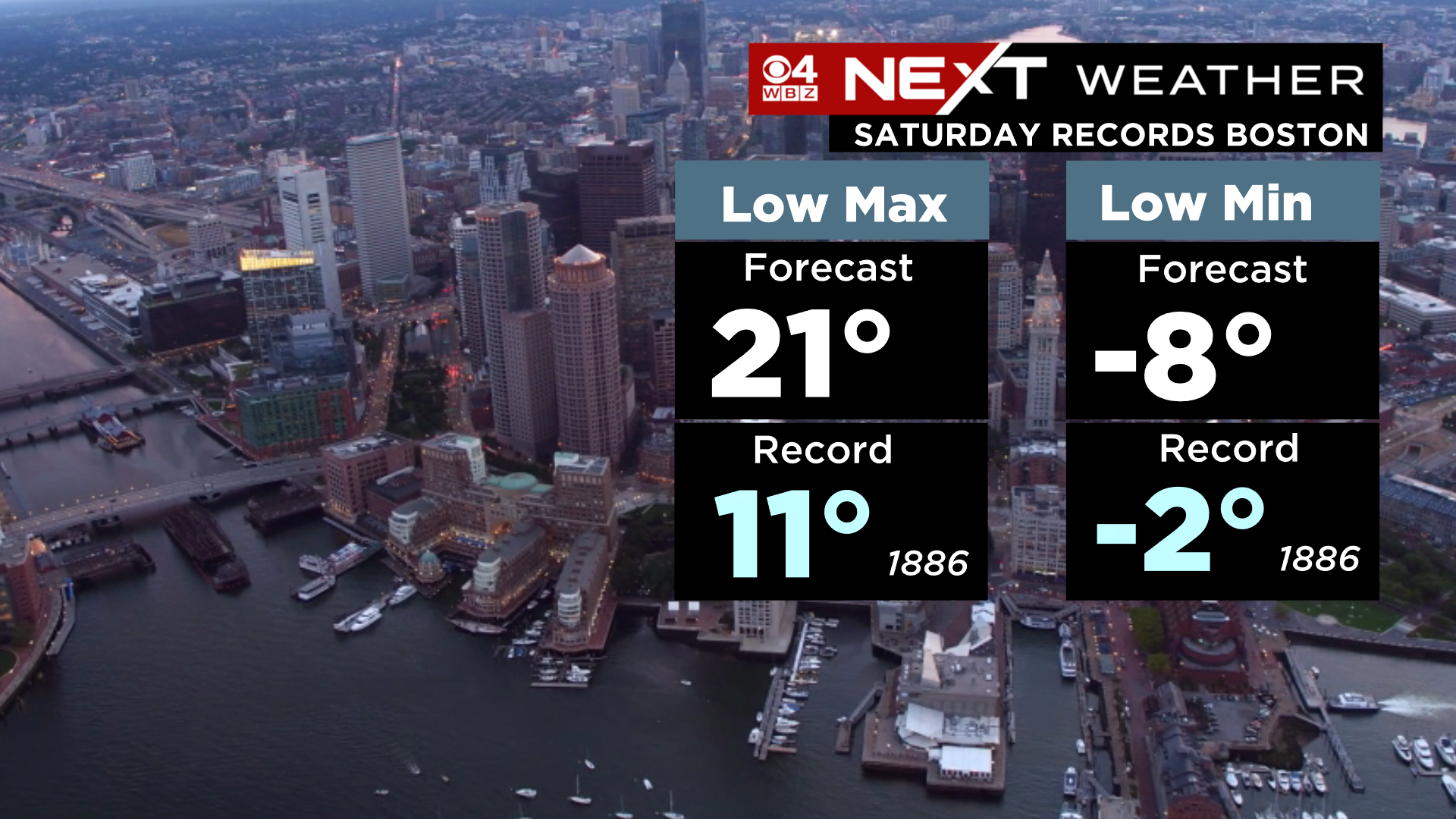
Boston’s record low on Saturday is -2 degrees set back in the late 1800s…we have a VERY good chance of destroying this mark. Our current forecast for Boston, -8 degrees!
If Boston were to drop to -10 on Saturday (I’d give that about a 20% chance of happening), that would be the coldest reading in the City since January of 1957!
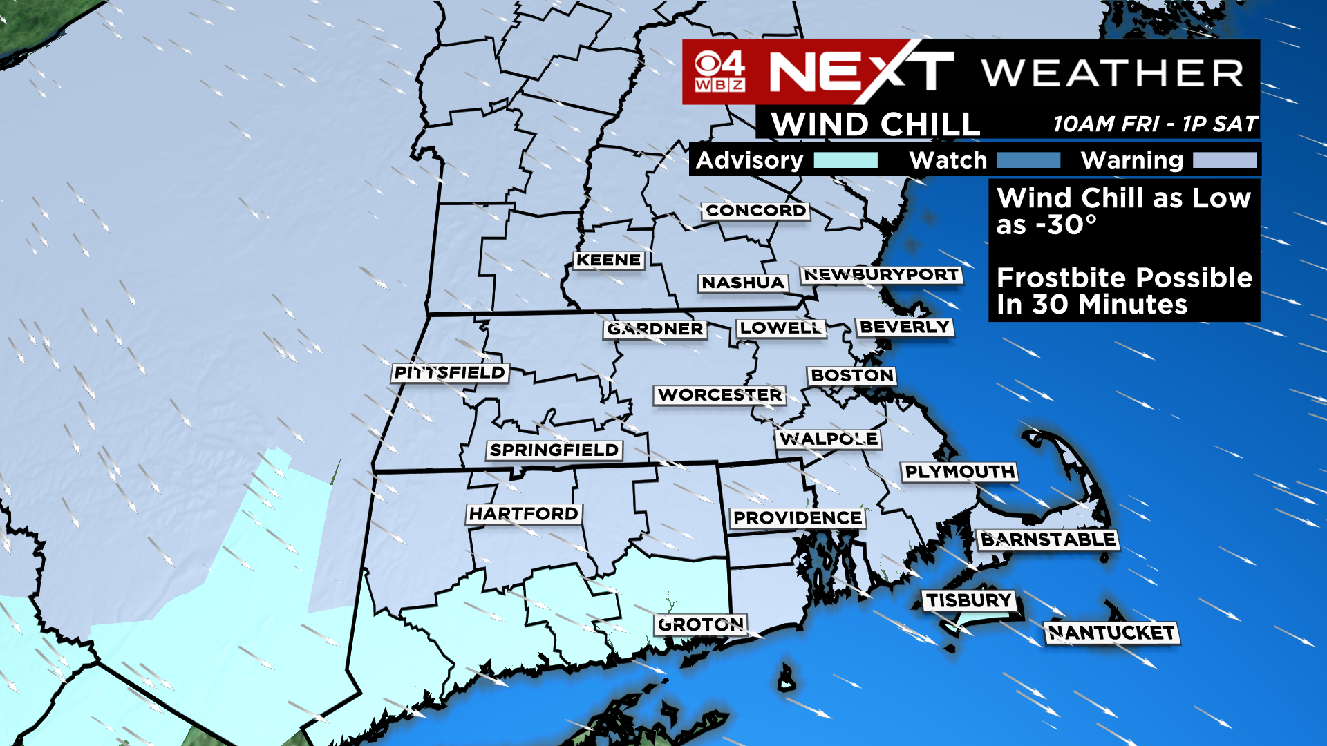
And then there is the wind…There is currently a wind chill warning posted for the entire area beginning late Friday morning and lasting through early Saturday afternoon. During this timeframe, we expect wind chill values to bottom out as low as -30 degrees at times.
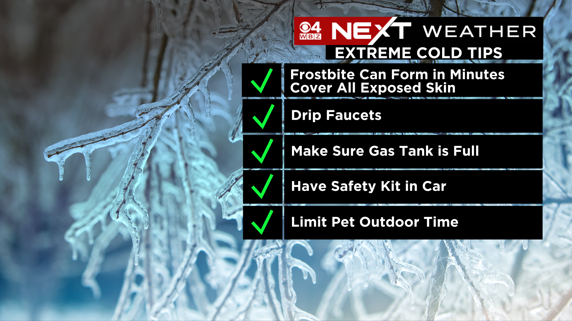
At these levels, frostbite can occur on exposed skin in 30 minutes or less. If you must go outside during the peak of this cold, be sure to dress in layers and cover up any exposed areas. Also, be sure that your car battery is healthy and that you have an emergency kit in your trunk. And of course, keep your pets in mind!
Thankfully, this cold shot will be very short-lived. By Saturday afternoon, the core of the cold will already be retreating. And believe it or not, temperatures will be in the 40s by Sunday afternoon!
Click here for Westford snow storm data and past totals or select “Winter Snowfall“ under “Pages” on the left hand side.
For more up to date forecast information follow me on Twitter (@terrywbz) or follow the WBZ weather team on Facebook, search WBZWeather
Reader Comments