


Heavy banding dropping up to 2” per hour in some spots is leading to higher snow totals…
Here is the very latest…
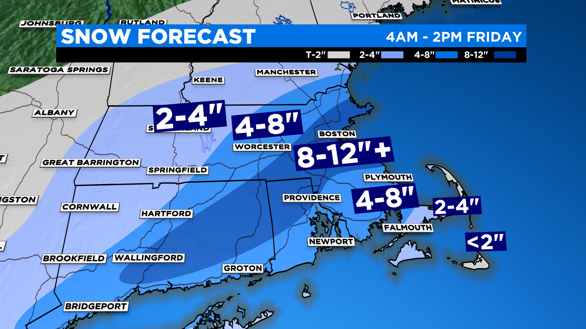
Forecast snow totals have increased to 8-12”+ from Boston to Providence and down into parts of Connecticut
Heaviest snow and worst travel continues through about 10-11am
Snow falling at such a high rate road crews will struggle to keep up
Latest Timeline…
The steadiest and heaviest snow will fall through 11am Friday morning. This is when the majority of the accumulation will occur.
The snowfall intensity wanes by late morning and very little additional accumulation is expected by Friday afternoon.
Last to see the snow end with be the immediate Coastline, and Cape Cod this afternoon
How Much…
8-12”+ North Shore through Boston to the immediate South Shore and back westward through Norfolk county into northern Rhode Island and Connecticut
4”-8” for the rest of eastern and central MA
2”-4” well to the north and west, beyond northern Worcester county into central New England (farther away from the storm), much lighter/fluffier snow up this way
2”-4” over most of the Cape with some mixing with rain likely at times and a much heavier/wetter consistency
Less than 2” over Nantucket with a lot of mixing and rain
Northern Ski Areas…this isn’t your storm, perhaps a few inches…
We could see as much as 14” in the 8-12”+ zone where the heaviest banding occurs!
Stay home and off the roads through early afternoon if possible.
Click here for Westford snow storm data and past totals or select “Winter Snowfall“ under “Pages” on the left hand side.
For more up to date forecast information follow me on Twitter (@terrywbz) or follow the WBZ weather team on Facebook, search WBZWeather
Reader Comments