


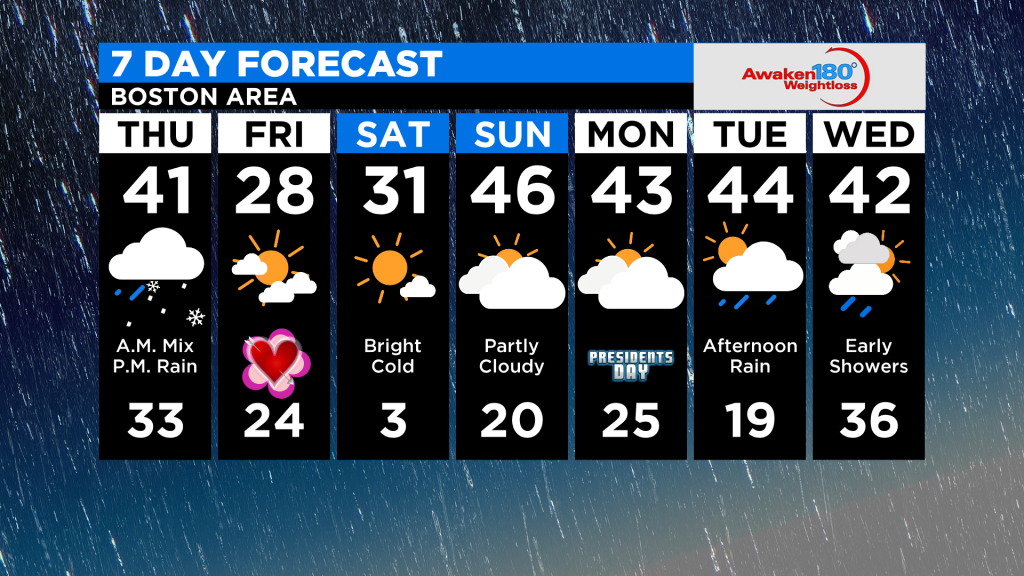
THURSDAY: Brief early morning snow/sleet goes quickly over to rain, 1-3″ of snow and sleet before changeover, 38-44 (read more below)
FRIDAY: Sunny, windy and very cold, highs 25-30 with lower wind chills
SATURDAY: Sunny and very cold…starting in the single digits and climbing to near 30 in the afternoon
SUNDAY: Becoming mainly cloudy, slight chance of a few passing showers, 40s
BOSTON (CBS) – Feeling a bit of deja-vu? It was just about last week at this time when we started talking about a wintry mix coming on Thursday morning, followed by a change to rain. That storm left a light snow and ice accumulation, mainly in areas north and west of Boston. Welp, perhaps I should just re-rack the blog I wrote last week…we have a very similar storm coming this week with nearly the same exact timing and impacts. Once again, winter will try to make an appearance, and once again it will ultimately be overshadowed and halted by a surge of mild air.ADVERTISING
TIMING:
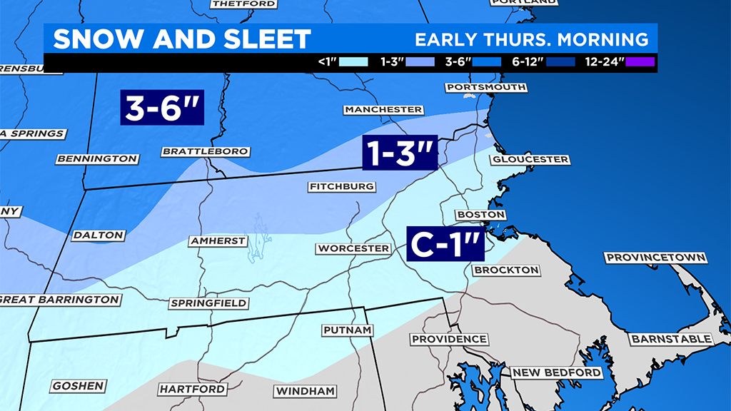
Precipitation arrives between Midnight and 3 a.m. Thursday. Starts as snow north and west of I-95 and north of the Mass Pike. Starts as rain along the immediate Coastline from Boston-southward including most of southeastern MA.
The snow will only last for a few hours in most places as milder air aloft forces a change to sleet. In far northern MA and southern New Hampshire, the snow may hang on just a tad bit longer, leading to slightly higher totals.

(WBZ-TV graphic)
By the time of the Thursday AM commute (say between 7a-9a) snow will have ended in southern New England with just some lingering pockets of ice in the northern Worcester Hills, Berkshires and parts of southern New Hampshire.
Steady rain will come to an end by late Thursday morning, transitioning to rain showers by Thursday afternoon and tapering in the evening.
SNOW & SLEET AMOUNTS:
A coating to an inch in areas near the Mass Pike and 5-10 miles on either side including Boston and Worcester
(WBZ-TV graphic)
1 to 3″ north and west of I-495 and Rt 2.
3 to 6″ in parts of the Berkshires, Green and Whites and as far south as Manchester, NH
So, in the end, another minor snow event, with the primary impact during Thursday mornings commute. Whatever does remain on the ground after Thursdays rain will stick around for a few days.
(WBZ-TV graphic)
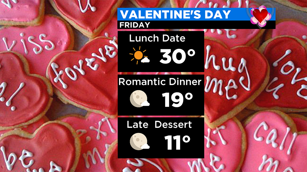
Much colder air pours in behind the system Thursday night and Friday (again eerily familiar to what occurred last week). Highs on Friday (Valentine’s Day) and Saturday will be in the 20s to near 30 and one of the coldest mornings of the season is likely on Saturday with lows in the single digits.
Click here for Westford snow storm data and past totals or select “Winter Snowfall“ under “Pages” on the left hand side.
For more up to date forecast information follow me on Twitter (@terrywbz) or follow the WBZ weather team on Facebook, search WBZWeather
Reader Comments