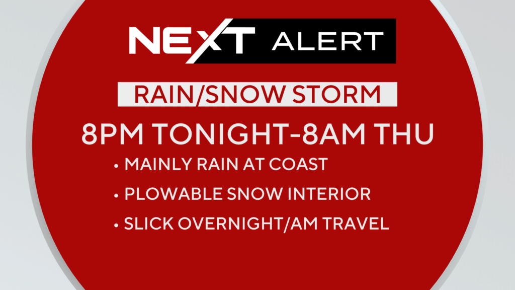
Here it comes! The first plowable snowfall of the season for parts of southern New England is set to move in. While it won’t be a big storm, it will be the first wintry test for drivers in quite some time.
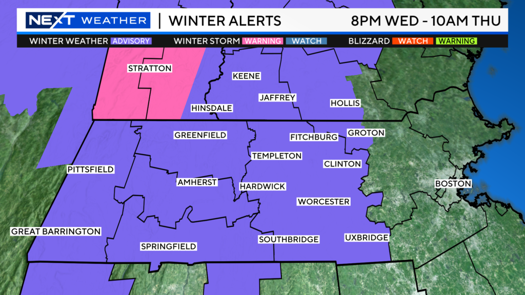
A winter weather advisory remains in effect through 10am Thursday for central and western MA and southwestern New Hampshire.
There is a winter storm warning (in pink) for parts of southern Vermont, this denotes an area that is likely to meet or exceed the 6″ mark.
TIMELINE:
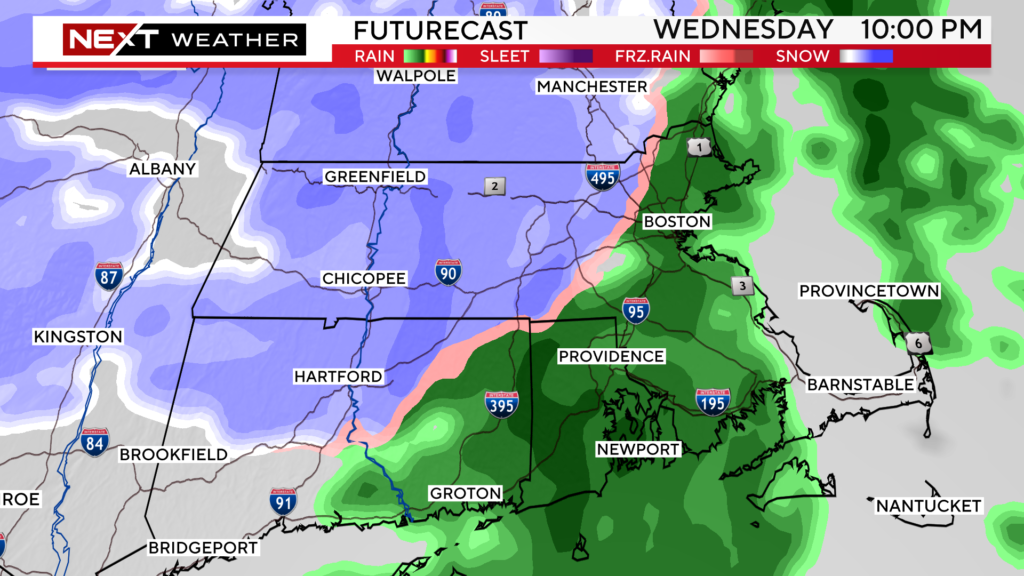
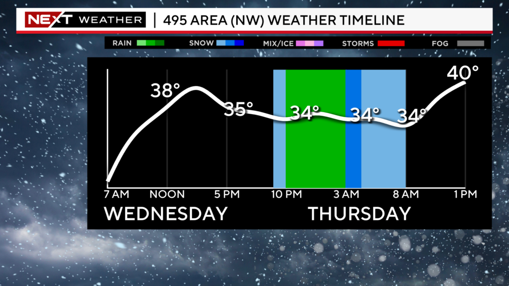
The steady rain and snow begins around 8pm.
Rain will be falling along and east of I95.
Snow will be falling west of 495.
In between 128 and 495, a mix of rain and wet snow.
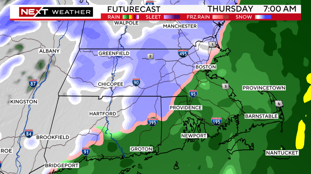
Thursday mornings commute is going to be a rough one.
The rain/snow line will inch a bit eastward, and snow or a wintry mix will be falling in most of Boston’s northern and western suburbs.
The steady precipitation will taper off between 8am-10am Thursday morning.
Beyond that, there will just be a few midday and early afternoon rain/snow showers as the cold front sweeps through ushering in much colder air.
The best chance for a widespread, plowable snow will be in the higher elevations of Worcester county, southwest New Hampshire and the Berkshires. If you live in any of these areas, I would definitely gas up the snowblower, we are forecasting 3-6″ of snow.
We expect 1-3″ in the lower elevations in eastern Worcester county and in westernmost Middlesex county, west of 495…have the shovels handy
We are forecasting a coating to an inch of wet snow around and just inside 495.
Closer to the Coast, near and east of I95, it will be mainly rain with some wet flakes mixing in here and there.
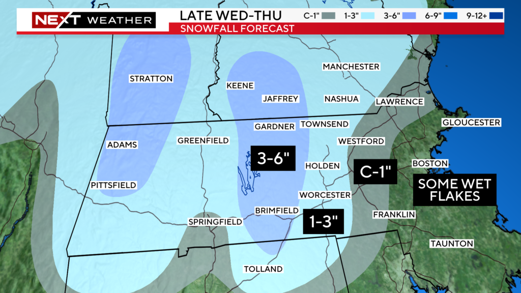
The toughest call with this storm is the in-between area where there will be a mix of rain and snow…generally right around 495 from the Pike northward to 93/95.
The stakes aren’t all that high, but obviously a degree or two difference in temperature could mean a bit more snow (or rain). It wouldn’t be shocking for a few towns in the “coating to 1 inch” area to receive an extra inch or two.

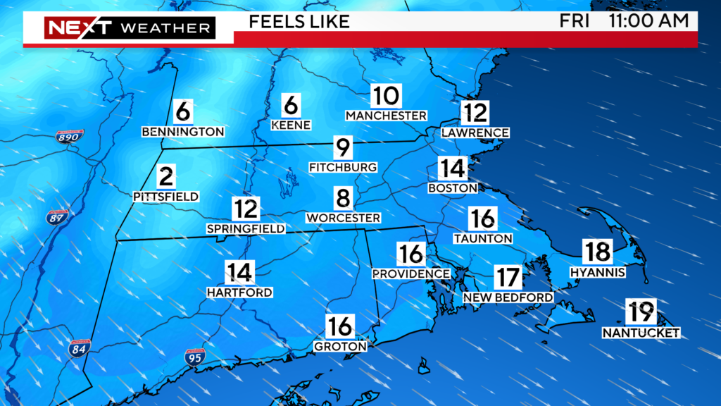
After the storm, it’s back to the cold. Another blast from Canada arrives on Friday. Expect high temperatures in the 20s and low 30s Friday and Saturday with overnight lows in the teens.
Factor in a gusty wind and “feels like” temperatures will be in the single digits and teens on Friday.
Click here for Westford snow storm data and past totals or select “Winter Snowfall“ under “Pages” on the left hand side.
For more up to date forecast information follow me on Twitter (@terrywbz) or follow the WBZ weather team on Facebook, search WBZWeather


Reader Comments