


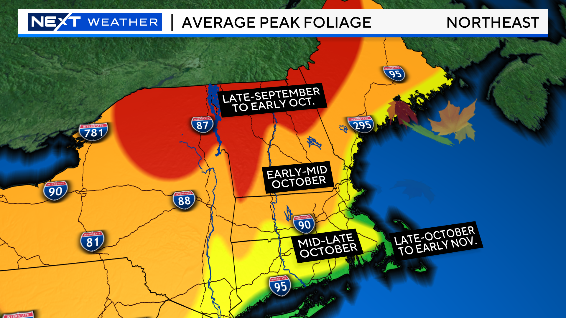
The fall season is flying by.
Just this morning we saw the snow whiten the ground in the highest elevations up north including Mount Washington and Killington Ski Resort. The upcoming Weekend is probably the busiest and most popular Weekend to head north and check out the foliage.
So, where should you go and what should you expect to see?
Overall, the foliage season has been good, not great and highly variable. As you drive north up route 93 you will come across patches of vibrant color mixed with areas that are still green. Even locally, you will see some trees starting to burst with color mixed with trees that are totally green mixed with others that seemed to go right to brown.
In general, these areas are past peak…(this means a mix of leaf drop, brown leaves and dull/fading color)
Northeast Kingdom in Vermont
Highest elevations in the Green Mountains
Northernmost woods in New Hampshire
Highest elevations in the White Mountains
Mountains/Crown of northernmost Maine
If you are planning on hiking some of the higher peaks, be on the lookout for “snowliage”! A mix of colorful leaves and some light snowfall.
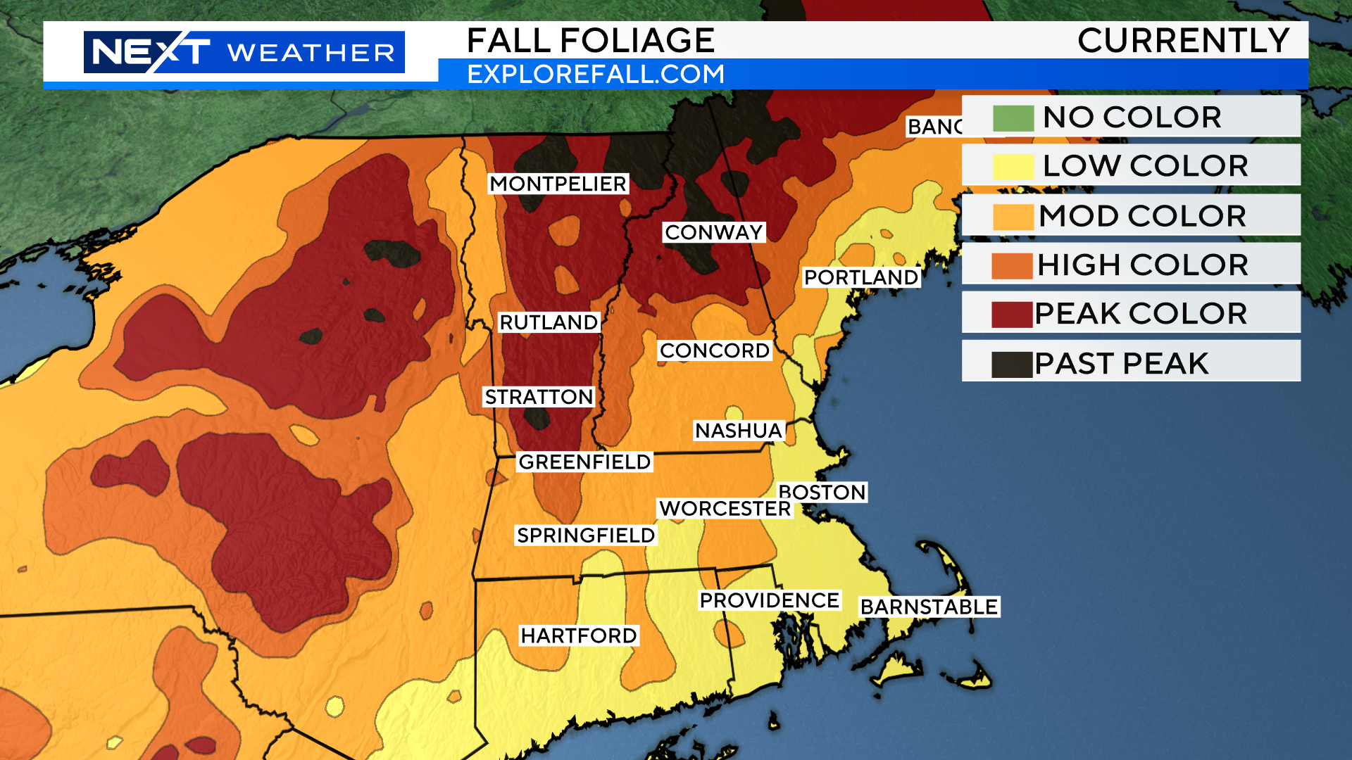
Peaking now/this Weekend:
Lower elevations in Vermont including most of the valleys in southern and central Vermont
Lakes Region in New Hampshire
Monadnock Region in New Hampshire
Highest elevations in the Berkshires
Spotty locations up route 2 in MA and up route 3 and route 93 in southern NH
Peaking in the next 1-2 weeks:
The remainder of southern New England. Areas north and west first and then Coastal areas later in the month.
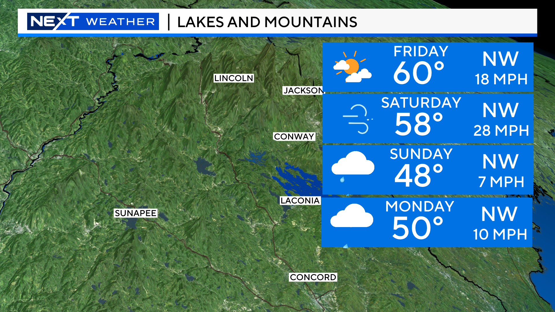
The forecast this weekend is OK. If you can get out a day early, Friday looks tremendous. Mainly sunny skies and temperatures up north near 60 degrees. It will be a bit breezy, mainly 10-20mph.
SATURDAY:
After some early morning clouds, the day will feature abundant sunshine and great views.
Temperatures will be mainly in the 50s in the lower elevations up north.
The main issue will be the wind. There will be a steady, gusty, northwest wind most of the day. Sustained 12-25mph with gusts 25-45mph. The higher you go in elevation, the gustier the winds. Atop some of the big mountains there may be gusts near or slightly over 50mph. There will certainly be a lot of leaves flying off the trees Saturday.
SUNDAY:
Not an ideal day. Skies will be mainly cloudy if not completely overcast by late morning.
Rain showers are likely to arrive by the afternoon.
Temperatures will be chilly up north, in the 40s.
The good news…the winds will be much calmer than Saturday.
MONDAY:
Meh. Likely to be some leftover rain showers, especially in the morning along with a thick cloud cover.
Temperatures will range from 45-50 in the northern areas with a slight northwest breeze.
COMET TSUCHUINSHAN-ATLAS
It isn’t often that we get the chance to see a comet with the naked eye. But, in a year already filled with so many astronomical treats, it looks like we will be able to add a comet to the list!
Comet Tsuchinshan-ATLAS has an 80,000 year orbit and, it just so happens, that it is now approaching its closest pass to Earth! On Wednesday, the Comet made its closest approach to our Sun and on Saturday, October 12 at 11:39am it will be just 43,911,824 miles from Earth (its closest pass). At that time, the Comet’s tail will essentially be pointing right at Earth. However, in the days to follow, the tail will pivot eastward, making for dramatic changes in viewing from night to night.
The Comet is massive in size and length. Its head currently measures a whopping 130,000 miles in diameter. The tail, which is largely comprised of tiny pieces of ice and dust, is believed to be as long as 18 million miles!
Comet C/2023 A3 was briefly and barely visible last week in the early morning sky. In the end, most folks were unable to see it as it was very faint and low to the horizon.
We will have a much better chance this time around. Starting on Friday night and lasting for several days, the Comet will be visible in the western sky just AFTER sunset.
On Friday it will be very low on the horizon (about 4 degrees) and likely a bit tough to spot.
In the nights to follow, conditions should get better and better!
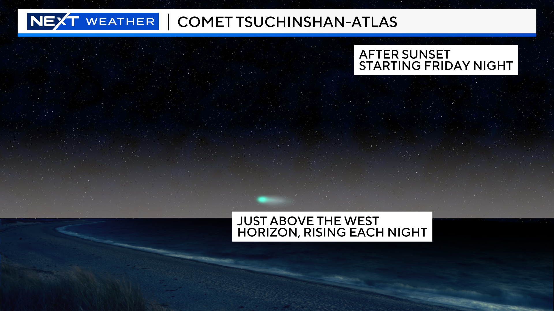
Peak viewing will occur between October 12-26. The Comet will become the largest visible object in our solar system (after the Moon obviously).
On Saturday, the Comet will be about 6 degrees above the west-southwest horizon about 45 minutes after sunset. If you hold out your fist at an arm’s length the Comet will be about one half “fist” above the horizon. It will set about 45 minutes later.
Each successive night next week, the Comet will be about 3 degrees higher in the sky and it will set about 16 minutes later.
Doing a little math…by Saturday, October 19, the comet will have risen to about 30 degrees (3 fists) above the horizon and will set nearly three and a half hours later. It will lose some brightness each night though, slowly fading and getting harder and harder to see with the naked eye.
Naturally, we will need the weather to cooperate in order for us to see anything on any given night. In the short term, both Friday and Saturday nights should be mainly clear with perhaps just some high cirrus clouds in some areas late on Saturday. We expect some clouds and showers Sunday night. Those should clear during the day Monday and allow for good viewing once again.
As always, we would love to see and share your pictures! Send them to weather@wbztv.com
Happy Viewing!
AURORA VIEWING
Here we go again…
Space weather forecasters have issued a “Severe G4 Geomagnetic Storm Watch” for Tonight through Friday.
This has the potential to be another major Northern Lights event, perhaps even approaching the stunning event back on May 10th.
Space weather models are in agreement that this fast moving, coronal mass ejection will strike Earth’s atmosphere tonight and last as long as 12 hours.
While Aurora’s are never guaranteed, our odds Tonight are about as high as they get as far as Aurora predictions go.
This started on Tuesday when a giant explosion of solar material ejected from sunspot (AR3848) that was facing directly at Earth.
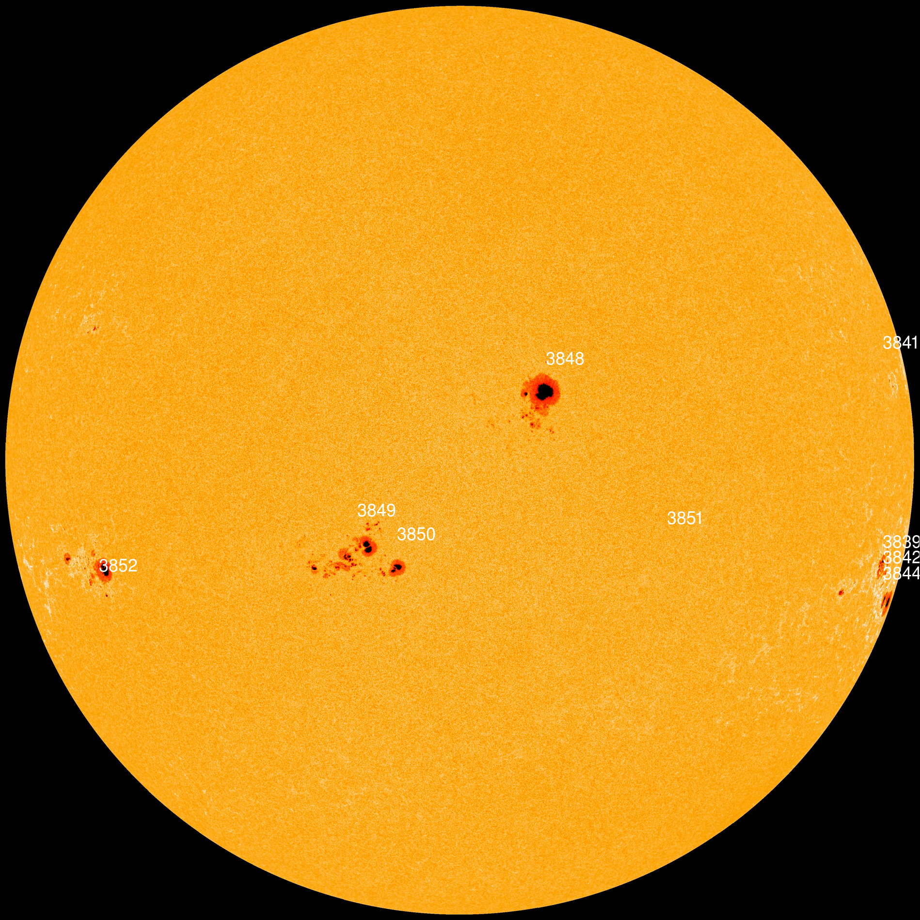
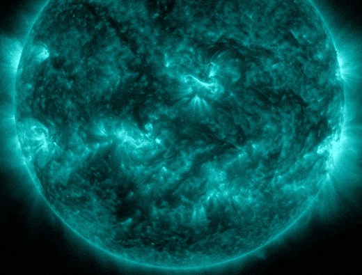
(images courtesy of SpaceWeather.com)
Check out this amazing image from a SOHO spacecraft currently orbiting around the Sun.
Remarkably, it caught the massive CME AND Comet Tsuchinshan-ATLAS!
Scientists think it is possible that the massive blast from the Sun might have ripped off part of the tail of the Comet! Time will tell as the Comet comes back into view this Weekend in the western horizon.
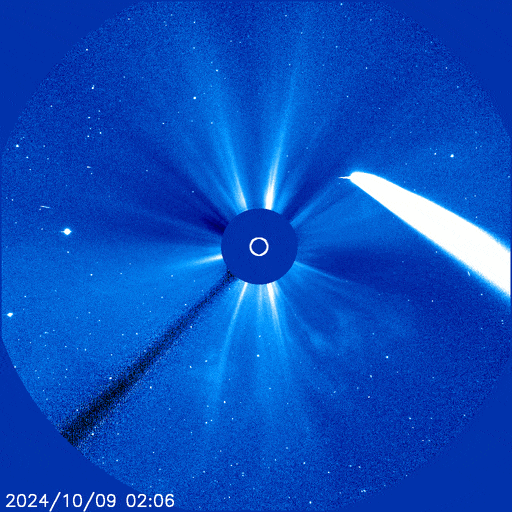
(images courtesy of SpaceWeather.com)
That mass of solar particles has been speeding towards Earth in the last 36 hours and is forecast to slam into Earth’s magnetic field Tonight.
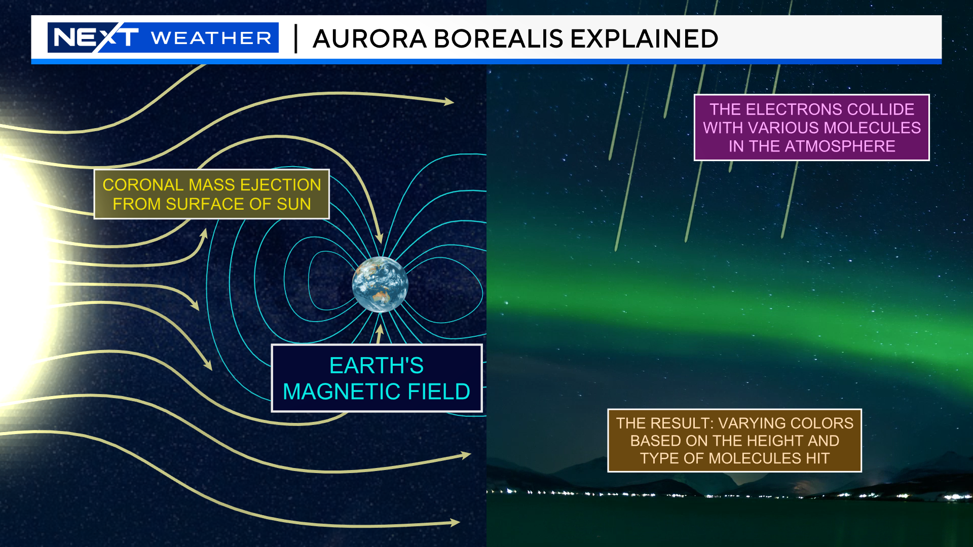
The level of storm activity is measured using something called a “K index”. Typically, in order for us in New England to have a shot at seeing Aurora’s we need a K index of 7 or higher.
The current forecast for tonight is as high as 8-9, near the top of the chart!
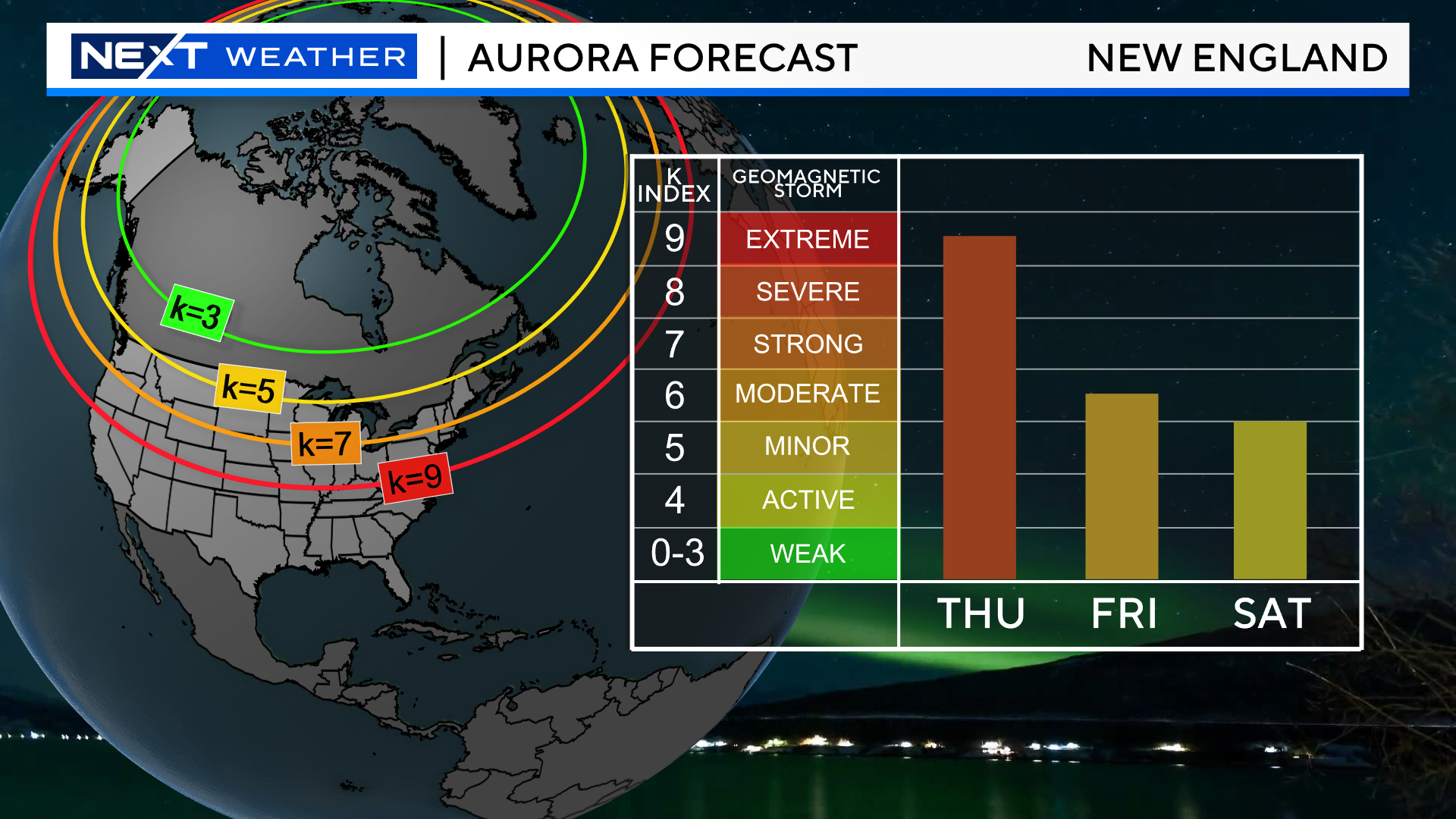
If the geomagnetic storm arrives as advertised, Aurora’s may be seen as far south as Texas! Certainly, anyone living in the northern tier of the United States would have a decent shot Tonight.
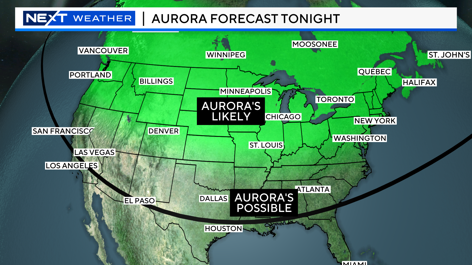
The weather forecast couldn’t be better! Any clouds that form today are forecast to melt away after sunset and we expect mainly clear skies all night long across all of New England.
A reminder…if possible, find a location with as little artificial light as possible and with an unobstructed view of the night sky.
And, as always, if you snap any pics we would love to see and share them! Send them to weather@wbztv.com
Click here for Westford snow storm data and past totals or select “Winter Snowfall“ under “Pages” on the left hand side.
For more up to date forecast information follow me on Twitter (@terrywbz) or follow the WBZ weather team on Facebook, search WBZWeather
Reader Comments