


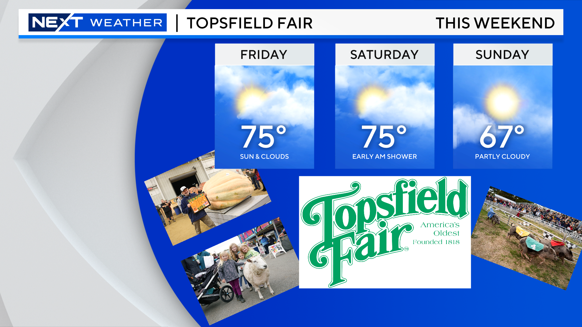
Our weather remains very quiet and, for the most part, we have a fantastic Weekend ahead!
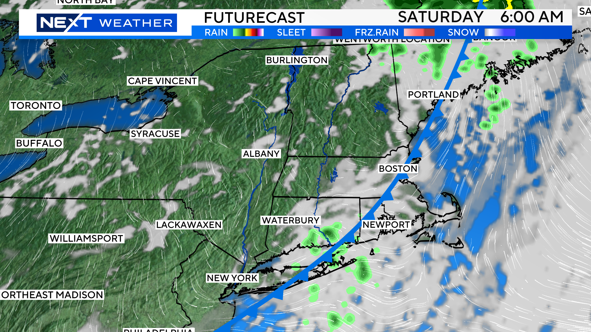
The only chance of rain will come early Saturday morning, and I think most of the area will actually remain dry. There will just be a few, quick moving, light showers passing through around dawn.
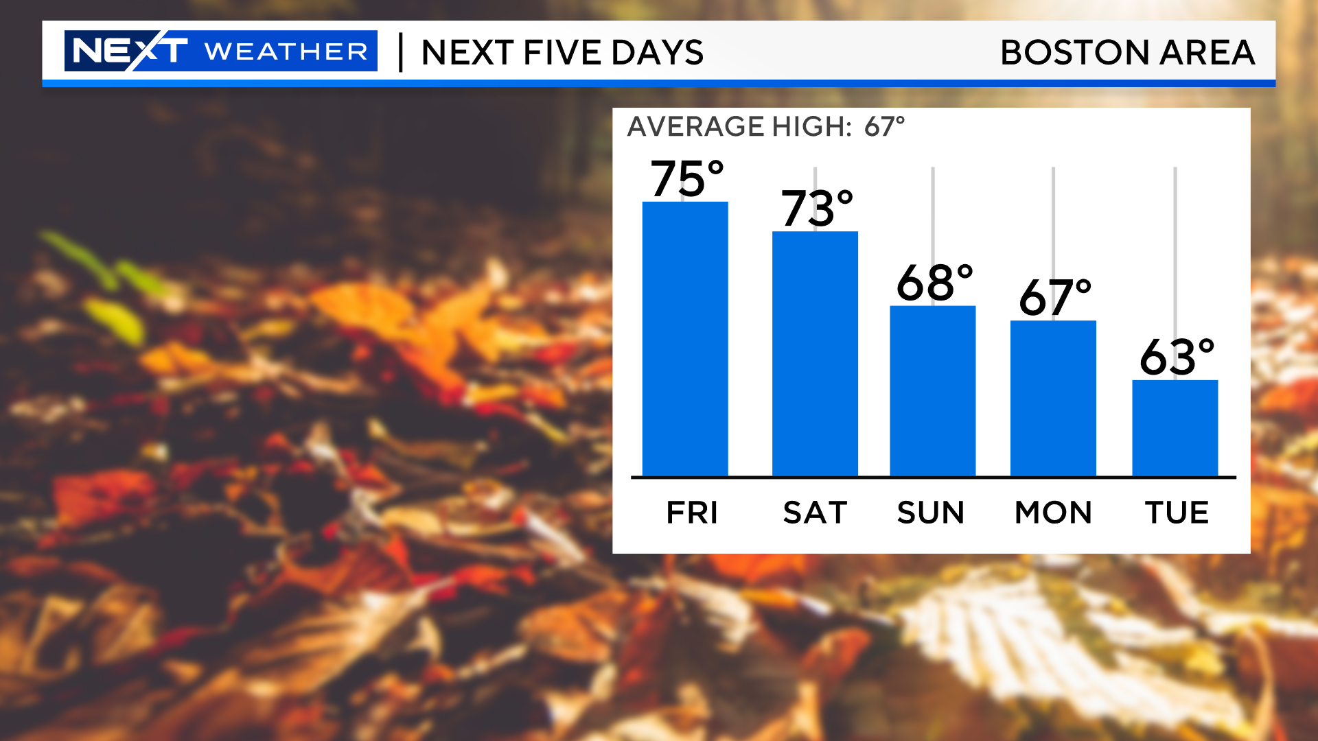
The rest of the Weekend will feature plenty of sunshine and comfy temperatures.
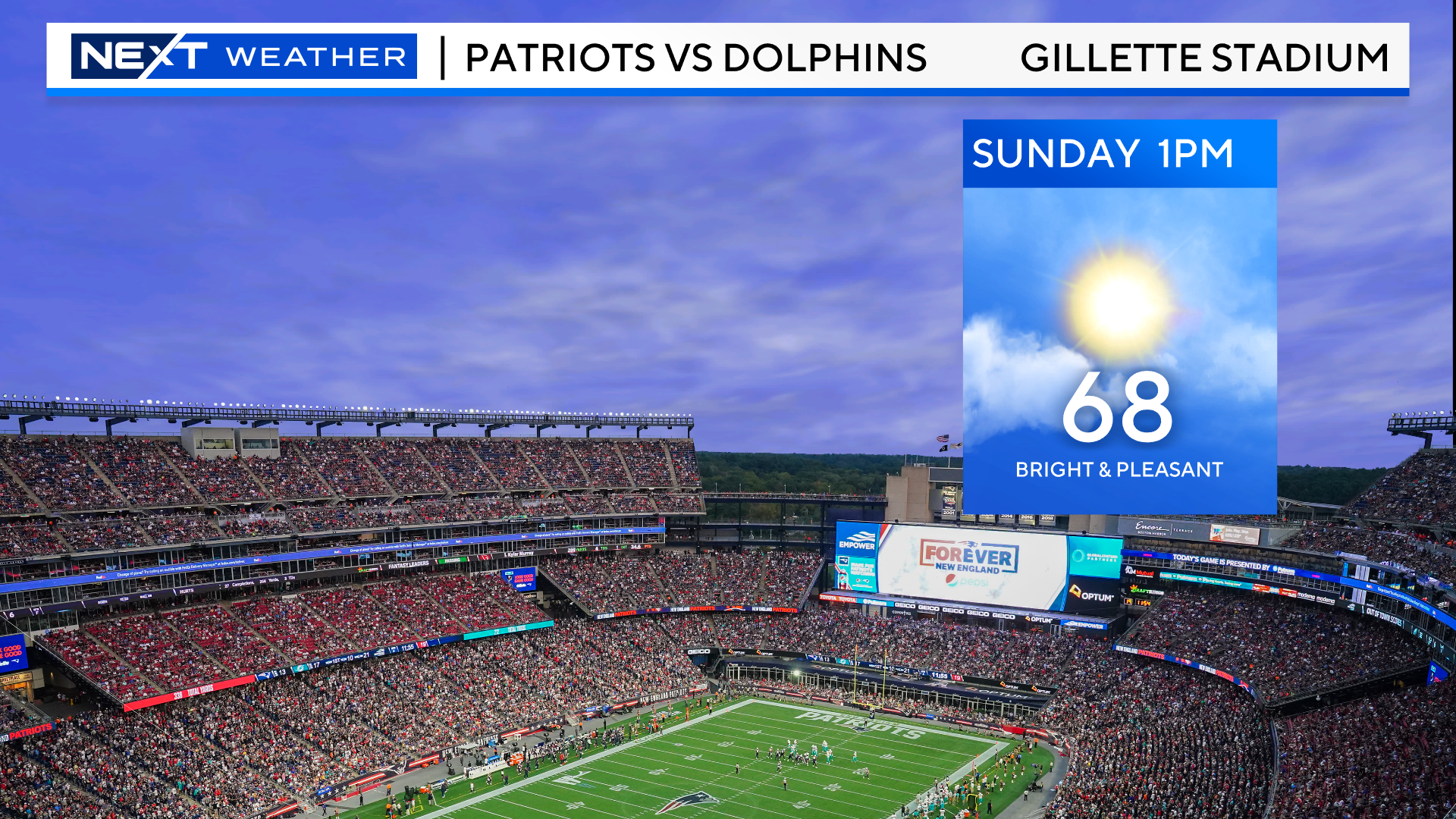
It will be a wonderful fall day at Gillette Stadium on Sunday, let’s hope the Pats can make it even better with a W!
Our next chance of any significant rainfall comes on Monday. I’d say odds are fairly high that most of our region will have a wet start to the workweek.
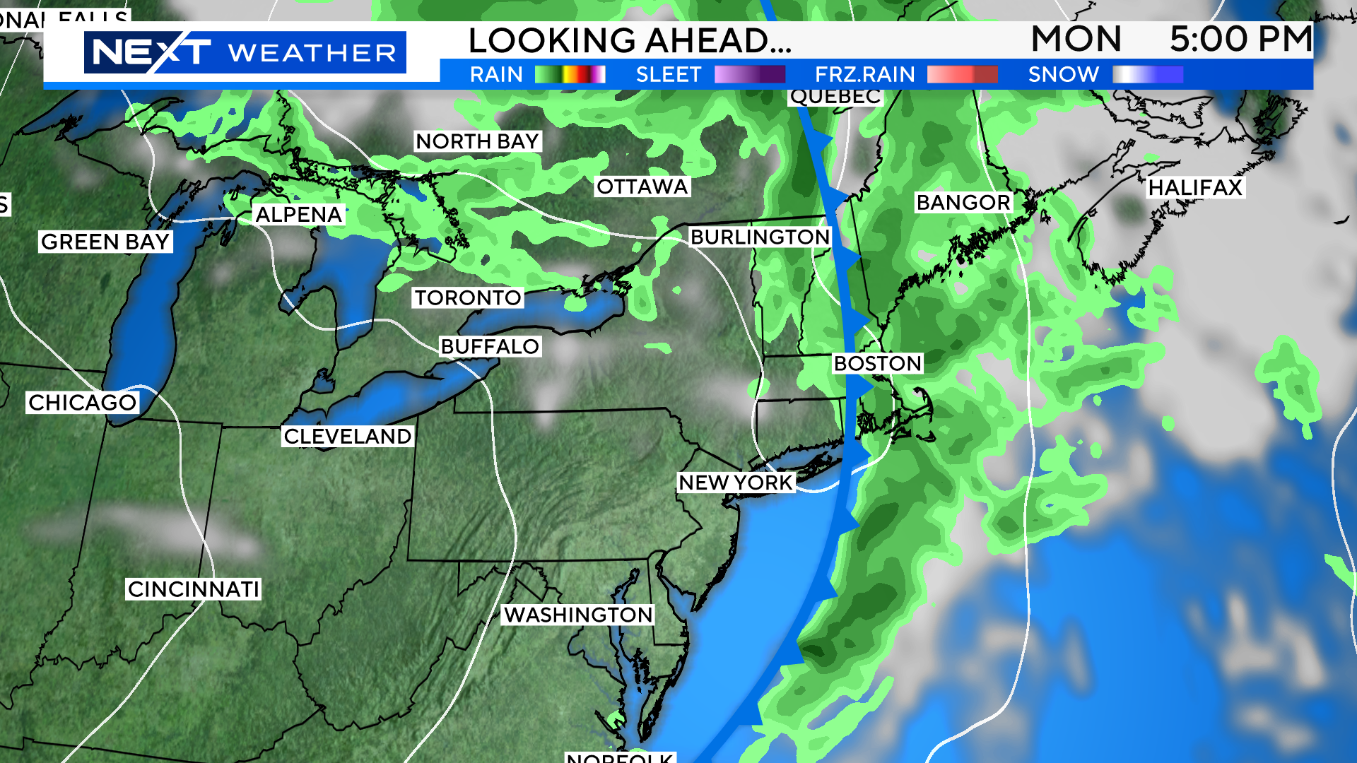
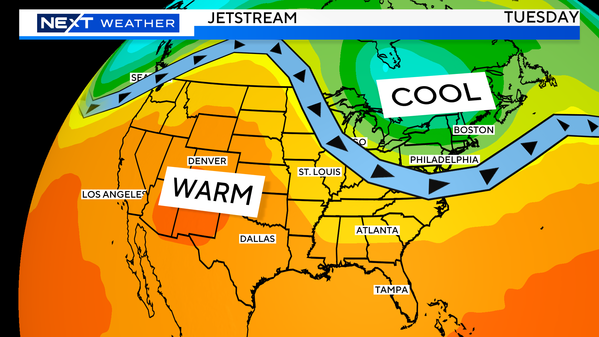
Lastly, it appears as though there will be a cold shot of air coming out of Canada, arriving in New England next Tuesday/Wednesday. This could lead to our first frost in some of the northern and western suburbs.
FOLIAGE OUTLOOK
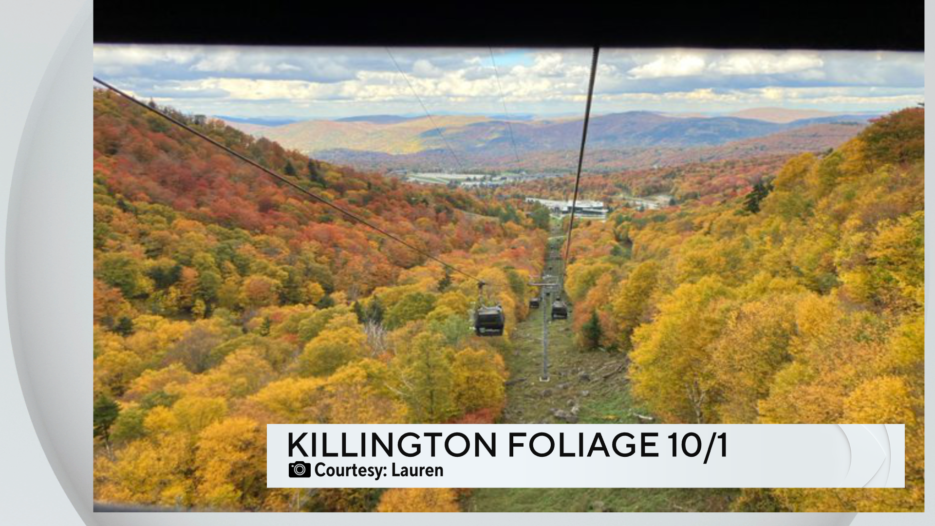
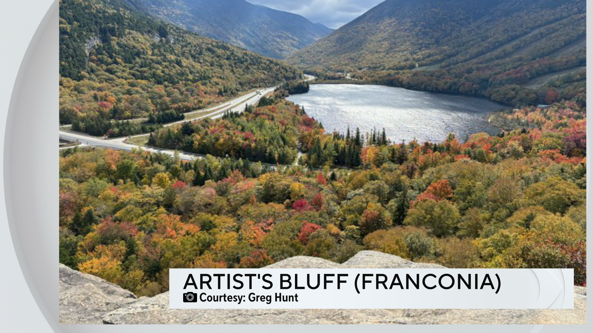
Peak foliage season has begun! Northern New England is bursting with color right now and this Weekend will be the BEST time to head to the Green and White Mountains.
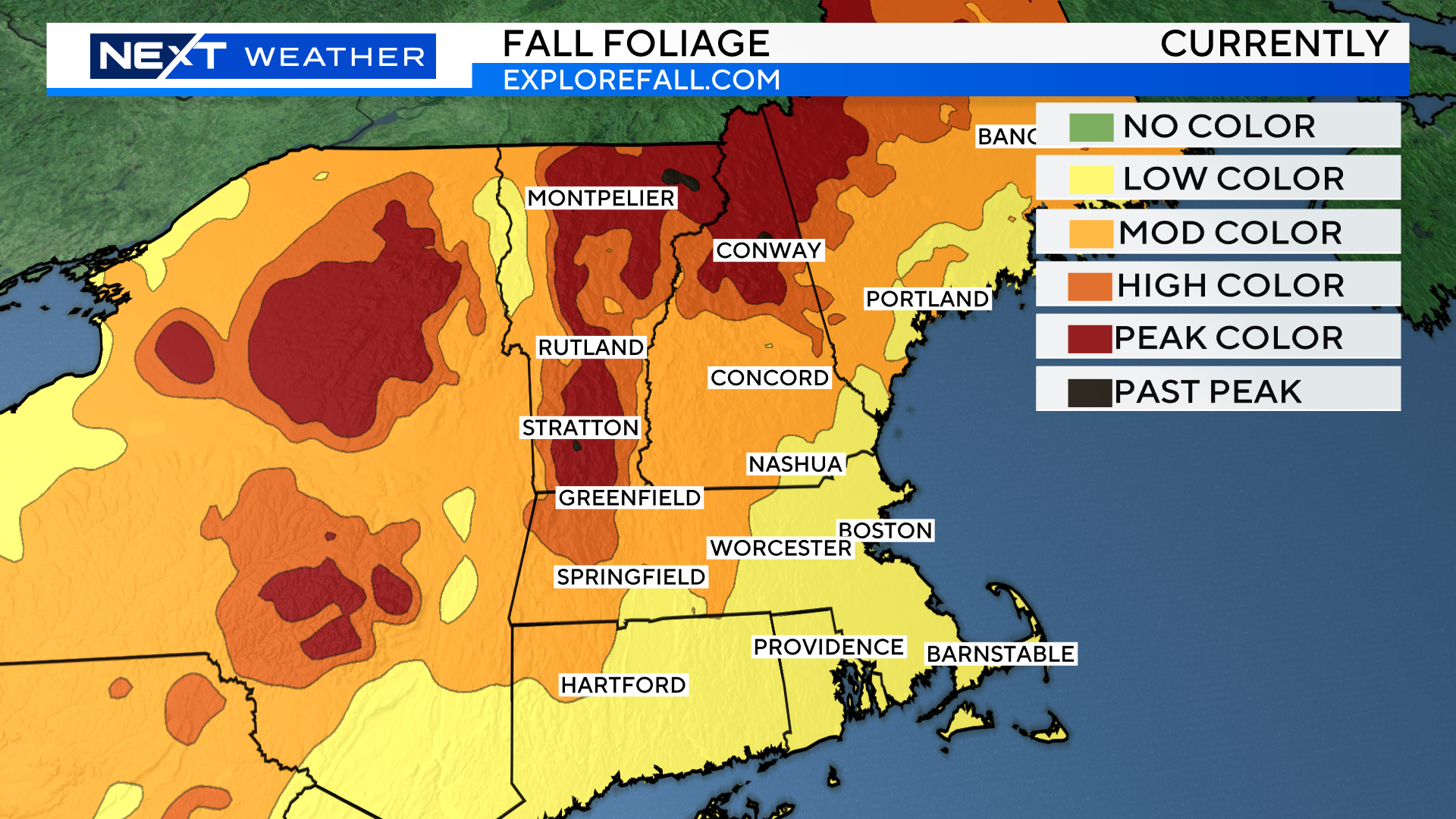
Thankfully, the weather has been cooperating as of late with a couple periods of rain mixed in with some cool nights up North.
If you are thinking of taking a road trip, I would suggest taking one of the following routes…
93 North up into the White Mountain National Forest.
Kancamagus Highway from Lincoln to Conway, NH.
Route 302 from Bretton Woods to Glen, NH
Routes 4 and 7 through the Green Mountains of Vermont
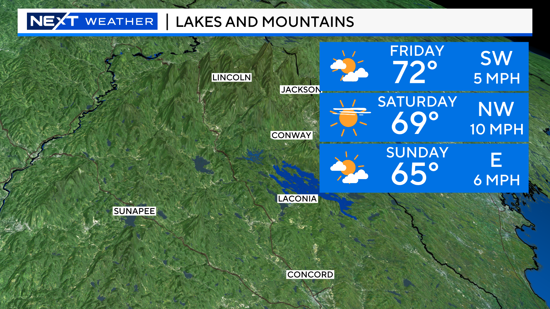
The forecast up North is also great this Weekend! Daytime highs in the 60s, nighttime lows in the 40s with plentiful sunshine.
Northwest winds could get a little gusty during the day Saturday but nothing all that disruptive.
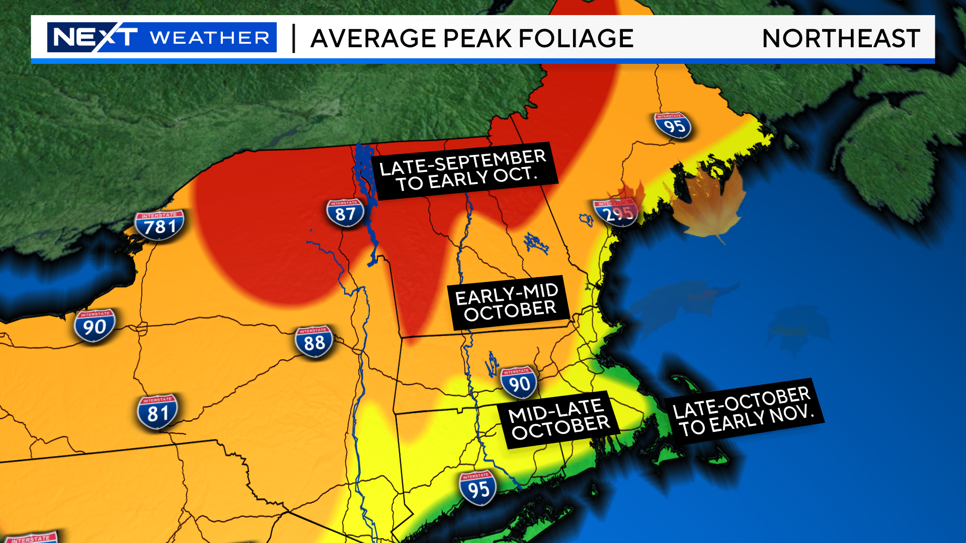
I expect that by next Weekend the peak colors will have migrated southward into the N.H. Lakes Region, the Monadnock Region and the Berkshires.
This has been a banner year for astronomical events. From the total Solar eclipse in April to the “once in a generation” Northern Lights display back in May we have been treated to so many amazing sights in the sky.
Well, here we go again!
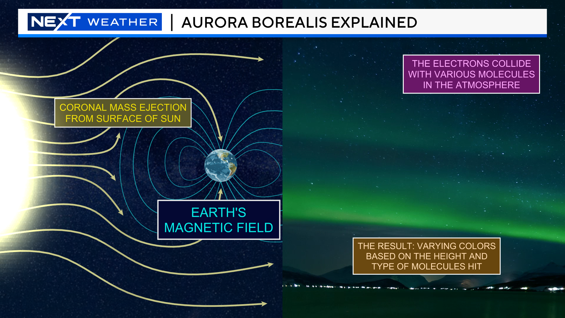
Over the last few days, there have been multiple coronal mass ejections from the surface of the Sun.
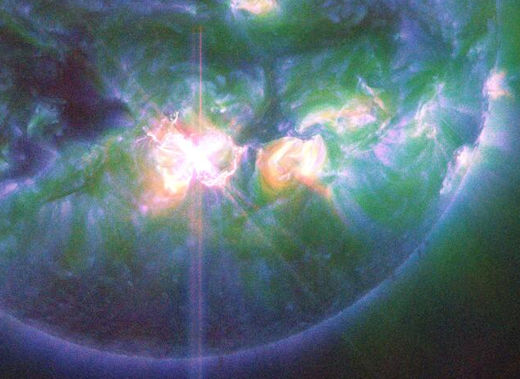
Two of these “CME’s” ejected out of Sunspot AR3842, that big ol’ hole in the lower center of the Sun. These ejections took place when the active sunspot was facing directly at Earth.

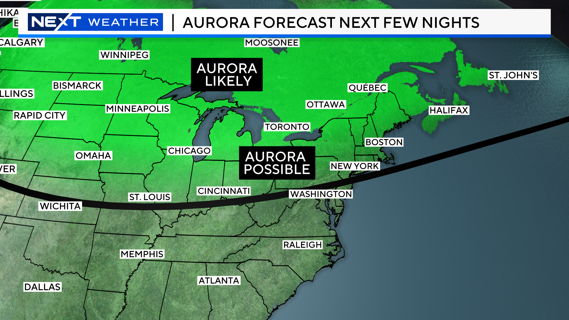
Therefore, we are now “on alert” for a potential geomagnetic storm and possible Auroras over the next few nights.
Since the Sun is 93 million miles away, it takes a few days for the CME’s to reach Earth.
Predicting the speed, size and intensity of these CME’s is extremely difficult…much harder than forecasting the weather.
Therefore, we cannot really know the exact impact it will have on Earth until it reaches some of our outermost satellites which are located about a million miles from Earth’s surface. This gives us less than an hour’s “heads up” as to the exact magnitude and impact of each wave of CME.
Scientists are typically able to get an initial indication (estimate) almost immediately after the explosion on the Sun’s surface.
The two flares of interest were measured at X7.1 and X9.1, quite high on the solar flare scale and plenty strong enough to produce mid latitude Auroras.
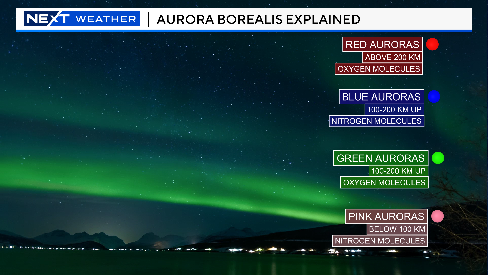
An Aurora Borealis occurs when these large and dense solar ejections collide with the molecules in the Earth’s upper atmosphere. Our magnetic field causes the particles to be largely re-routed towards our Poles, hence why it is so much more typical to see the Northern Lights that farther north you live.
When we have large ejections and strong geomagnetic storms the Lights can seen farther south.
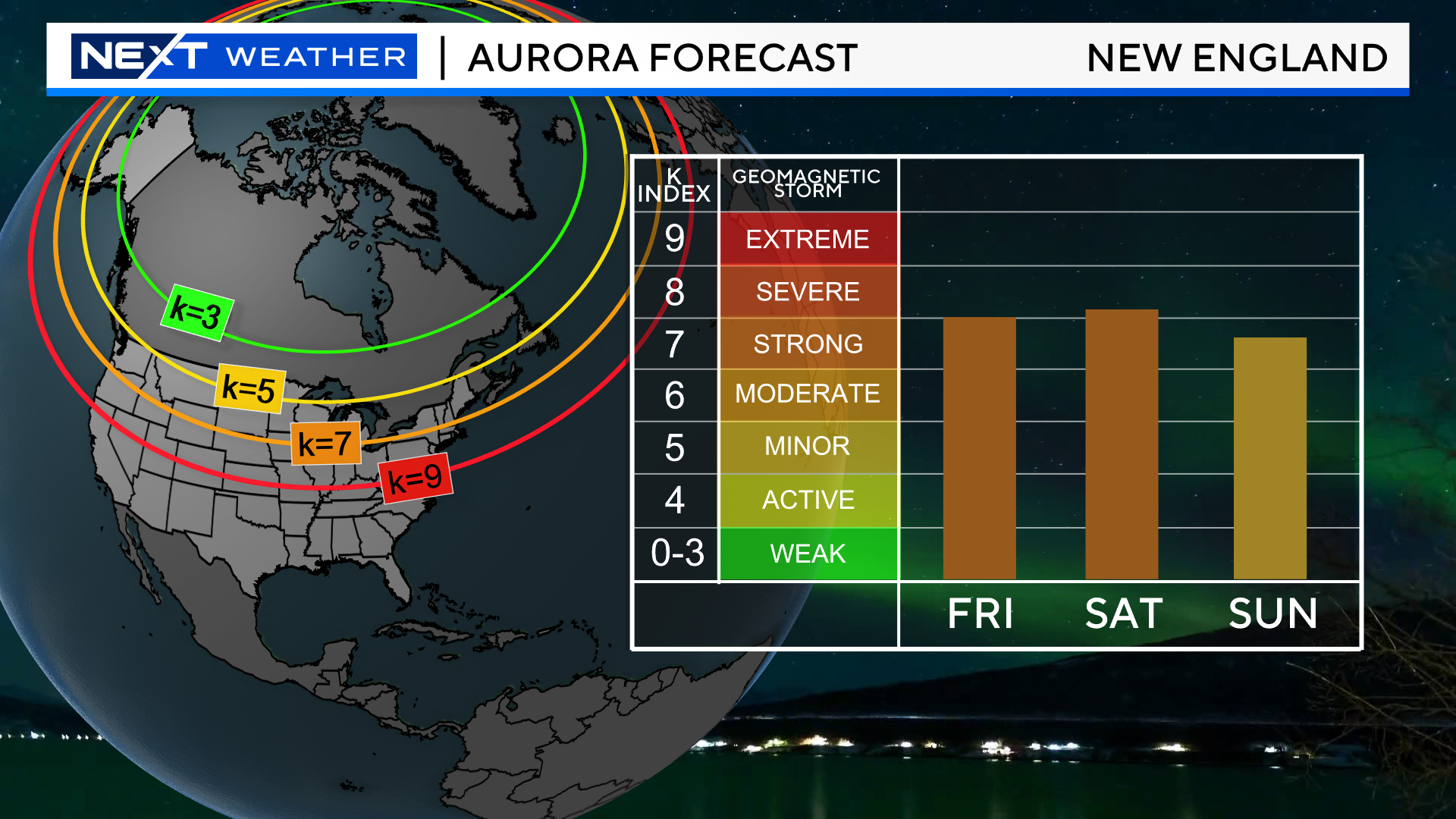
These storms are measured on a “K index”. Typically, when the K index is 7 or higher that indicates a higher chance of Auroras at lower latitudes (including New England). The forecast for the next few nights is currently right at 7.
If you want to optimize your chances to see the Northern Lights, you need to find an area with the least amount of light pollution (dark sky). Also, give yourself a view of as much open sky as possible without any obstructions. Other than that, all I can say is GOOD LUCK. More often than not, Aurora hunting in New England ends in disappointment.
Weather-wise your odds are better Saturday night as there will be periods of clouds overnight tonight.
Finally, is you are able to snap some pics tonight, we would love to see them! Send them to weather@wbztv.com!
A word of warning…most of the images you see of the Northern Lights online and on TV are using long exposure, very expensive cameras. Seeing an Aurora with the naked eye likely won’t be nearly as vivid or deep in color but, it is still well worth the effort!
Click here for Westford snow storm data and past totals or select “Winter Snowfall“ under “Pages” on the left hand side.
For more up to date forecast information follow me on Twitter (@terrywbz) or follow the WBZ weather team on Facebook, search WBZWeather
Reader Comments