Great news for the upcoming Weekend! Another area of high pressure will set up shop over the Northeast blocking any rainfall or storms from penetrating the region, including the remnants of Helene.
The rain will stay well to our southwest…there may be some high cloudiness at times
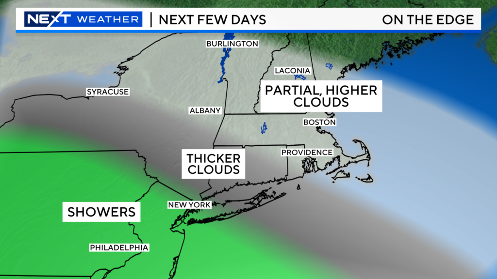
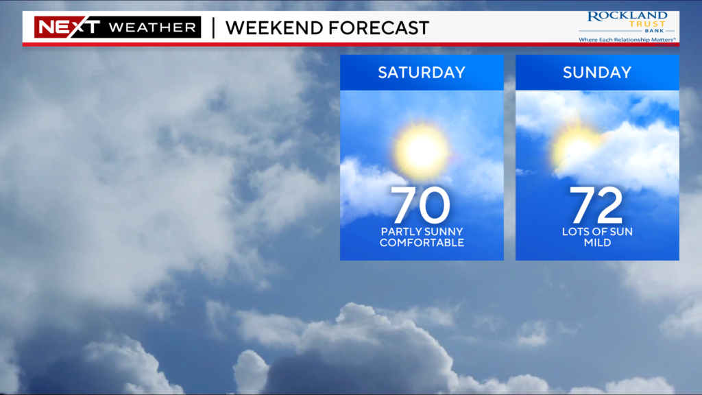
Looks like a great weekend for all the fall things!
Astronomical events are some of the most fun and shareable stories that we cover here at WBZ.
This has been a banner year for stargazing. In 2024 alone, you had the opportunity to see a total solar eclipse, a partial lunar eclipse, one of the most amazing auroral displays (Northern Lights) in decades and also a couple of decent meteor showers!
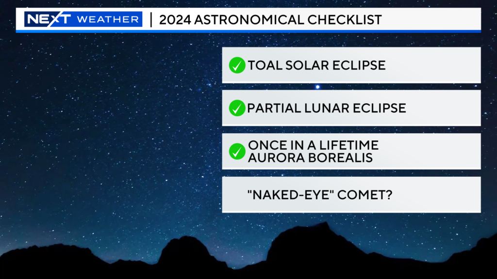
We may be able to check one more thing off your astronomical bucket list.
Coming up later this week, the potential for a “naked-eye” comet! In simpler terms, a comet that is visible to the naked eye without the aid of binoculars or a telescope.
Comet C/2023 A3 Tsuchinshan-ATLAS, reaches its perihelion this Friday. This marks its closest pass by our Sun in its 80,000 year-long orbit. It is expected that the Comet will be just bright enough to see with the naked eye for several days starting this Friday and lasting through Monday of next week.
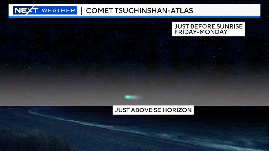
In order to have a chance at catching a glimpse, you will need to get up early, have a clear view of the east-southeastern horizon and, of course, have clear skies.
The Comet will be just a few degrees above the ESE horizon and be visible for less than an hour, right before sunrise.
Comet viewing can be a difficult sport. Nothing is guaranteed with respect to its brightness, so it may be wise to grab a pair of binoculars just in case. Astronomers feel fairly certain that at least some of the Comet’s large, dusty tail should be visible.
After Monday, folks in the northern hemisphere will be unable to see the Comet for several days. It is forecast to re-emerge low in the western horizon around Saturday, October 12th for a few more days of potential viewing.
As far as the weather goes, we have a nice stretch coming up Friday through Monday with just some occasional passing clouds.
We will update you on the viewing chances this Weekend and again before the next window later in October.
FALL FOLIAGE:
Hard to believe the final Weekend of September has arrived. We are flying at light speed through the season and before you know it, well, you know what comes next.
Historically, this Weekend is the fall foliage “kickoff party” up north. Typically, the wave of peak fall color starts right about now in northernmost New England before making the journey southward through the month of October.
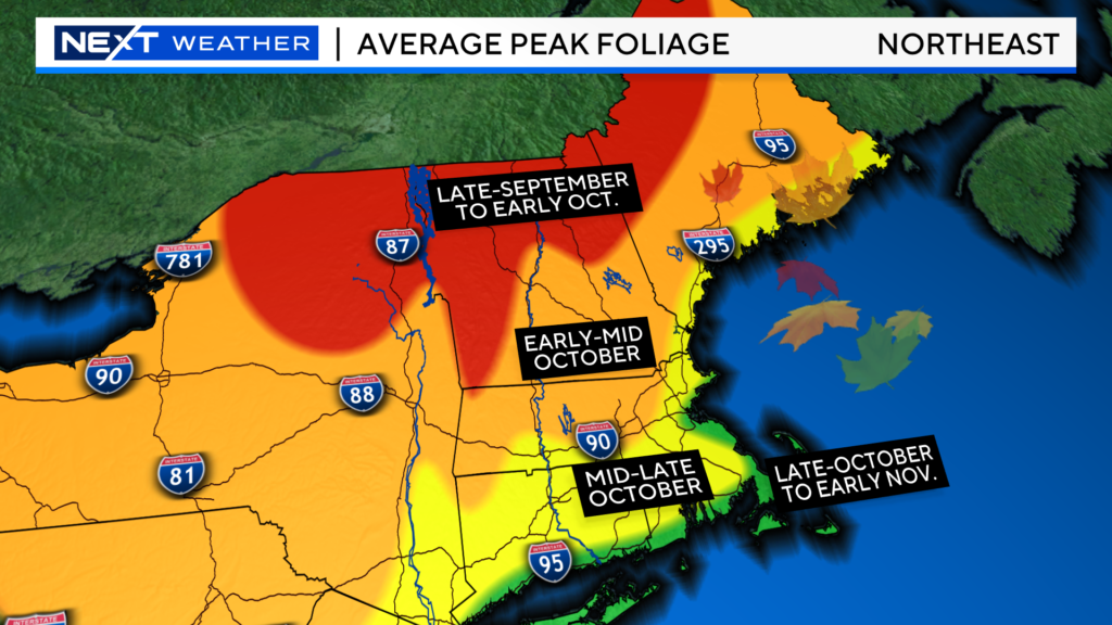
So, how’s the foliage doing so far?
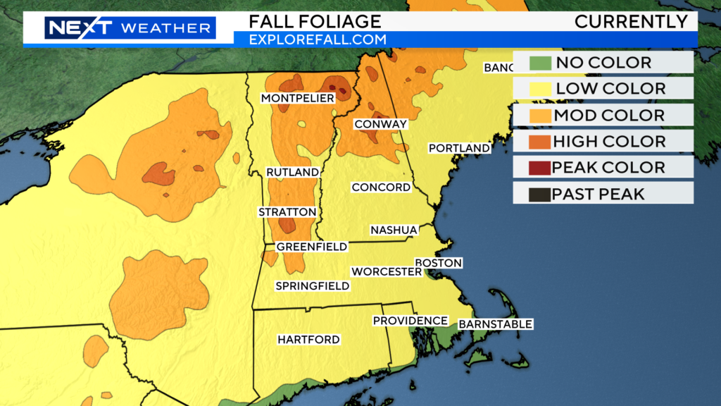
Here’s a look at the current state of foliage in New England.
You’ve likely noticed some spotty color even around the Boston area and throughout southern New England, particularly in the low-lying areas.
The best color right now is in the highest elevations of the Green and White Mountains as well as the northern crown of Maine.
I would classify this area, in general, as moderate to high color with splashes of peak.
Honestly, it probably needs to cook for another week or so before we see widespread peak color up north.
That is certainly not to dissuade you from a road trip this Weekend. There is still plenty of color to see and some lovely weather to go with it. Of course, there are no guarantees weather-wise in the Weekends ahead.
There will be some high clouds at times this Weekend, but it will be dry and quite comfy.
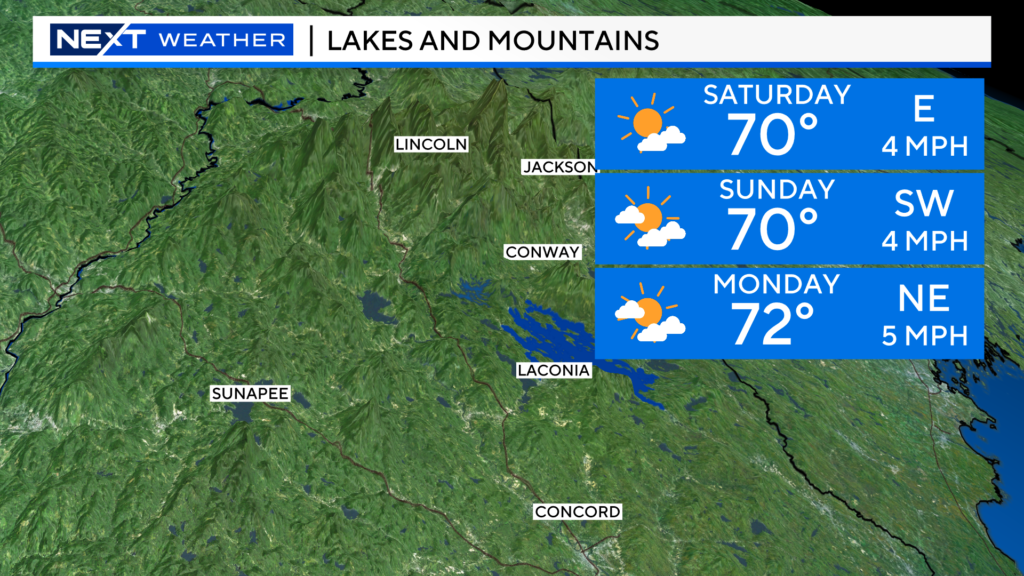
So, again, my picks for this Weekend would be:
The Green Mountain of Vermont up through Montpelier and Burlington
The White Mountains of New Hampshire, essentially from Conway-northward
The northernmost reaches of Maine
If you are looking for a shorter drive, you could take your chances and head west to the Berkshires. You won’t find much peak color but there should still be some very colorful areas.
The outlook for the remainder of the season remains decent.
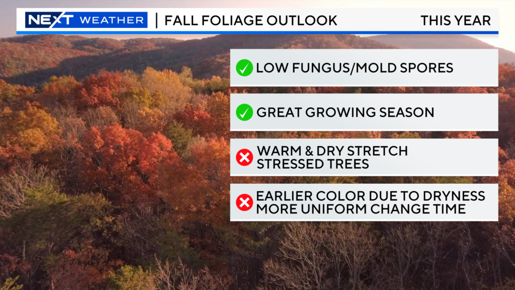
We were predicting a banner season until the recent dry spell hit in late August and early September.
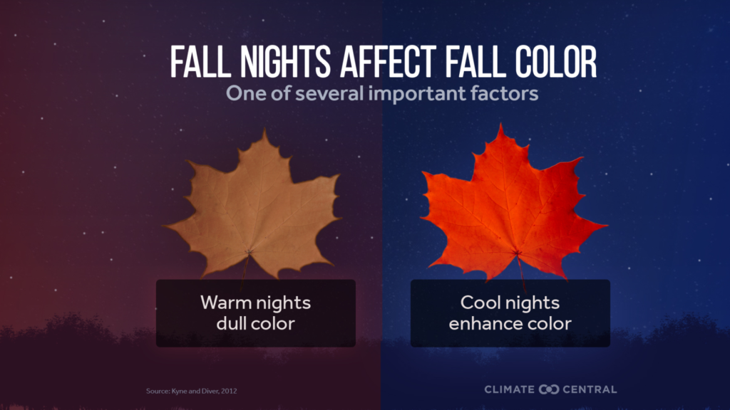
That, along with some very warm days and nights a few weeks back, caused us to lower our expectations just a bit.
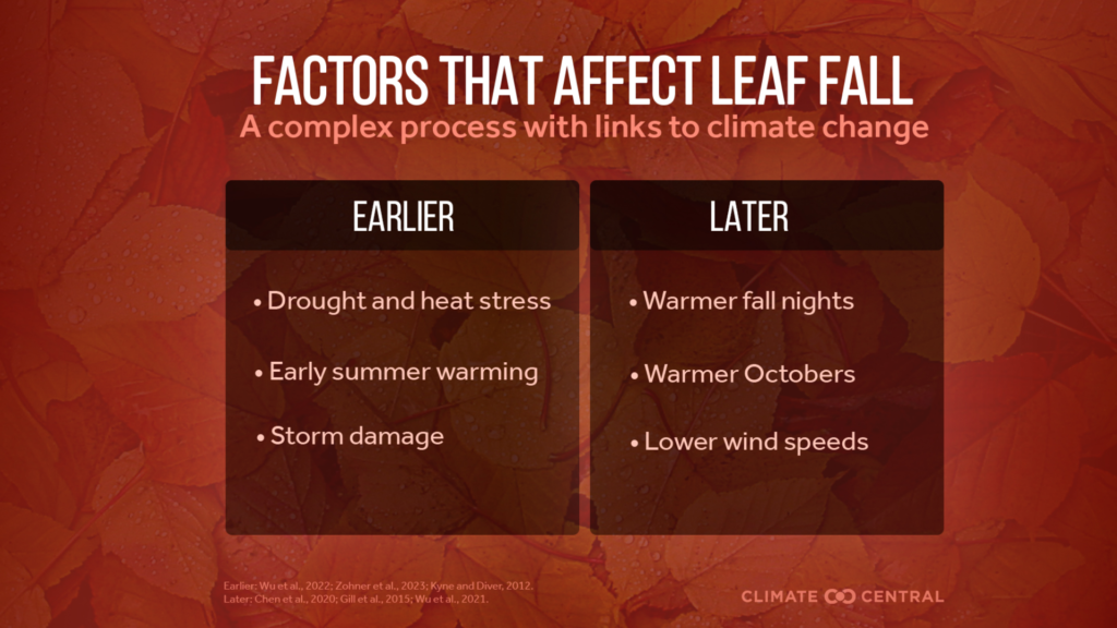
I still believe if we can get some more typical fall weather in the weeks ahead and avoid any major wind storms, this year should be fairly high quality.
We will keep you updated each week and have some road trip picks before each Weekend!
As always, if you head out and snap some pictures we would love to see and share them! Send them to weather@wbztv.com
Click here for Westford snow storm data and past totals or select “Winter Snowfall“ under “Pages” on the left hand side.
For more up to date forecast information follow me on Twitter (@terrywbz) or follow the WBZ weather team on Facebook, search WBZWeather


Reader Comments