All I can say is thank goodness this isn’t winter. A very large storm system has set up residence just off our Coastline and the impacts from region to region are extremely variable. As of Friday afternoon, there was as much as 3-4″ of rain on parts of the Outer Cape and Nantucket while Boston had received 0.01″. Yes, if this were snow, that would be an insane gradient!
RAIN TIMELINE:
The rain has remained nearly stationary during the day Friday, covering most of southeastern MA. There is going to be a final push later tonight and this is when Boston and areas father to the north and west will receive their share. Light to moderate rain is expected across most of eastern MA during Saturday morning and afternoon. There will be a sharp cutoff to the west, somewhere close to Worcester county. Areas to the west of this line will remain mainly dry Saturday.
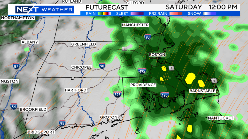
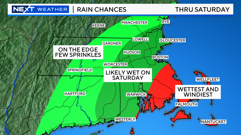
The rain will pivot out of southern New England Saturday evening, drying us out for the second half of the Weekend. Yes, Sunday is the pick!
Look at this as sort of a warmup storm for the upcoming “storm season”.
Folks at the Coast will continue to deal with some wind and flooding throughout the remainder of the Weekend.
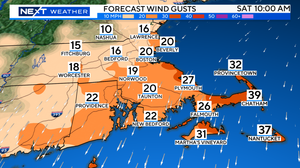
Strongest northeast winds will occur over extreme southeastern MA with gusts to 45mph through Saturday, a bit less on Sunday but still gusty.
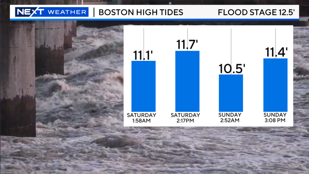
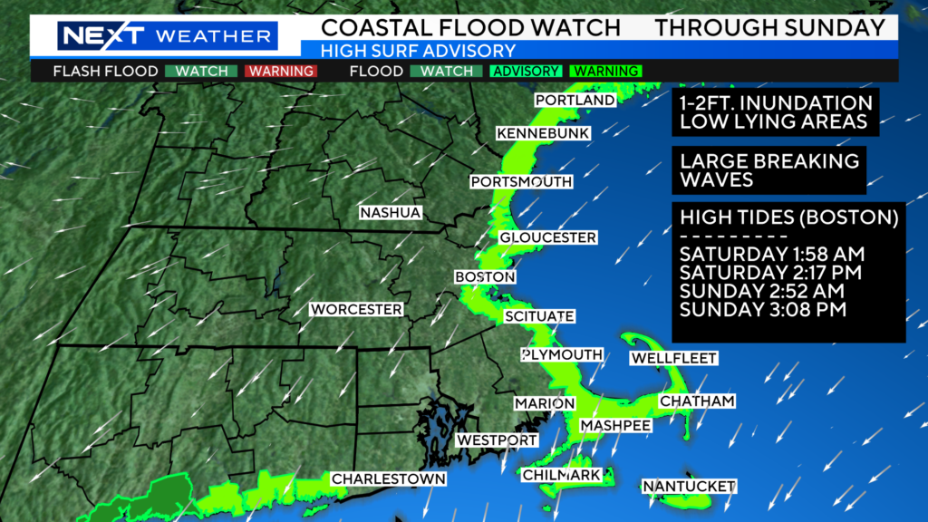
There is a Coastal Flood Watch posted for all the upcoming high tide cycles through Sunday. Tides are astronomically quite high right now. Combine that with the persistent, gusty northeast wind and we expect some inundation of Coastal roadways and splashover during the next several high tide cycles. Of particular interest: Saturday high tide between 1-4pm and Sunday high tide between 2-5pm.
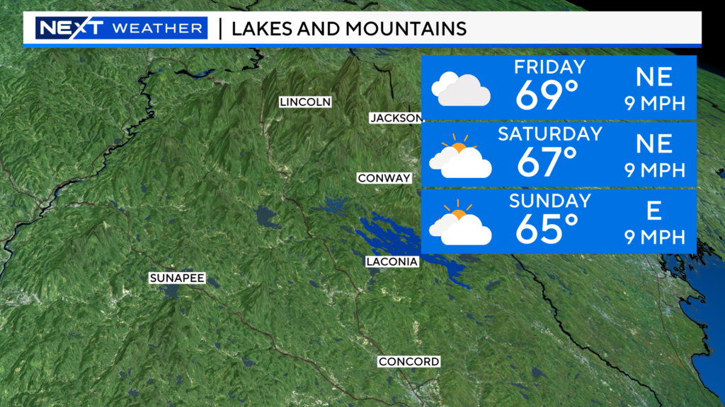
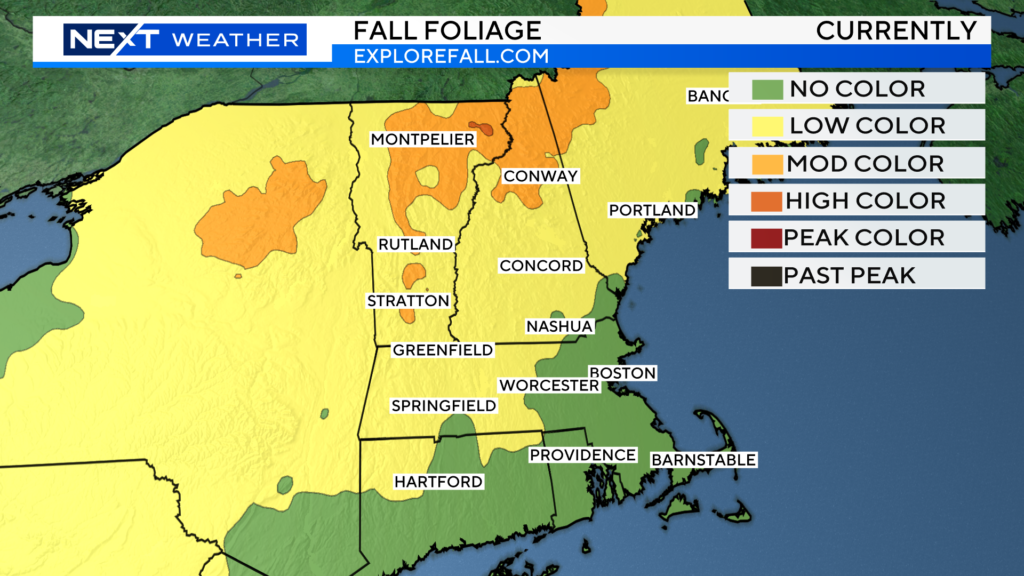
This is a popular Weekend for foliage viewing up north. Currently, we have spotty, “moderate” color in northernmost areas. We are still a week or two away from peak color in the Whites and Greens. We do not expect any rainfall up north this Weekend, just a mix of sun and clouds. It will certainly feel like fall with highs in the 60s.
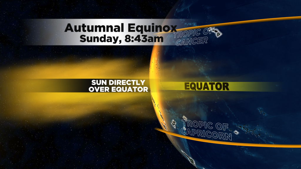
Lastly, the Autumnal Equinox arrives this Sunday morning! This marks the sun’s direct rays passing over the equator and heading towards the Southern Hemisphere. From here on out, you will start to notice the sun being lower and lower in the sky and the days getting shorter and shorter.
WINTER OUTLOOK
This clearly is NOT one of our better Friday’s. After a tough Pats game last night, depending on where you live, you either are blanketed with clouds, getting waves of rain or gearing up for some coastal flooding.
I am here today to take your mind off the gloom for a bit. What better way to do so than to talk about winter!
HOLD ON! Don’t stop reading! Depending on your perspective, some of what I am about to say may be good news!
First off, you may be asking, why are we talking about winter on September 20th?
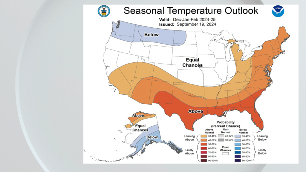
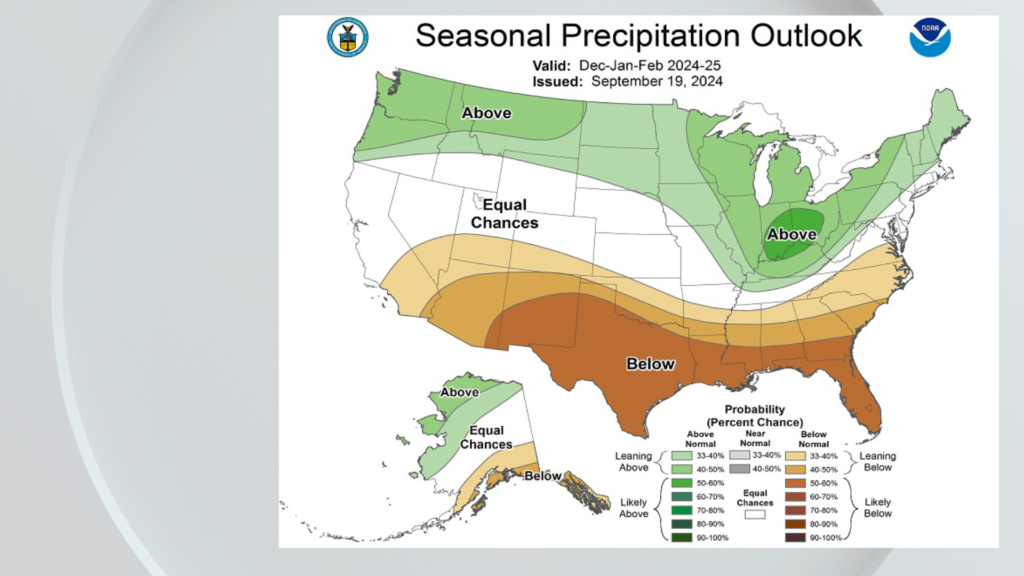
Well, NOAA released their winter seasonal outlook…
These maps are probability based and for the months of Dec-Jan-Feb.
Their temperature forecast favors above average temperatures across the Southern-tier and for the entire East Coast.
NOAA’s precipitation forecast looks wetter than average across most of the northern states and drier than average across the south.
The vast majority of this forecast was based on one factor, La Nina.
We are already seeing signs of a La Nina in the waters off of South America.
La Nina is a cooling of these waters compared to average, the opposite of El Nino.
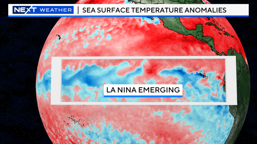
NOAA is predicting a 71% chance of La Nina emerging and continuing in the coming months, likely lasting right through the upcoming winter.
Most models are forecasting a relatively weak La Nina.
Looking at a typical La Nina winter across the United States, you can see why NOAA made their prediction…
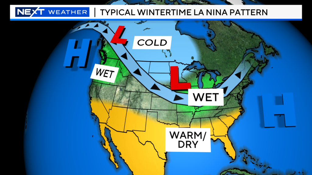
This is just a general idea for the winter, of course there will always be day to day and week to week variability.
Despite the Ocean being cooler than average in the La Nina region, it is otherwise still very warm overall. The Ocean temperatures across the Pacific and Atlantic also play a major role in shaping the winter pattern.
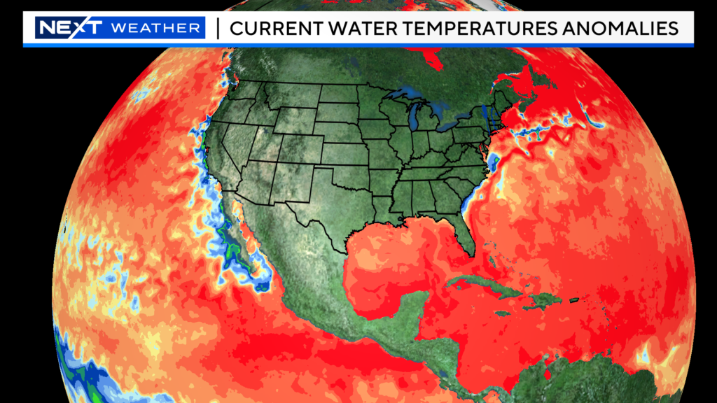
The WBZ Weather Team will make our official winter prediction in November. However, at this point, I do not see any major reason or evidence to dispute the NOAA forecast. We haven’t had a truly cold winter here since 2014-2015 and the snowfall amounts in recent years have been laughably low. Given the current state of our Oceans and atmosphere, I think it will be exceedingly difficult to get a below average (temperatures) winter season. Sure, there will be some periods of cold and SOME snow…but the early odds favor yet another mild winter for 2024-2025.
Our team will continue to monitor all the various, complex atmospheric factors that will play into the upcoming winter. As things unfold in the weeks ahead, we will keep you updated as to how things are shaping up and what you can expect this winter!
Click here for Westford snow storm data and past totals or select “Winter Snowfall“ under “Pages” on the left hand side.
For more up to date forecast information follow me on Twitter (@terrywbz) or follow the WBZ weather team on Facebook, search WBZWeather


Reader Comments