Happy Thursday!
The news today is mostly good. The outlook through the Weekend is steadily improving! We won’t have any repeats of Tuesday’s sunny and 70s but we also won’t have any washouts.
Essentially, each day (Today through Sunday) will feature more clouds than sun, temperatures in the 50s to near 60 (inland) and just a slight risk of some light showers here and there.
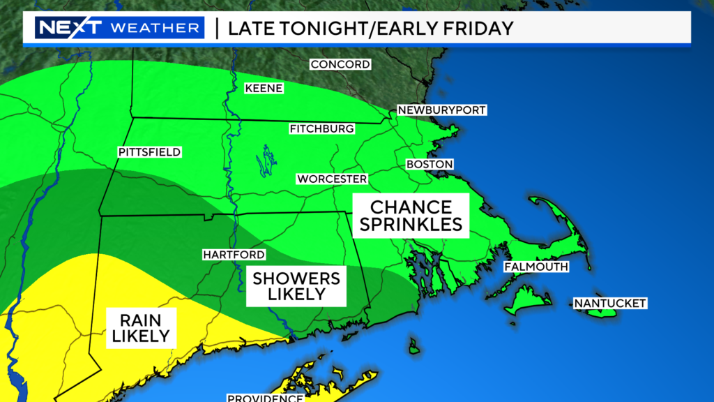
The first chance of some wet weather comes overnight tonight into early Friday.
Most of the steadier rain will remain well to our south and west, however we could see a few light sprinkles up through the MA/NH border.
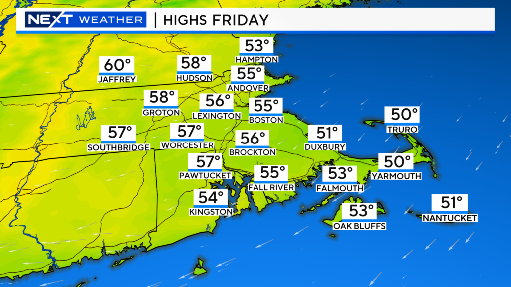
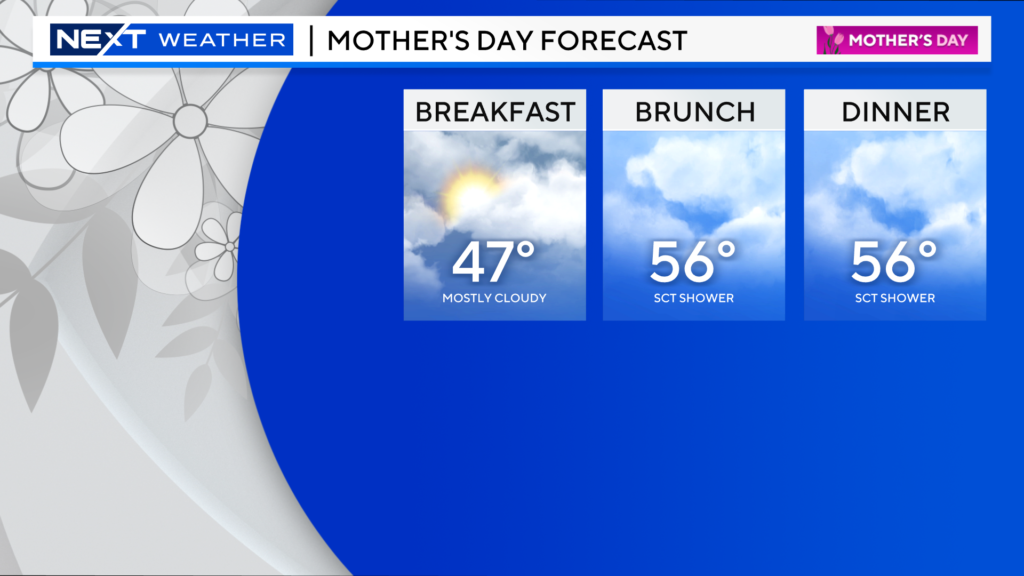
Friday will be a tad cooler than today, again , mostly cloudy and coolest at the Coast.
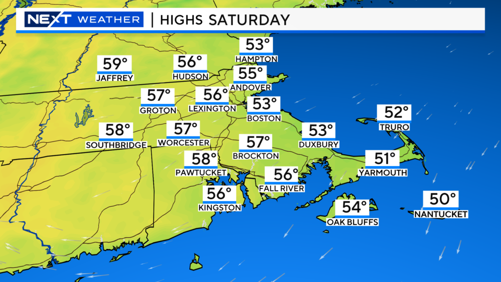
Saturday will be very similar to Friday…highs in the 50s to near 60, manly dry, cooler at the Coast.
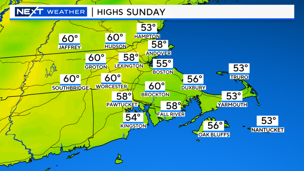
Mother’s Day…more of the same…More clouds than sun, chance of a few sprinkles, highs mainly in the 50s.
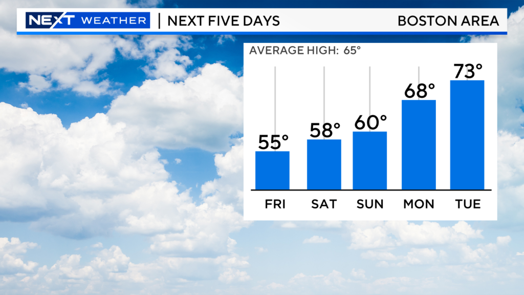
Temperatures next week will be on the rise…of course…Mondays and Tuesdays are always the nicest!
Our planet is now under a “severe geomagnetic storm watch”.
This may sound awfully scary, but in actuality this is exciting news! The Northern Lights may be coming to a backyard near you!
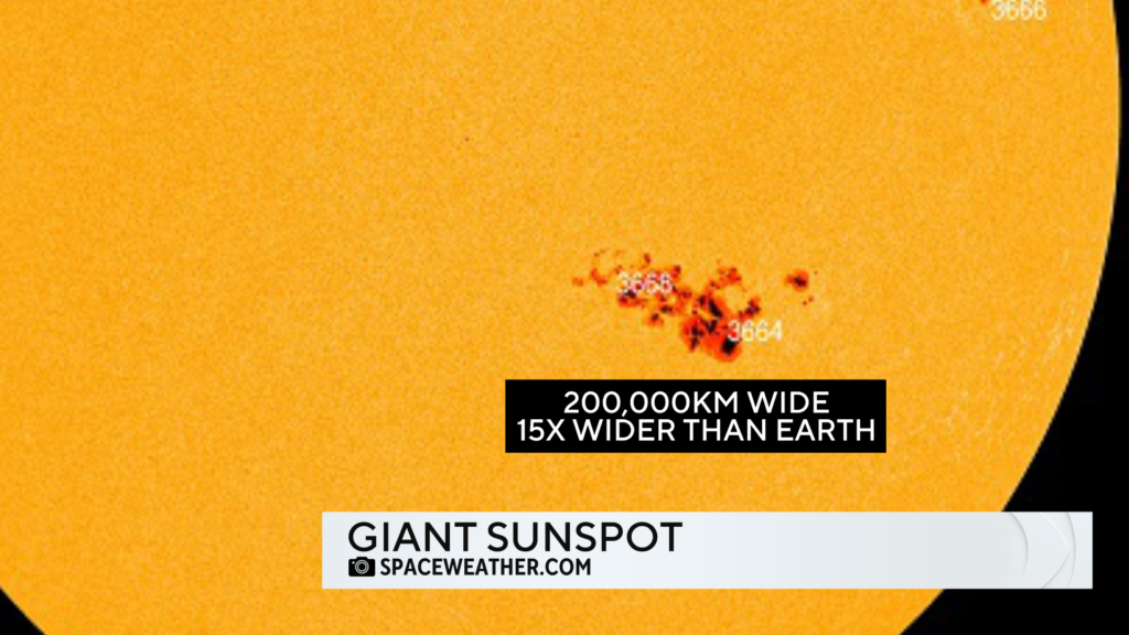
Right now, there is a massive sunspot pointed towards Earth. Known as Sunspot AR3664, this is one of the largest sunspots we have seen in decades.
In fact, many experts are comparing it to a famous sunspot way back in 1859, known as “Carrington’s sunspot”.
AR3664 is nearly 200,000 km wide, the size of about 15 Earth’s!
Over the last 24 hours, several CME’s (coronal mass ejections) have burst outward from the Sun and are now headed towards Earth. It is believed that some of these massive ejections will combine into one enormous “Cannibal CME”.
This cannibal CME is the reason why NOAA is predicting a severe geomagnetic storm (level G4 or severe) late tomorrow night and early on Saturday.
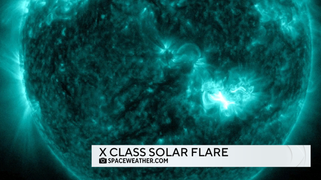
Today’s solar flare was classified as an X2.2.
X class solar flares are the largest followed by M class and C class.
Within the X class, the flares are subdivided from X1 to X9.
Long story short, today’s solar flare was pretty darn big. Big enough to potentially spark Aurora’s much farther south (in latitude) than usual but not big enough to warrant concern over blackouts or grid issues.
In order for us to get a decent shot at seeing anything in southern New England, we typically need the “k index” ( a measure of the level of geomagnetic activity) to be 7 or higher.
You can see that early on Saturday the forecast is for a k index of around 8.
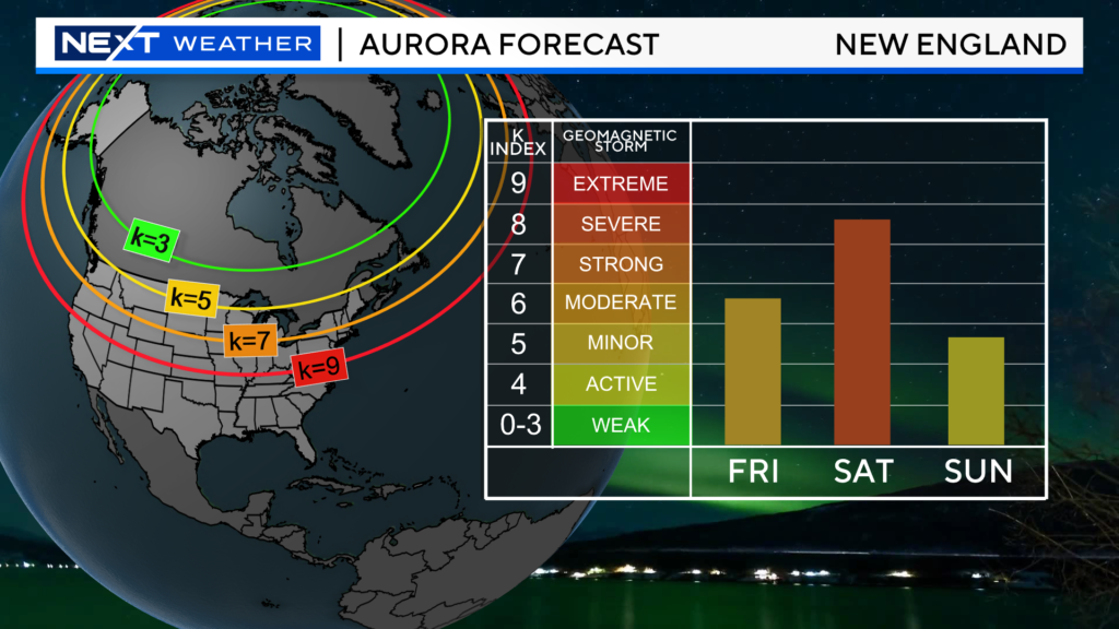
If you want to optimize your chances to see the Northern Lights, you need to find an area with the least amount of light pollution (dark). Also, give yourself a view of as much open sky as possible without any obstructions.
Again, right now it seems the early hours of Saturday morning may be the peak timeframe (before the light of dawn starts interfering).
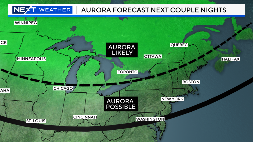
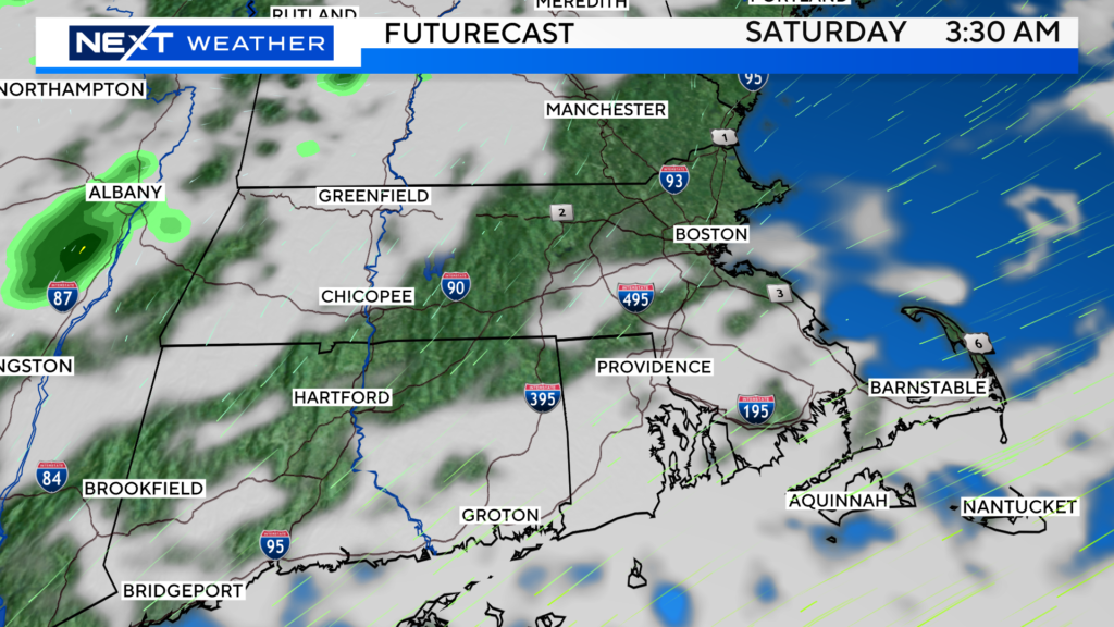
Obviously, all of this is for nothing if the weather doesn’t cooperate!
Clouds would certainly ruin the show.
The forecast right now for early Saturday morning is for some cloudiness, especially near the Coastline. However, overall, I would say odds favor clear or mostly clear skies for the majority of folks in southern New England!
Stay tuned to forecast updates over the next 24 hours. We will have the latest cloud cover and Aurora forecasts right here and on WBZ-TV!
Click here for Westford snow storm data and past totals or select “Winter Snowfall“ under “Pages” on the left hand side.
For more up to date forecast information follow me on Twitter (@terrywbz) or follow the WBZ weather team on Facebook, search WBZWeather


Reader Comments