


What could be more “April” than this…Freeze warnings and 80 degrees in the same 7-day forecast!
While neither one is all that unusual during the last week of April, the temperature swings in such a short period of time are certainly noteworthy and, for some, a bit concerning.
Let’s start with the chill…
The National Weather Service has posted freeze warnings overnight tonight for the Coastline and areas in southeastern MA (Bristol and Plymouth counties) where temperatures may fall as low as 27 degrees.
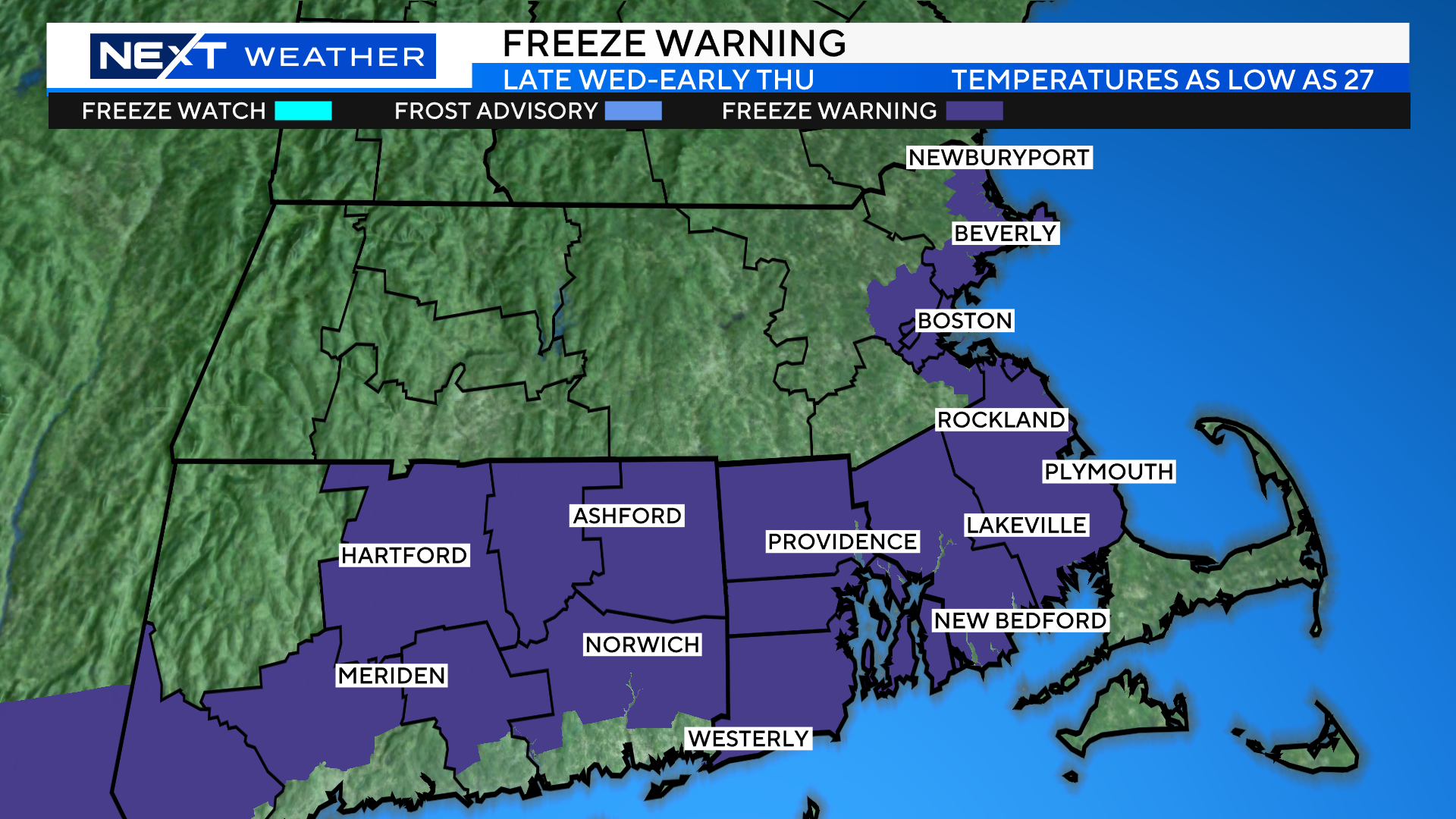
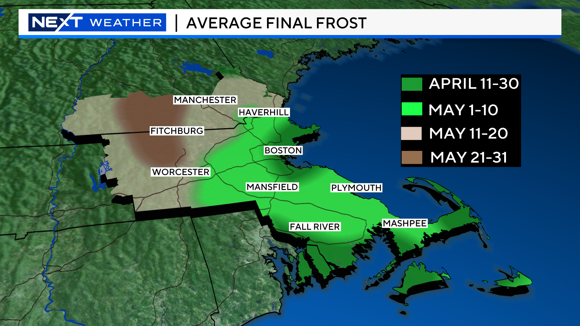
This graphic can be very deceiving as you may think that if you live north or west of Boston, you are “safe”. In fact, those areas will be just as cold, if not colder, but the National Weather Service does not include them in the frost/freeze headlines because of a technicality…
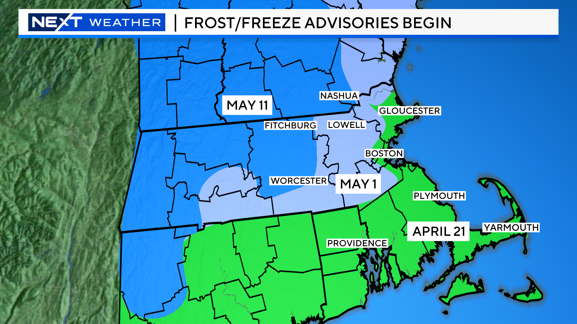
You see, along the Coast and over southeastern MA, the growing season technically begins on April 21, so, it is now underway.
North and west of Boston, the growing season hasn’t started yet (by definition). If this were May 1, you would see freeze warnings up in most of Middlesex county as well as parts of Essex and Worcester counties.
Confused?
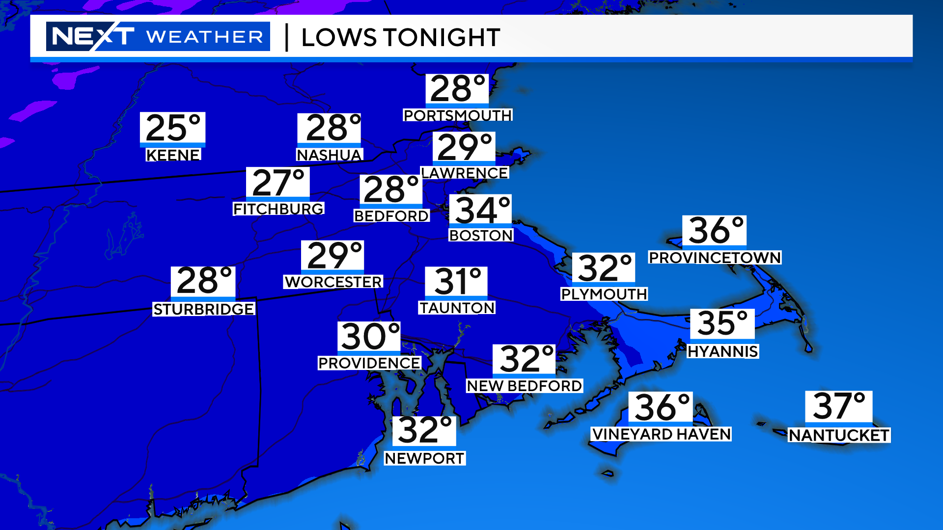
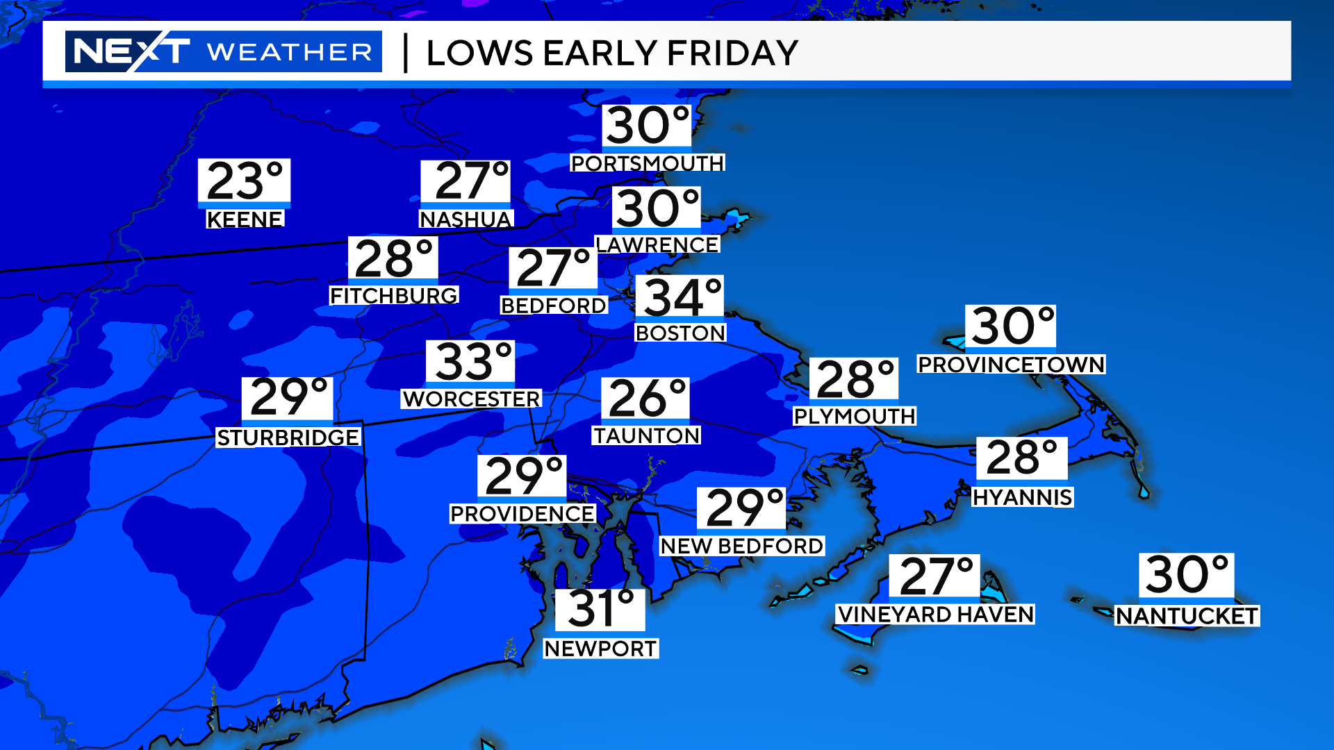
Here’s the bottom line. The next few mornings will be cold enough for a frost or freeze in just about our entire region.
These are our forecasted low temperatures which will occur in the early morning hours of Thursday and Friday.
Needless to say, if you jumped the gun and started planting in the garden already, you will need to take action to cover and protect your plants. Most things that are already growing or are being sold in the garden centers should be able to withstand the cold. These include the early season, more hardy plants like pansies and cold crop veggies.
As a reminder, there really isn’t a full “green light” for planting in southern New England until about Mother’s Day, which is still about 3 weeks away.
This is an average of course, and areas north and west of 495 tend to have their final frost a bit later than that.
The main concern over the next few mornings isn’t in your backyard, but more so in the local area farms.
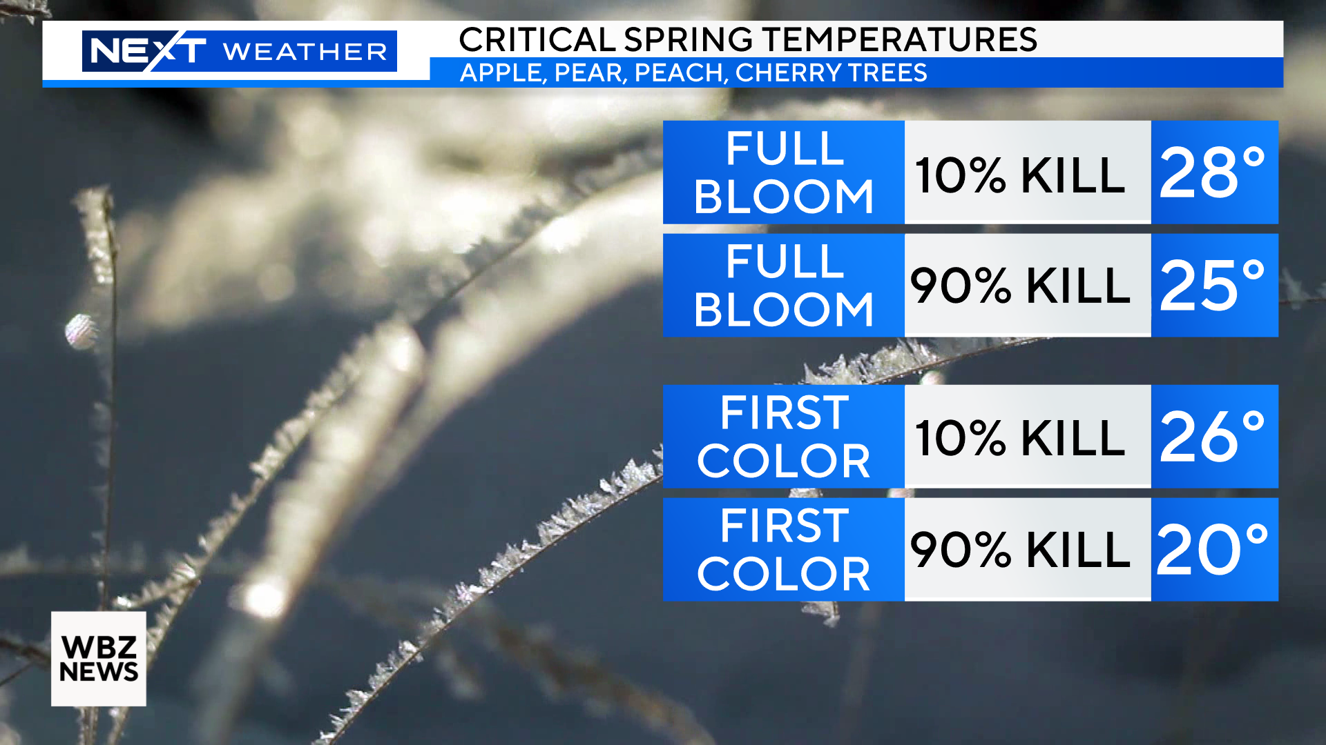
Right now, most of our area fruit trees are somewhere between “first color” (apple trees) and “full bloom” (pear and peach trees).
These are dangerous stages when temperatures are forecast to drop into the 20s.
Every degree is critical…Upper 20s could mean a 10% kill while low to mid 20s could mean near complete devastation.
Thus, most farmers will literally be losing sleep over the next few nights. The best way to prevent damage is to irrigate all night long. By spraying water on the trees and allowing it to freeze, this actually protects the delicate buds from being damaged by the cold air temperatures.
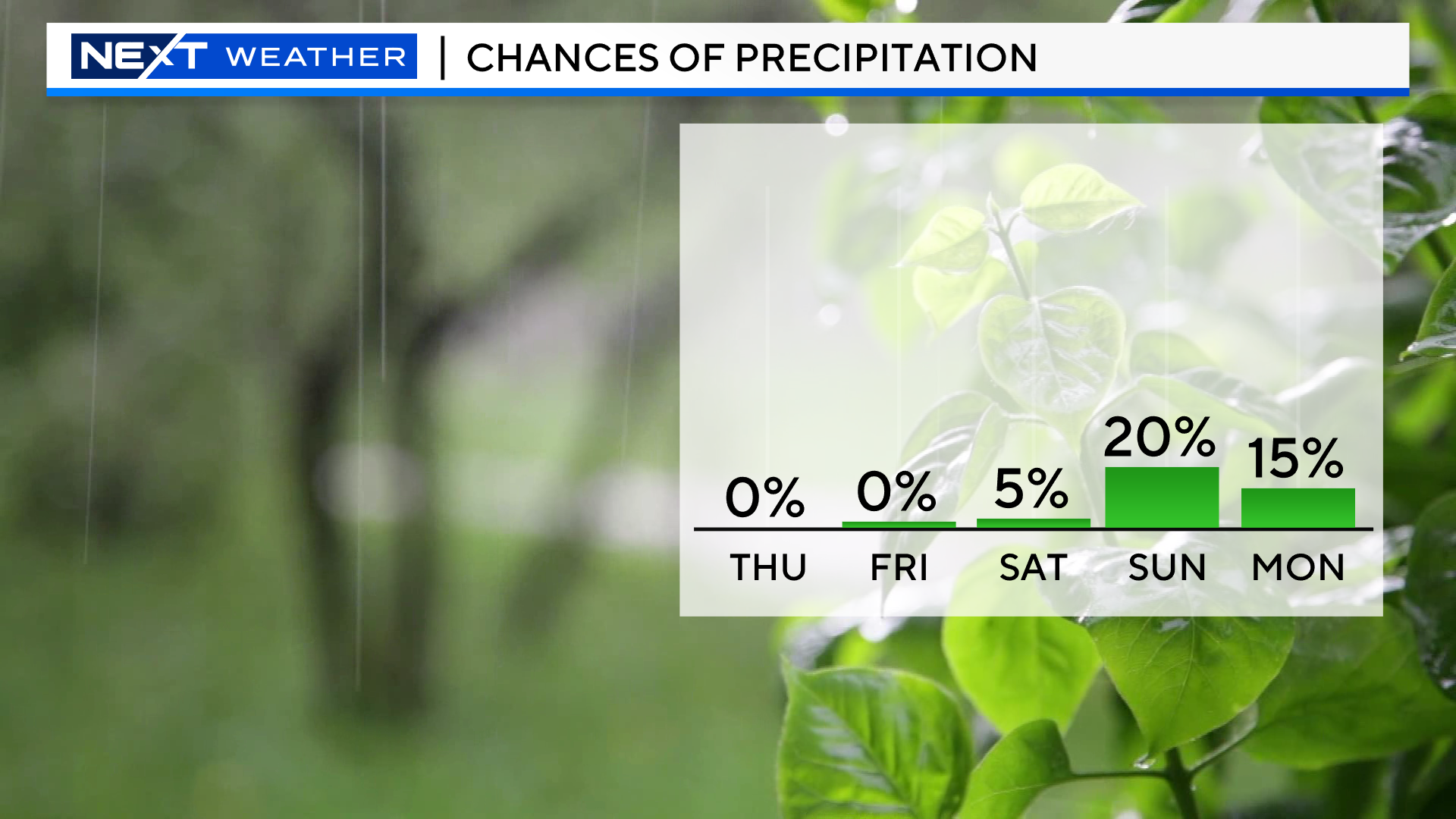
Ok, now onto the good news…Other than a very slight chance of a few showers Sunday, we are in for a very dry, pleasant stretch of weather!
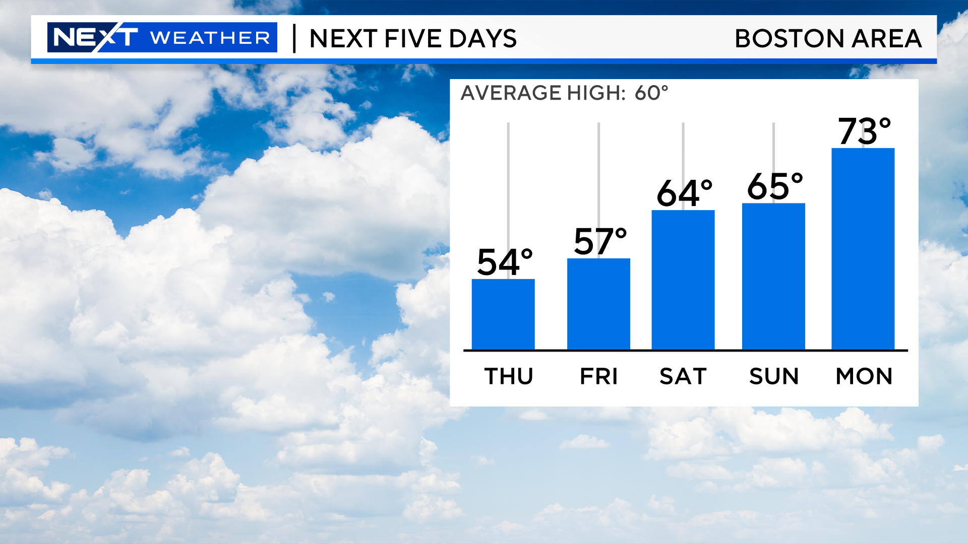
Temperatures will also be increasing day by day…Next Monday through Wednesday should be our warmest stretch of the season thus far.
High temperatures will top 70 degrees all three days with a chance of hitting 80 away from the Coastline on Tuesday and Wednesday.
Click here for Westford snow storm data and past totals or select “Winter Snowfall“ under “Pages” on the left hand side.
For more up to date forecast information follow me on Twitter (@terrywbz) or follow the WBZ weather team on Facebook, search WBZWeather
Reader Comments