


Happy Wednesday!
Sure looks nice outside from the comfort of being indoors, but as soon as you step outside, you are immediately reminded that it is almost December!
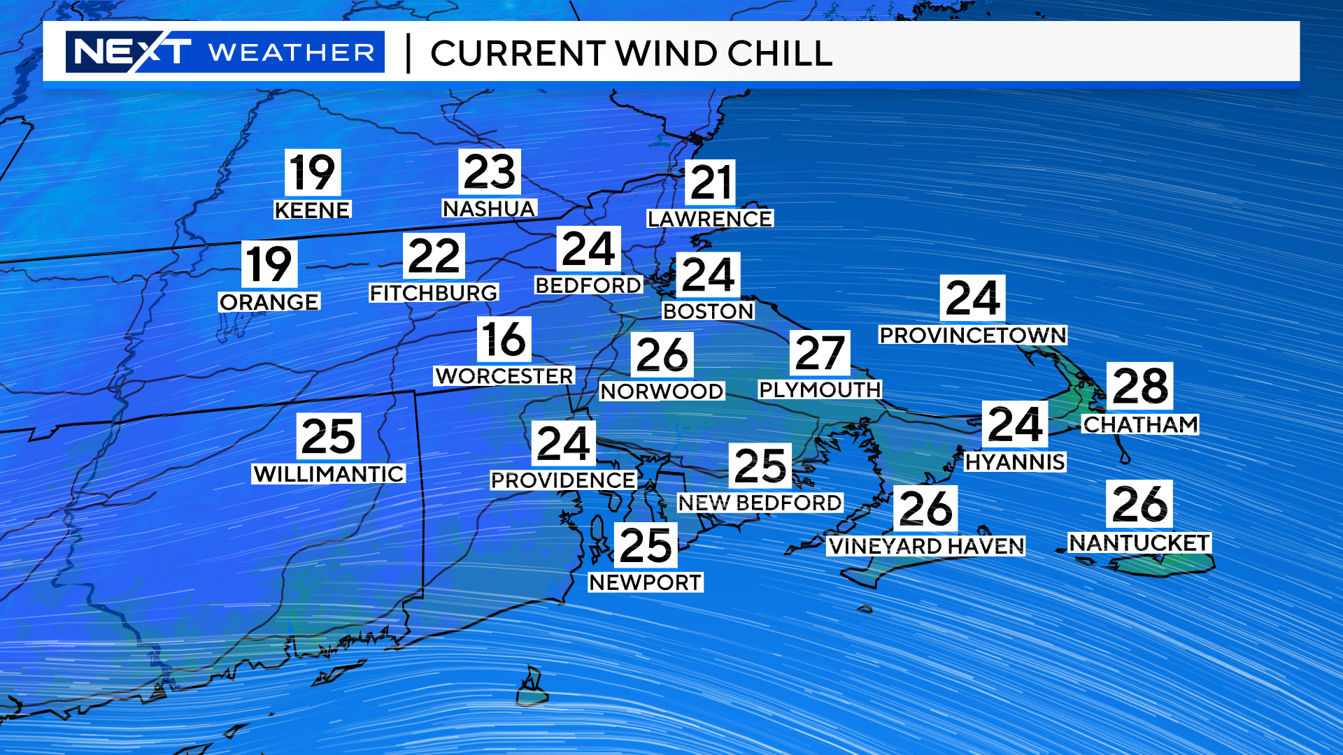
Low temperatures combined with a gusty wind this morning made it feel like teens and low 20s for most of the area…
High temperatures this afternoon will only reach the mid and upper 30s.
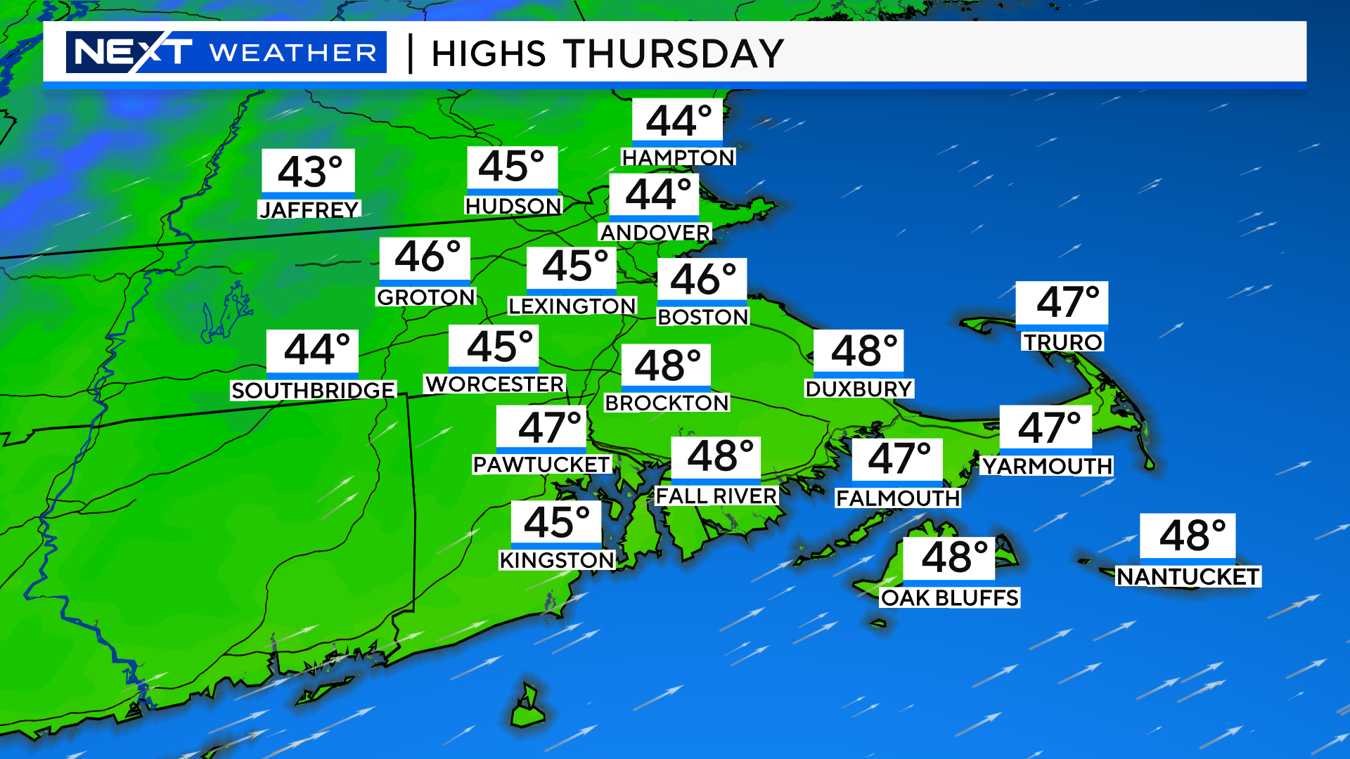
Thankfully, the current cold airmass is just about done with us. The winds will shift to the southwest later today, bringing in some milder, more seasonal air for Thursday.
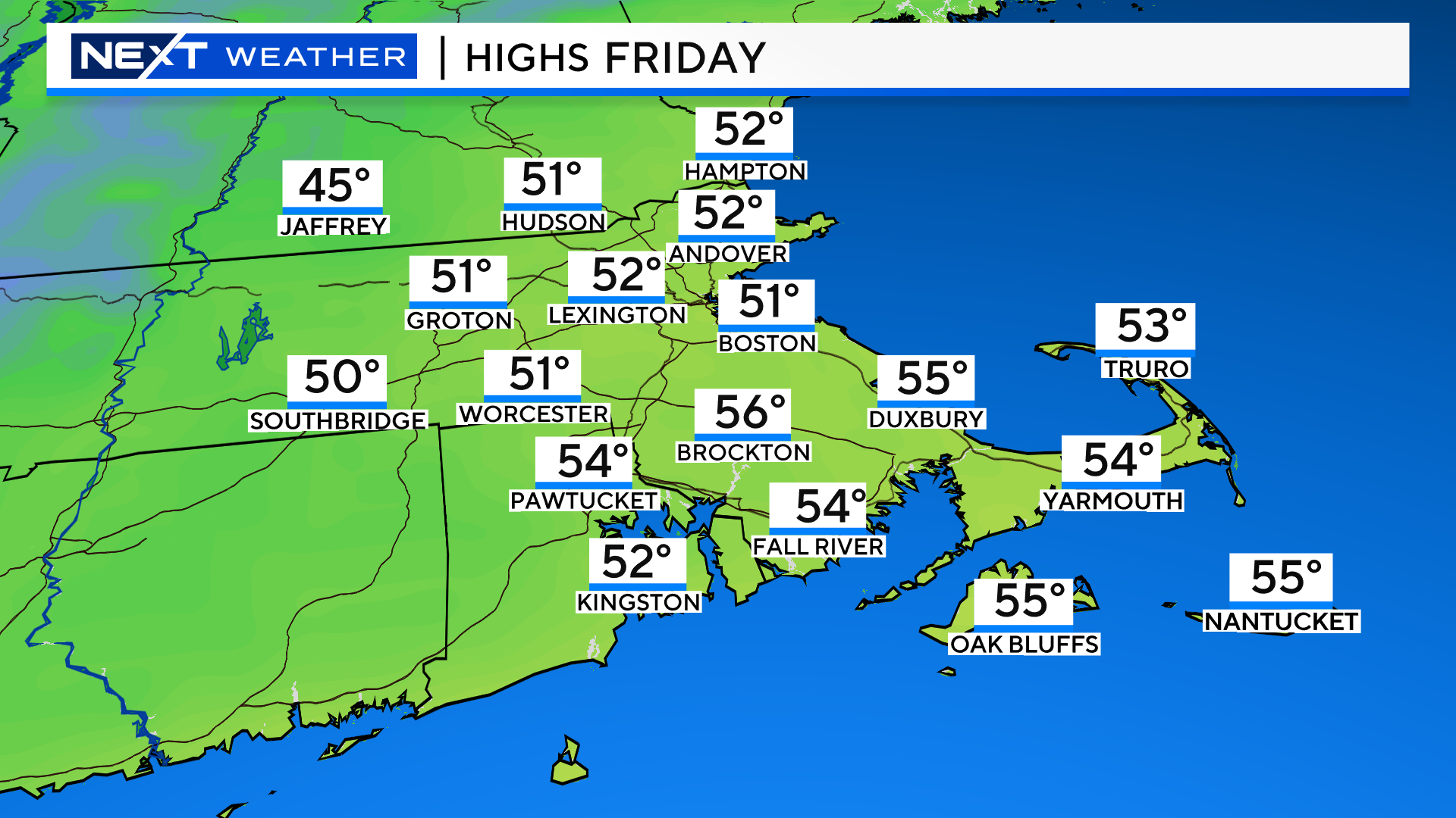
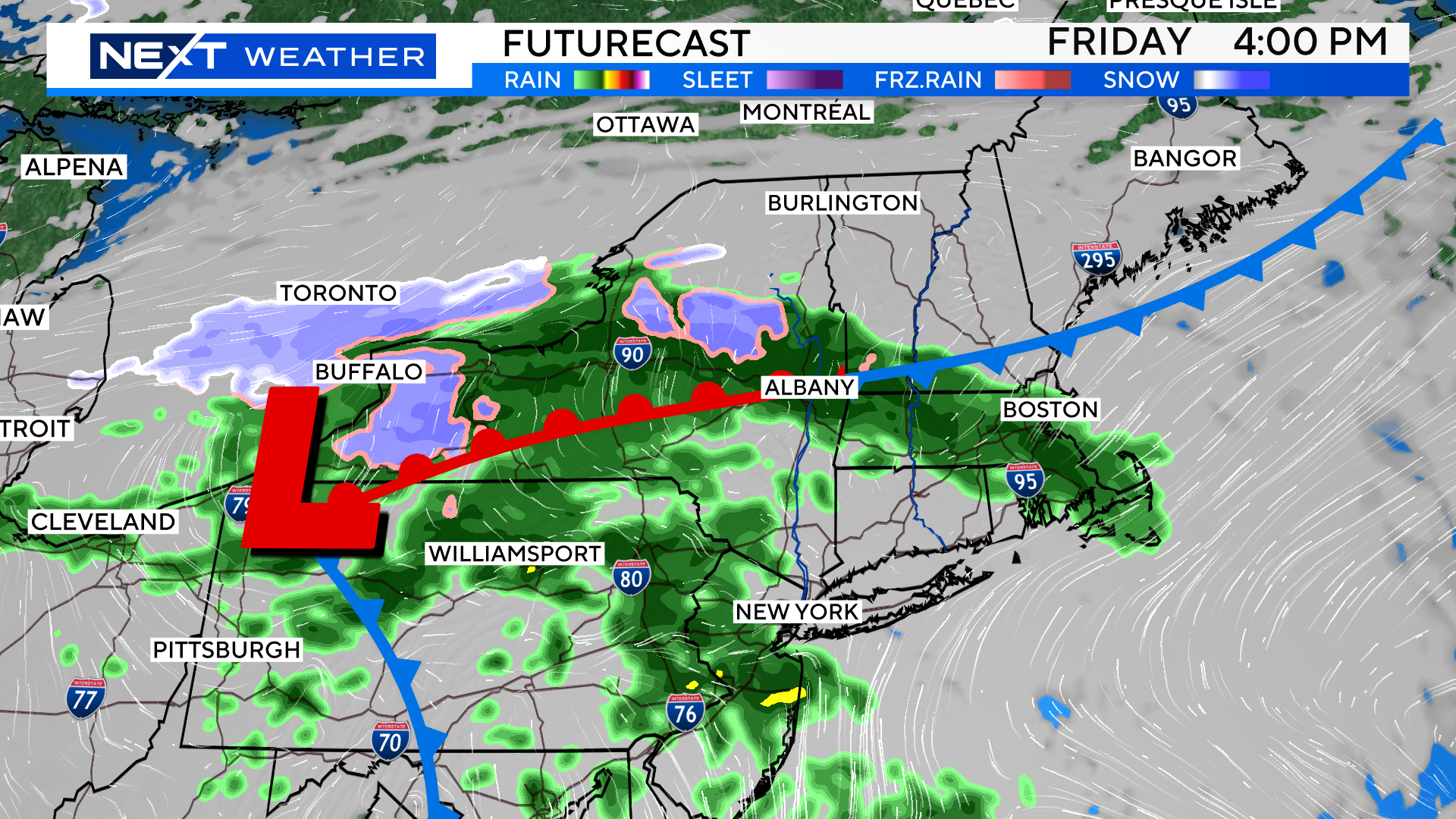
Friday will be even milder, albeit with an increase in clouds and some rainfall by the afternoon and evening.
The rain will be mainly light, and continue overnight, tapering off early Saturday morning.
After that the forecast gets much trickier. There will be a series of weak low pressure areas passing nearby over the weekend and into early next week.
This will mean lots of clouds and periods of showers as early as Saturday and continuing through next Monday or Tuesday.

It won’t be raining the entire time and in all locations but right now, timing the whole thing out is just about impossible.
If you’ve got outdoor plans this weekend or early next week, stay tuned to updated forecasts. It does NOT appear as though much, if any, winter precipitation will occur in southern New England.

AURORA BLOG…
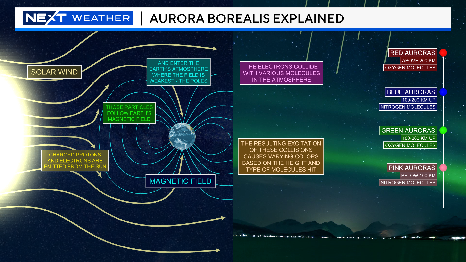
The Northern Lights are, by far, one of the most beautiful AND elusive phenomena in our nighttime sky.
If you have been lucky enough to catch a glimpse, it is something you never forget.
I have written dozens of blogs like this one, alerting you all to the chance of seeing an Aurora and, most of the time, it ends in disappointment.
Having said that, later this week, we may have a somewhat rare and unique opportunity to see the Northern Lights in parts of New England.
https://spaceweather.com/images2023/28nov23/halocme.gif
courtesy SpaceWeather.com
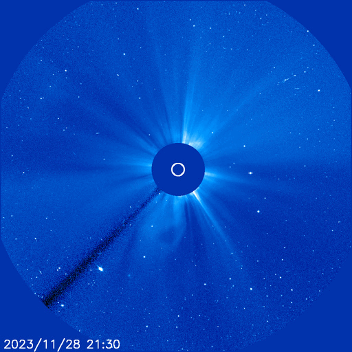
On Tuesday, a solar flare caused three separate “coronal mass ejections” on the surface of the Sun, creating a rather rare “halo CME”. A coronal mass ejection is a fancy way of describing a sudden burst of charged particles from the sun, heading outwards at speeds nearing 2,000 miles per second.
https://spaceweather.com/images2023/28nov23/m9_teal_anim.gif
courtesy SpaceWeather.com
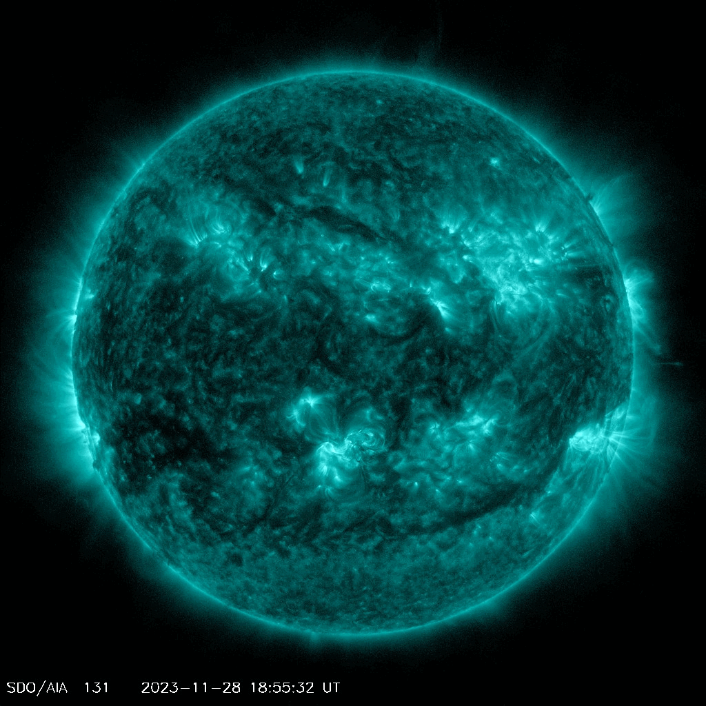
The ejection that occurred Tuesday came from a sunspot that was facing directly at Earth. Scientists are calling for the potential of a “severe geomagnetic storm” here on Earth when these particles arrive later this week.
The devil remains in the details…predicting the ferocity of an Auroral event days in advance is difficult. Given that there were multiple ejections, scientists believe that this could lead to something called a “cannibal CME”. Essentially one big wave swallowing up and combining with some smaller ones, creating the potential for a bigger event. If this occurs, we could see a G3 or G4 class geomagnetic storm, something much less common (most of these events are rated lower, G1 or G2). It is when we get a G3 or G4 sized event that the mid-latitudes (including where we live) have the best chance at seeing an Aurora.
The peak of the storm is currently forecast to reach Earth during Friday morning. So, our best chance at seeing anything will likely come overnight Thursday night, when skies conditions should be relatively clear. After that, clouds and rain enter the picture by Friday afternoon and evening.

Again, having said all of this, the odds still remain low that YOU will see much of anything Thursday night. If you want to increase your odds there are a few things you can do…
-Get as far away from any artificial light as possible…find the darkest night sky you can!
-Find a location with a clear, unobstructed view to the northern horizon
-Remain patient and stay tuned to updated forecasts
As always, if you are able to grab any pictures or video, we would love to see them and share on WBZ! Send them to weather@wbztv.com
Click here for Westford snow storm data and past totals or select “Winter Snowfall“ under “Pages” on the left hand side.
For more up to date forecast information follow me on Twitter (@terrywbz) or follow the WBZ weather team on Facebook, search WBZWeather
Reader Comments