


Going to make this a two-parter…first focusing on the heat and humidity and then on Hurricane Lee…
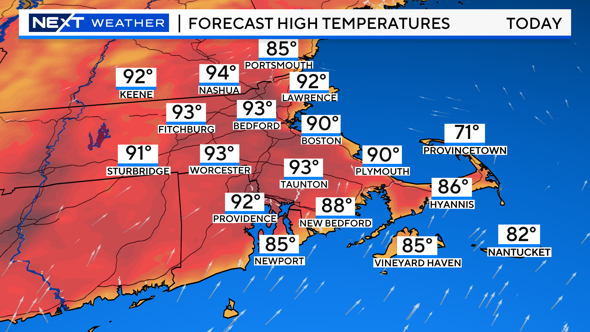
We are off to a sweltering start to September. We are expecting high temperatures today to peak out in the mid 90s in many inland areas…higher than any other day this summer!
The LOW temperature in Boston this morning was 75 degrees. This set a new record (high minimum) for the date and was just 1 degree shy of the average high (daytime) temperature for today’s date (76)!
Boston will likely get a seabreeze this afternoon, capping temperatures a bit, however, some records could fall at inland locations like Worcester and Hartford.
The heat peaks today but the humidity will not relent until sometime early next week.
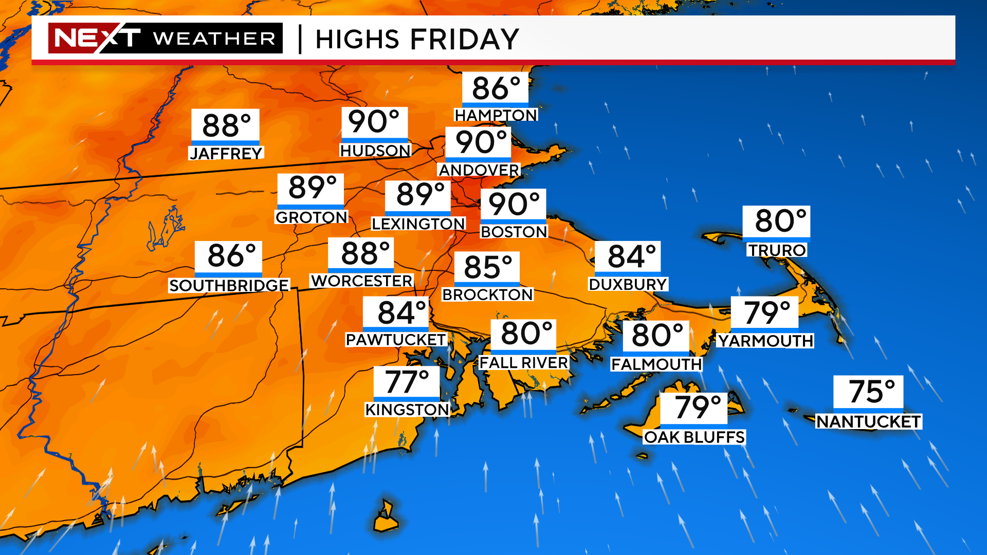
Highs tomorrow will be right around 90 for most areas away from the South Coast.
The dewpoints will be the real story for the next several days, pinned in the 70-75 degree range, about as high as they get in our area.
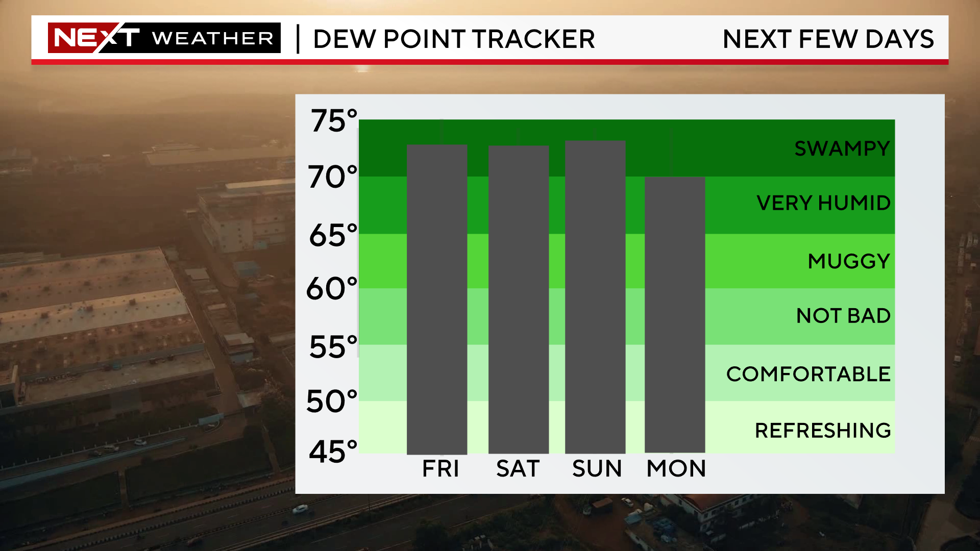
With that amount of moisture in the air, there is a high likelihood of some very heavy downpours as things turn unsettled this Weekend. It won’t be raining all of the time, neither day is expected to be a washout, however, when it does, it could come down in buckets.
For the next few days, you should try to limit your strenuous, outdoor activities as much as possible and beware of the signs of heat stroke. Check on your neighbors that don’t have air conditioning and take care of your pets too!

Now, on to Hurricane Lee…
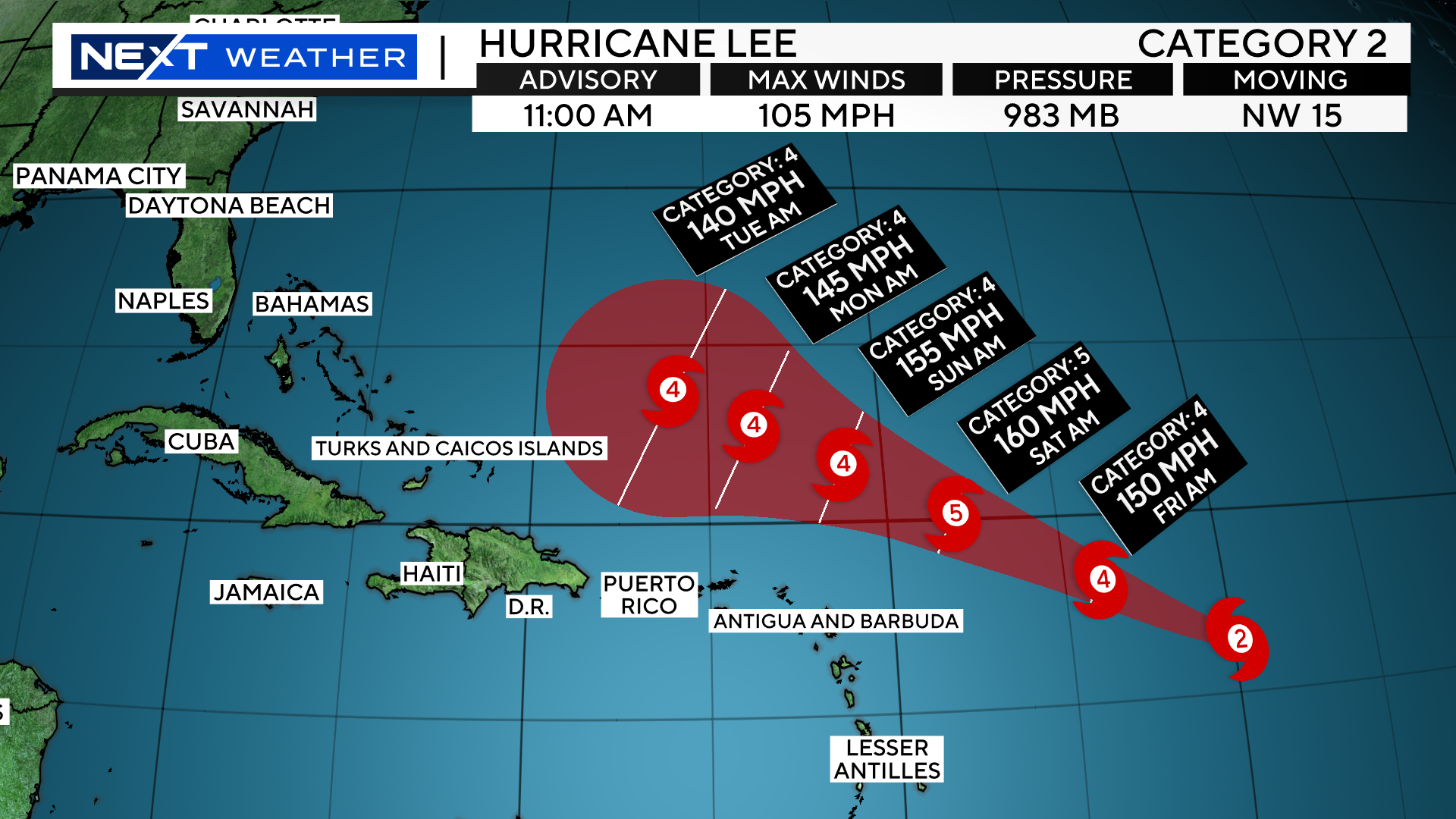
Just before Noon on Thursday, the National Hurricane Center upgraded Hurricane Lee to a category 2 storm. Lee has undergone “rapid intensification” in the last 24 hours, gaining 35mph in max wind speed.

The latest official forecast track continues that rapid strengthening over the next 24-48 hours. Lee is forecast to be a category 4 storm by Friday morning and a MAX category 5 storm by Saturday morning!
Thankfully, Lee is no threat to any landmass over the next several days. Model consensus brings the center of Lee well to the north of the Caribbean Islands through the weekend.
Early next week, it is forecast to take a sharp right before reaching the Bahamas.
It should then pass to the west of Bermuda late next week.
Obviously, the big question is, where does it go from there? Given that we are talking about a period of time between 7-10 days from now, the spread of possible tracks and solutions are fairly wide.
You can see by this map that given Lee’s current location, on average, it would take about a week to 10 days for landfall anywhere in the northeastern United States, sometime around next weekend.
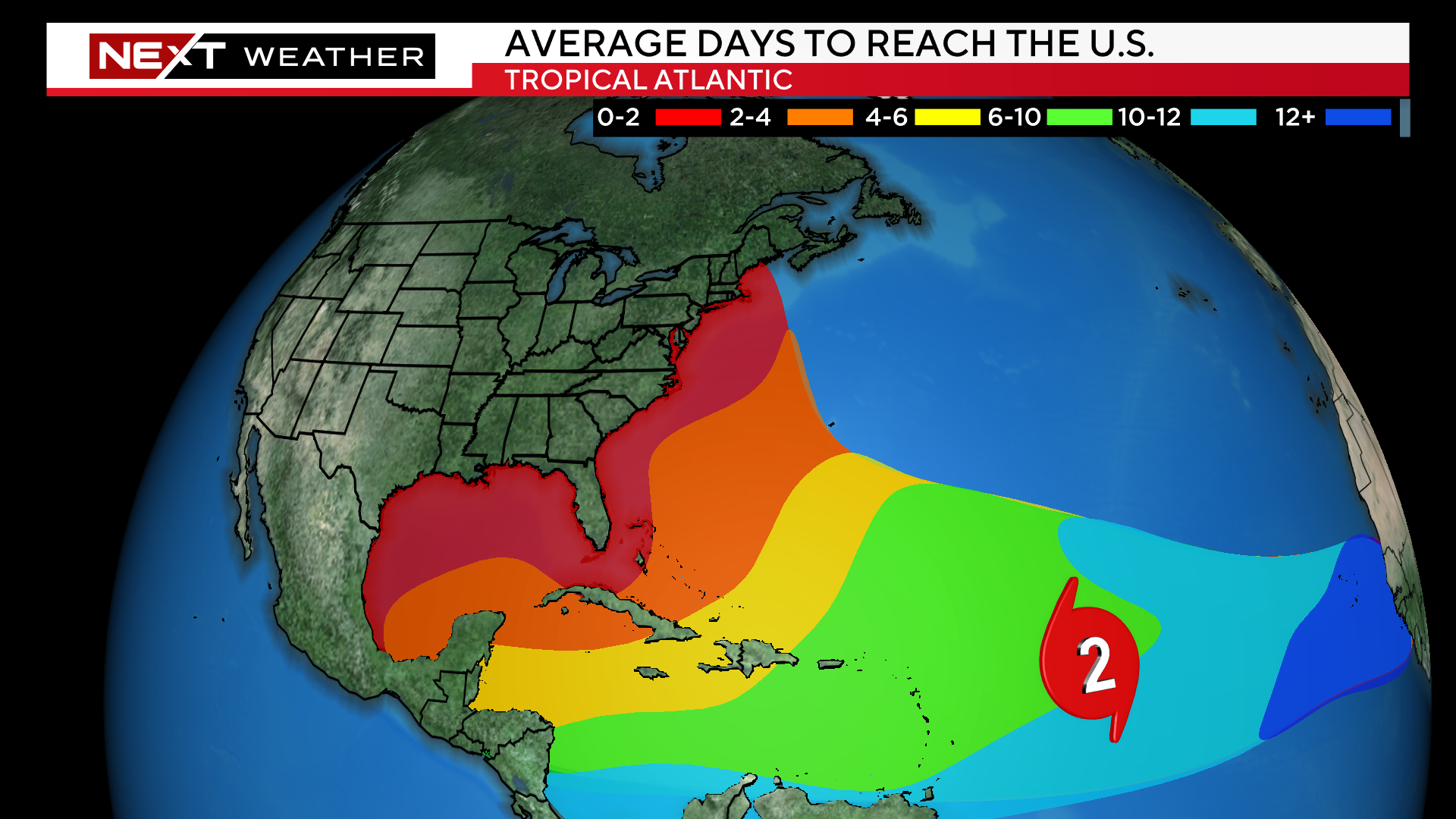
At this time, most longer range models do NOT have Lee making landfall anywhere on the East Coast, including New England.
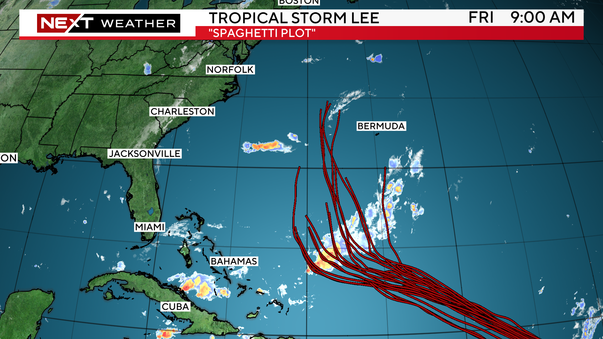
Take this spaghetti chart from one of our more reliable models…you can see most of the forecast tracks are well offshore with a potential landfall up in Nova Scotia or even a track east of there.
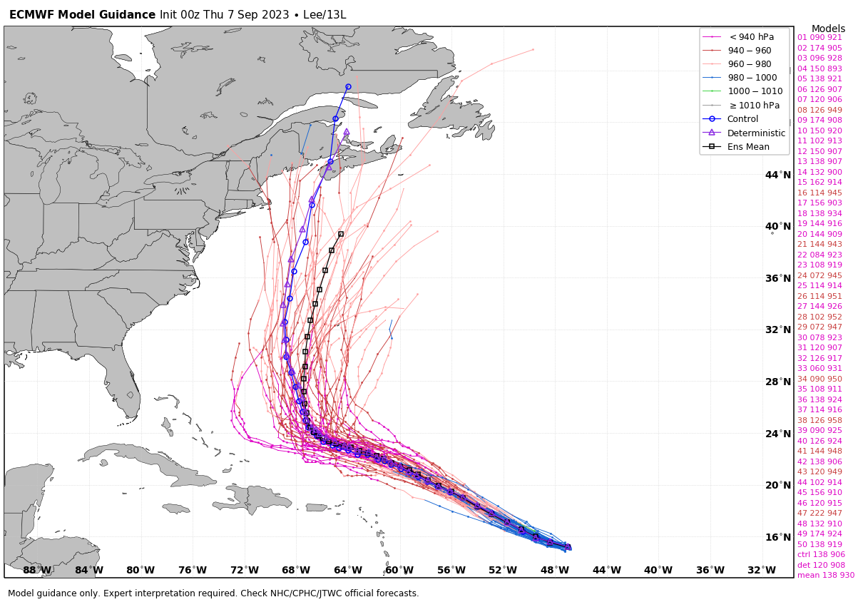
This is a very long-range forecast and LOTS can and will change in the coming days. So, by no means should anyone on the East Coast (or in New England) write this storm off and put your guard down.
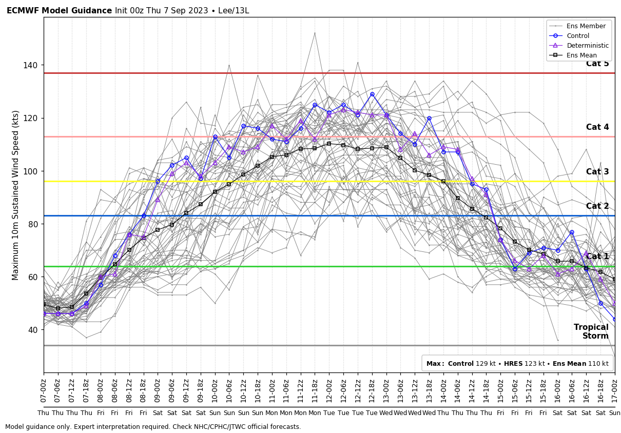
Lee is expected to remain a strong, major hurricane (Cat 3 or higher) right through early next week.
You can see that, by later in the week, model intensity forecasts start to come down, likely due to an interaction with cooler water in the northern Atlantic.
So, for now, we are in a wait and see mode. We will watch the model trends and keep you informed of any changes over the next several days. The good news is that there is plenty of time to prepare for whatever Lee may bring. Technology is such that we will have numerous days of advance warning.
Click here for Westford snow storm data and past totals or select “Winter Snowfall“ under “Pages” on the left hand side.
For more up to date forecast information follow me on Twitter (@terrywbz) or follow the WBZ weather team on Facebook, search WBZWeather
Reader Comments