Happy Friday!
We remain under a NEXT Weather Alert through tomorrow for oppressive heat AND another round of potentially severe storms.
First, the heat…
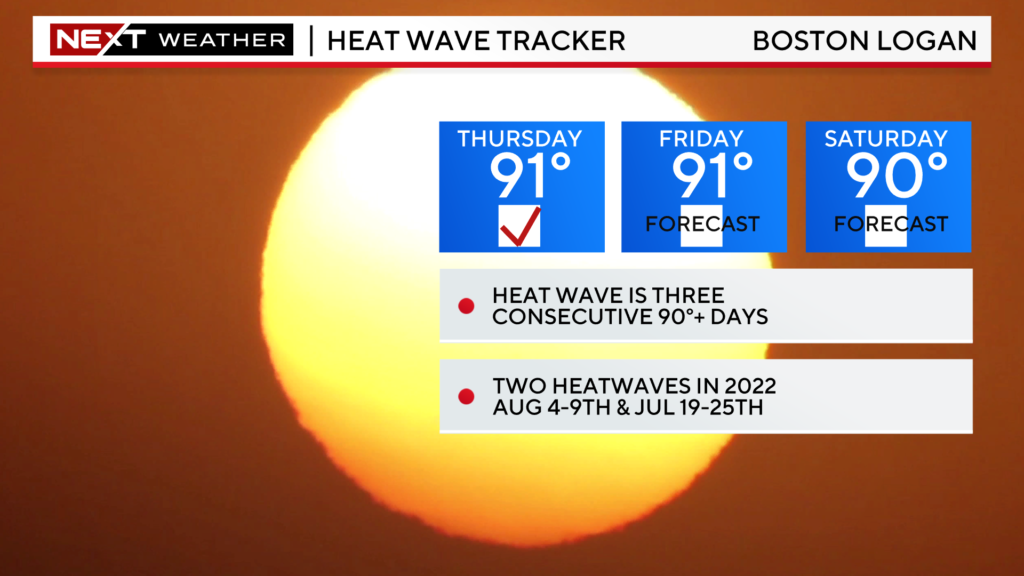
Highs today will reach the low 90s for a good portion of our area. This will be the second straight day with highs 90+, 1 day shy of an official heatwave.
There is about a 50-50 chance of hitting 90 on Saturday, which would make this our first heatwave of 2023.
Highs in the low 90s certainly are not all that unusual for July, it is the high dewpoints that make the current airmass feel so uncomfortable.
Typically, once you get over 60-degree dewpoints it starts to feel humid. As you approach 70, it gets uncomfortable. Over the next 24 hours or so, our dewpoints will soar well into the 70s. Combine that with highs near or slightly over 90 and you get a “feels-like” temperature close to 100.
Another Stormy Saturday…
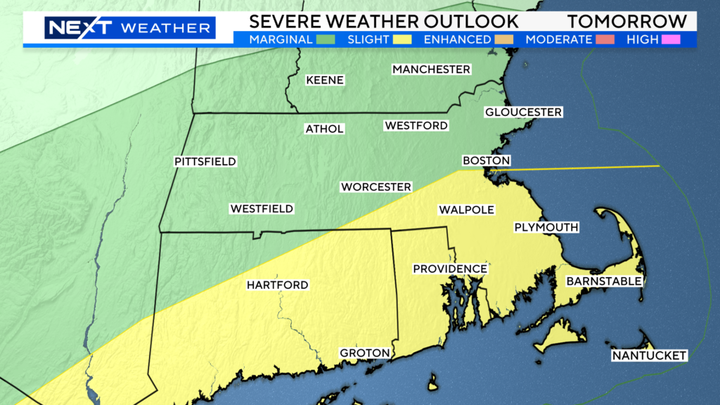
Once again, the Storms Prediction Center has placed parts of our area in a heightened risk for severe weather on Saturday.
Areas north of the Pike are currently in a “marginal” severe risk and south of the Pike we have a “slight” severe risk.
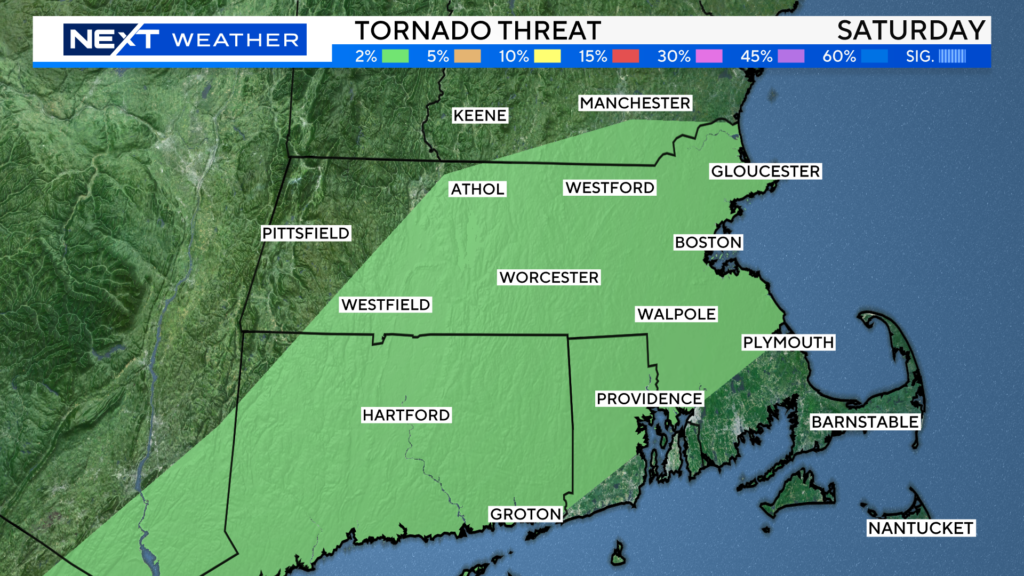
There is also a slight risk of an isolated tornado on Saturday, mainly in the area shaded in green below. The risk is not as high as it was yesterday, but still, it is non-zero.
While there is a slight chance of a few storms in the morning on Saturday, most of the action will likely be in the afternoon and evening hours.
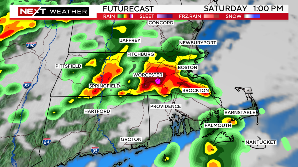

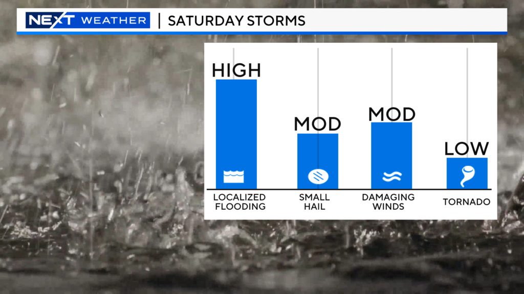
We expect several storms with torrential downpours, leading to localized flooding.
There may also be a few instances of damaging straight-line winds as well as small hail. And finally, we cannot rule out a spin-up tornado or two.
Sunday brings a massive change in airmass. Dewpoints will plunge, the storms will clear and the sun will shine brightly for a terrific end to the weekend!
Stay with WBZ-TV, WBZ.com and CBS News Boston all day Saturday for frequent updates on the storms.
Click here for Westford snow storm data and past totals or select “Winter Snowfall“ under “Pages” on the left hand side.
For more up to date forecast information follow me on Twitter (@terrywbz) or follow the WBZ weather team on Facebook, search WBZWeather


Reader Comments