Good Morning!
Is it me or does it sort of feel nice out today? After nearly a month of oppressive dewpoints, parts of the area today and tomorrow are going to get a bit of relief. This is not the typical post-cold front whoosh of refreshment, but more of a step in the right direction.
WEDNESDAY:
Partly sunny, warm, highs in the upper 80s with a bit less humidity.
Tonight after sunset, check out the western sky for a celestial treat!

THURSDAY:
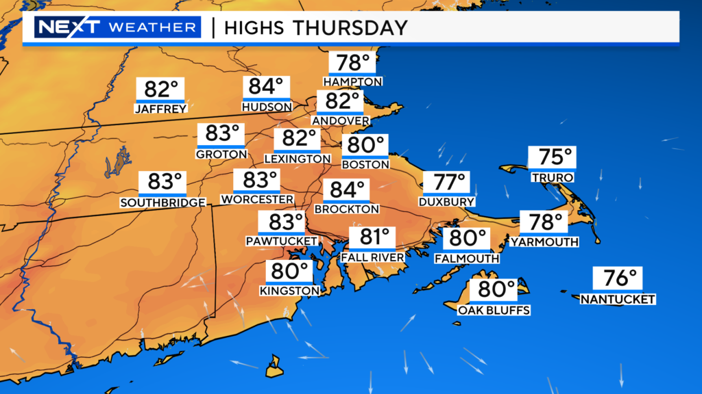
A few degrees cooler tomorrow, partly sunny, 80-85 with some cooling coastal seabreezes.
FRIDAY:
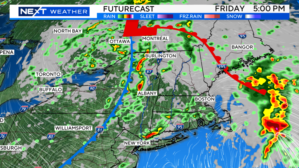
A storm system will approach from the west, sparking an increase in clouds and some scattered downpours/thunderstorms. At this point, the severe threat looks low, but we will have to watch for some localized flooding, especially later in the day.
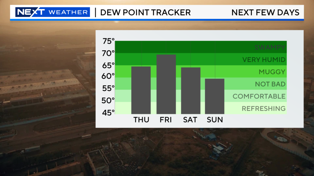
Humidity levels also spike again on Friday.
The Mets are in town this weekend. Gonna have to keep an eye on radar for the series opener Friday night but, the rest of the series is looking great!
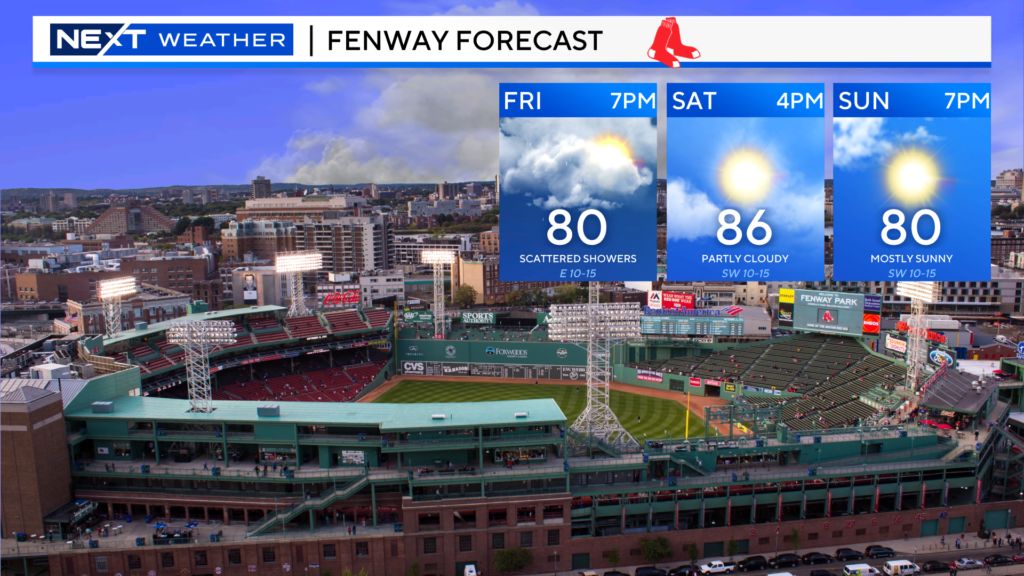
Other than an isolated, leftover shower on Saturday, the weekend (dare I say) is looking quite nice!
Sunday is trending towards an absolute beauty with dewpoints possibly dropping into the 50s for the first time in a long time.
It’s not the heat it’s the humidity…We have all heard that classic line before. This has certainly been the case this summer in New England. Here we are in mid-July and Boston has had just 2 days with temperatures topping 90 degrees. June finished with temperatures averaging a few degrees below average and July has only been slightly above.
The humidity has been an all-together different story.
Tuesday was the 26th consecutive day with max dewpoints of 65 degrees or higher. That is an awfully long time to go without a dry, refreshing airmass to recalibrate our bodies.
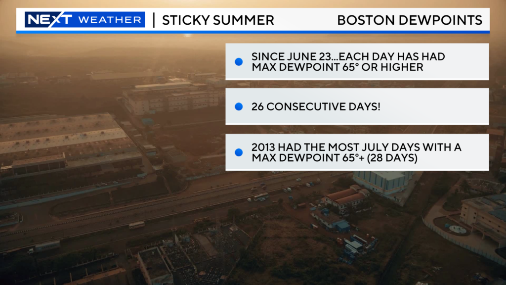
Just think about it…can you even remember the last time you stepped outside and felt comfortable and refreshed? When was the last time we had a crisp, deep-blue sky?
Some oppressive days in the summer are not all that unusual in our area but nearly a month straight?
If we keep up this pace, Boston could approach the July record for most days with a dewpoint 65 or higher, 28 in 2013.
So, what is happening?
Simply put, the weather pattern has been stuck. We keep reverting back to the same general atmospheric setup.
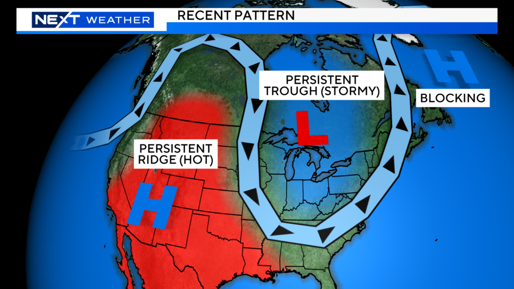
Instead of the more typical, west to east summer jetstream pattern, there has been a lot more “blocking” present…something we usually see more in the spring and fall seasons.
Much of the southwestern U.S. has been exceedingly dry and hot under a dome of high pressure.
A persistent trough has been sitting over parts of the Upper Midwest and Northeast, bringing a very unsettled, active pattern.
Lastly, there has been a “Greenland Block” (again, something more typical in winter/spring), gumming up the atmospheric highway, not allowing anything to get moving.
It just so happens that New England has been in the stormy/humid section of this congested atmospheric traffic jam.
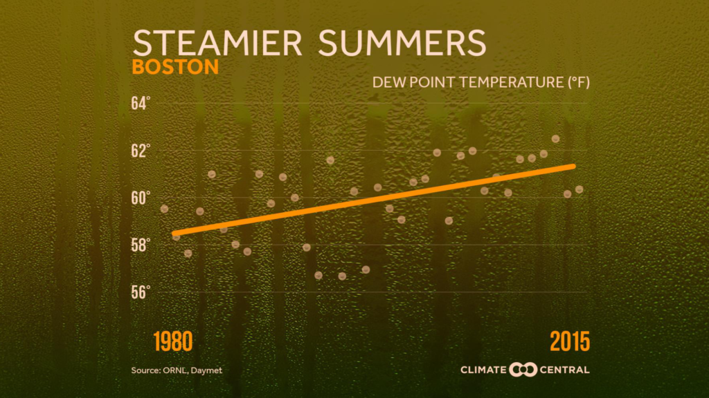
Add to this the fact that our summers have been getting warmer and more humid in general thanks to climate change.
And, on top of all that, our Oceans (worldwide and nearby) are in their warmest state in recorded history. Warmer water = more available moisture.
We haven’t even mentioned El Nino which is coming on very quickly in the Pacific and is sure to raise the Global temperatures even more in the months to come.

I think it is safe to conclude, given all these factors, that the high humidity, in general, is likely here to stay for most of the rest of summer. Sure, we will get SOME drier days (see this coming Sunday), but overall I think we can expect more of the same humidity-wise.
What can look forward to is a change in the pattern. It is very unlikely that the current setup will persist for too much longer. In other words, don’t count out August just yet!
Click here for Westford snow storm data and past totals or select “Winter Snowfall“ under “Pages” on the left hand side.
For more up to date forecast information follow me on Twitter (@terrywbz) or follow the WBZ weather team on Facebook, search WBZWeather


Reader Comments