Happy Monday!
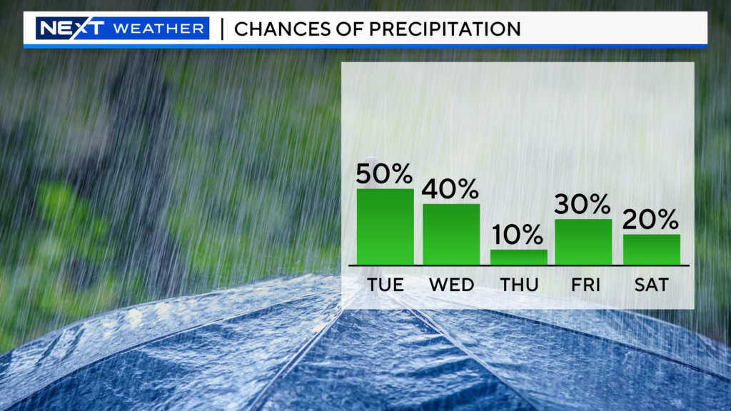
Wish I could say new week, new weather pattern…but…alas, we have several more chances of rain this week.
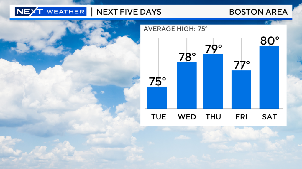
At least this week will be warmer than last…most days we will top out in the mid to upper 70s.
TODAY: Clouds will continue to thicken ahead of some rain coming tonight…Looks like the heaviest rain will fall well to our west. Just expecting a couple tenths of an inch of rain on average in central and eastern MA.
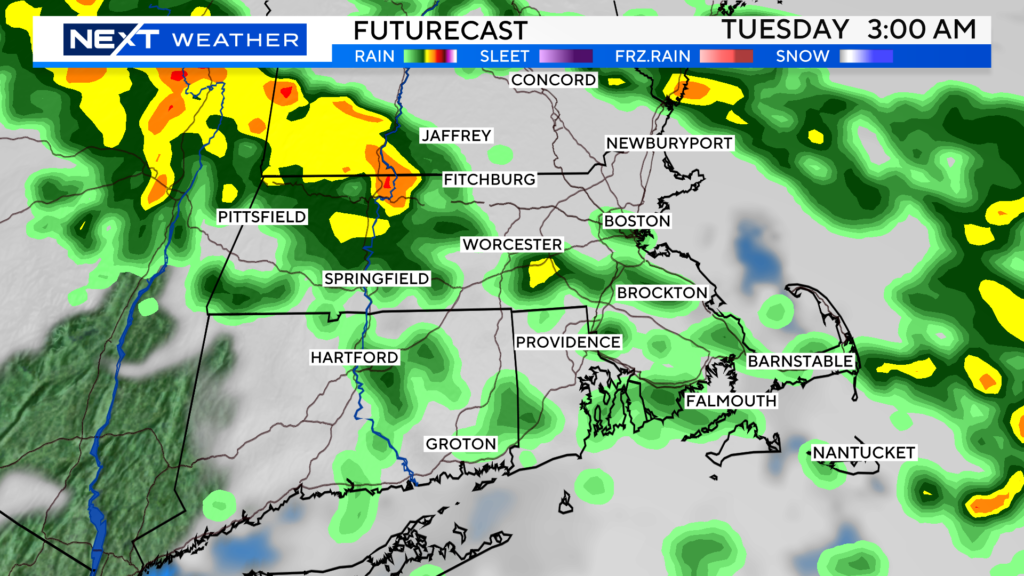
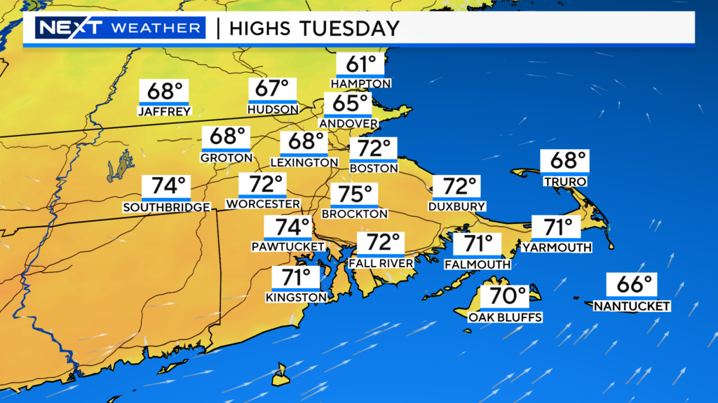
TUESDAY: Improving conditions with some clearing skies later in the day. Warmest temperatures will be south of the Mass Pike.
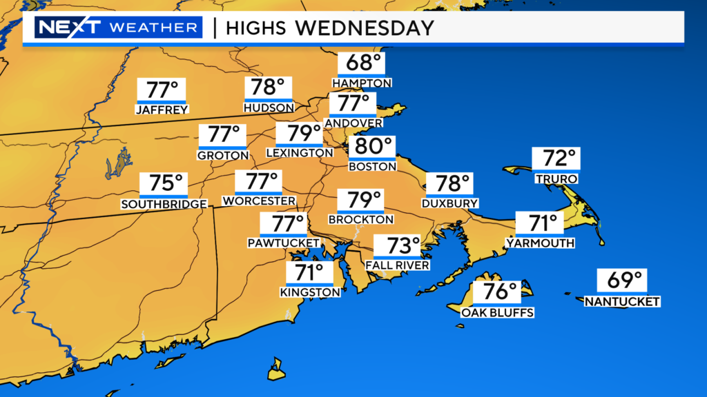
WEDNESDAY:
Sunny start, building clouds in the afternoon with the possibility of severe thunderstorms in the evening and at night. Warm, near 80
Thursday looks like the pick of the week with a very low risk of a shower and highs in the 70s.
Rain threat returns on Friday…numerous showers and storms likely in the PM
And, it’s early, but right now the weekend looks decent…chance of an isolated shower Saturday and some late-day rain to the south on Sunday…we will narrow in on the weekend in the next couple days!
Click here for Westford snow storm data and past totals or select “Winter Snowfall“ under “Pages” on the left hand side.
For more up to date forecast information follow me on Twitter (@terrywbz) or follow the WBZ weather team on Facebook, search WBZWeather


Reader Comments