


Happy Monday!
What a Weekend! Boston went from its coldest temperature since 1957 (-10 degrees Saturday morning) to 51 degrees just about 30 hours later! Just incredible to see such an anomalously cold airmass sandwiched in the middle of an otherwise warm winter. And, that is the main story this week…more mild weather.
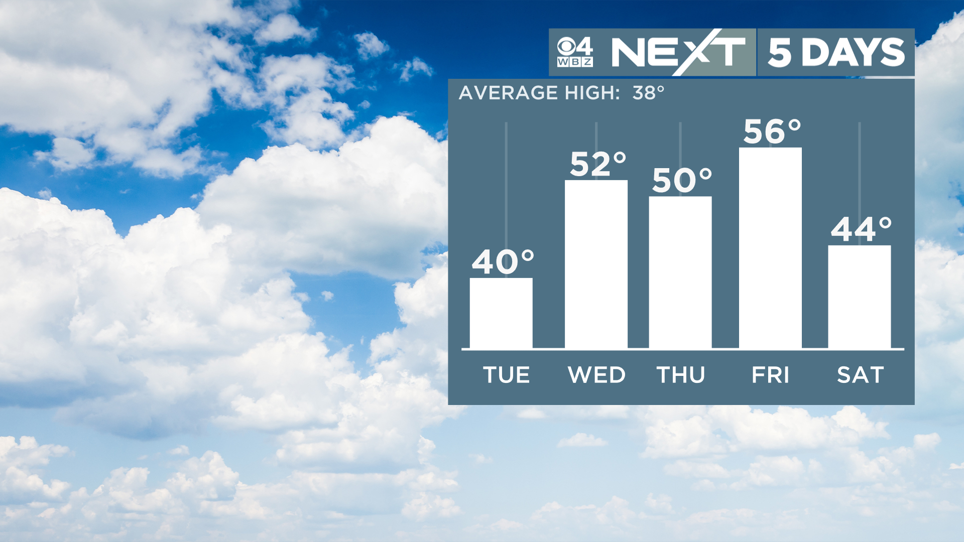
Check out the forecasted high temperatures this week and keep in mind the average this time of year is in the upper 30s…
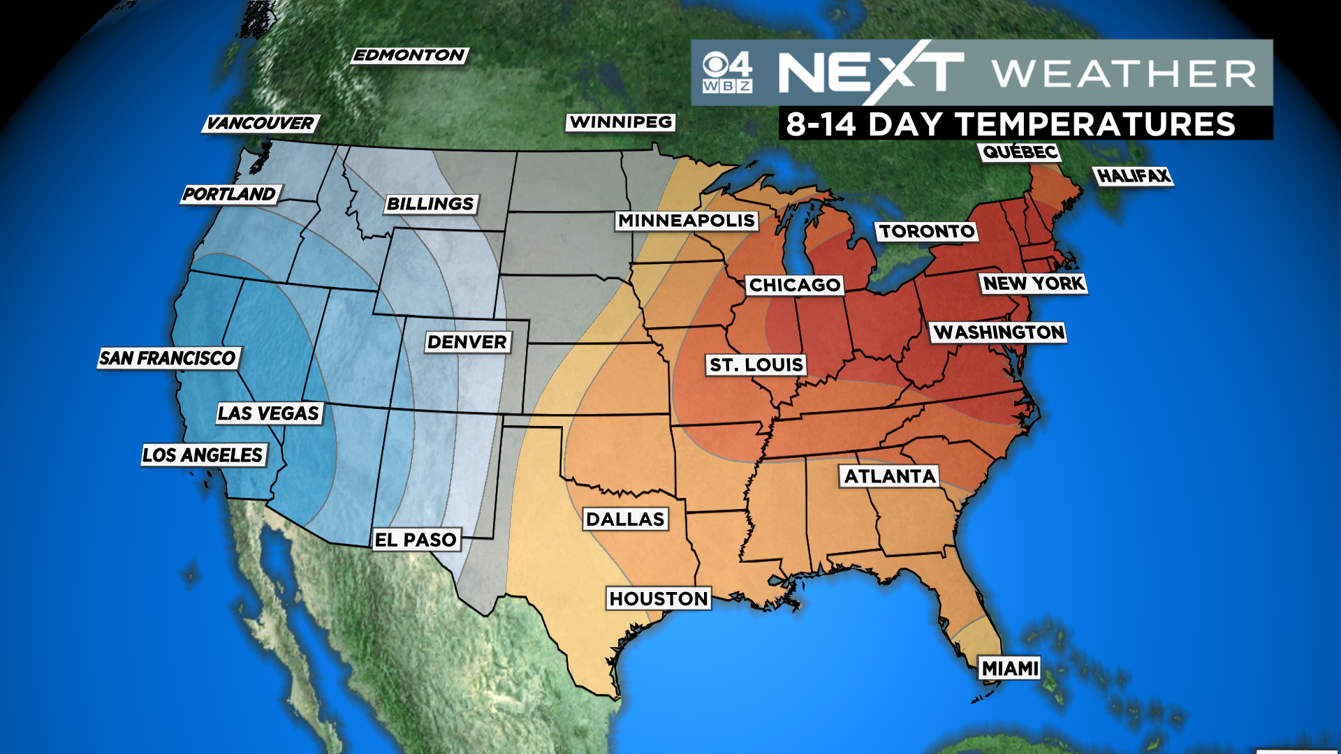
With a very mild look in the East over at least the next few weeks, it seems we are headed for another top 5 or top 10 warmest winter on record. 5 of the top 6 warmest winters in Boston have come in the last 20 years.
On to the forecast details this week…
First up, if you missed the Full “Snow” Moon last night, you can check it out tonight, it will be rising just before 6pm.
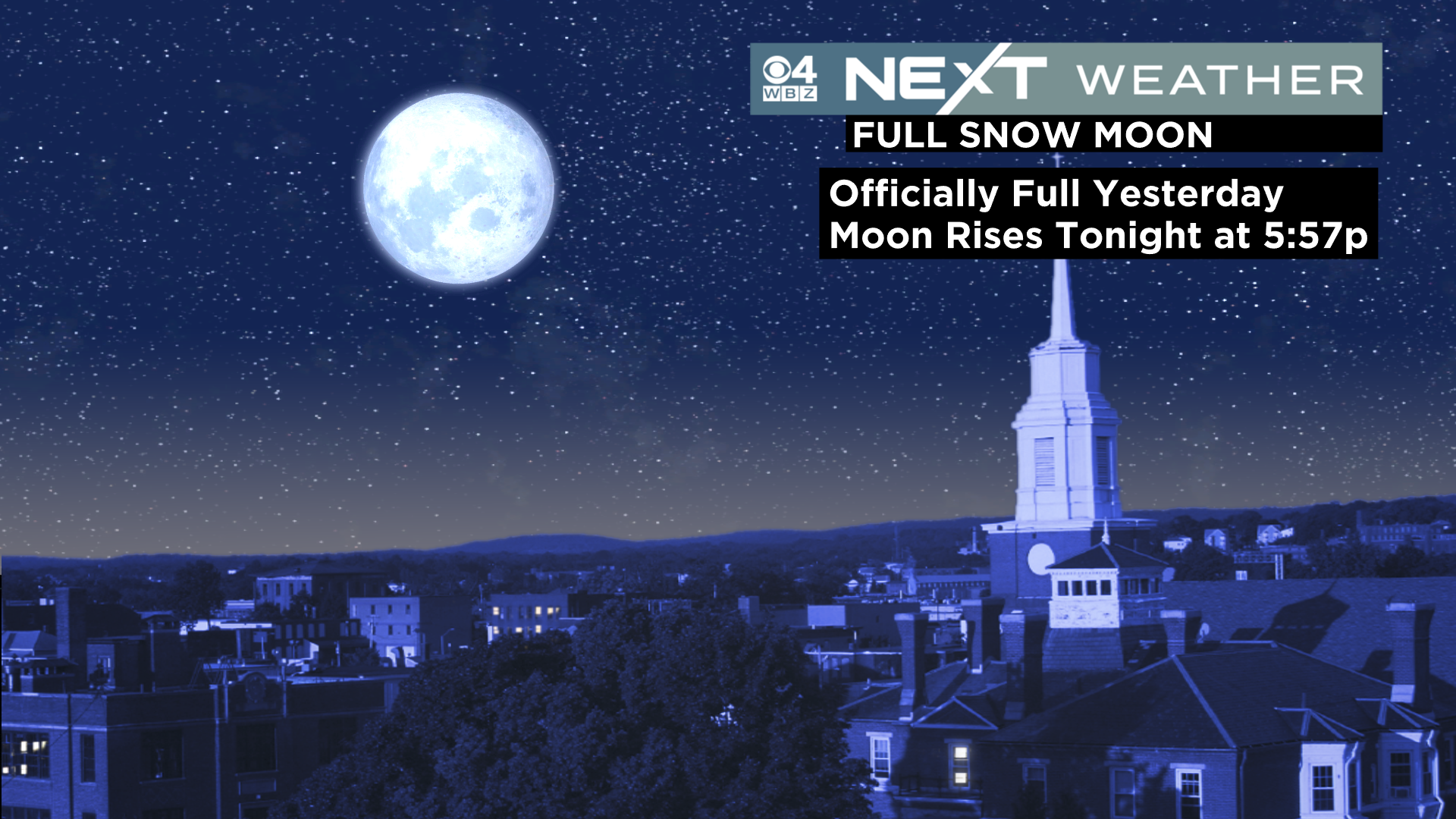
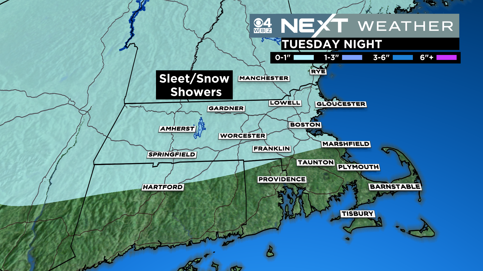
Typically, here is where I would make some comment about how appropriately named the February Moon is given how much snow we have…obviously NOT the case this year. However, there is a teeny bit of snow and sleet in the forecast for later Tuesday.
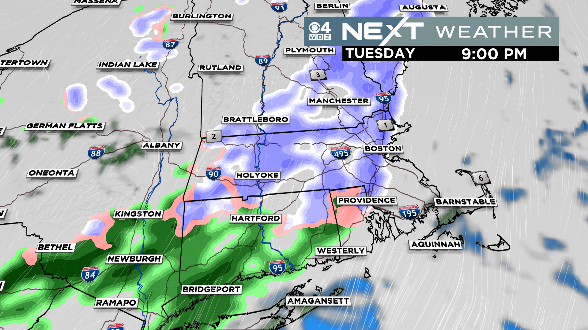
Highly unlikely that there would be any accumulation, best chance of a little sleet or snow on the grass would be north and west of Boston.
The latter half of the week looks quite mild. Highs each day, starting on Wednesday, will be near or over 50 degrees.
It also looks very unsettled with several chances of rain or a mix Thursday through Saturday.
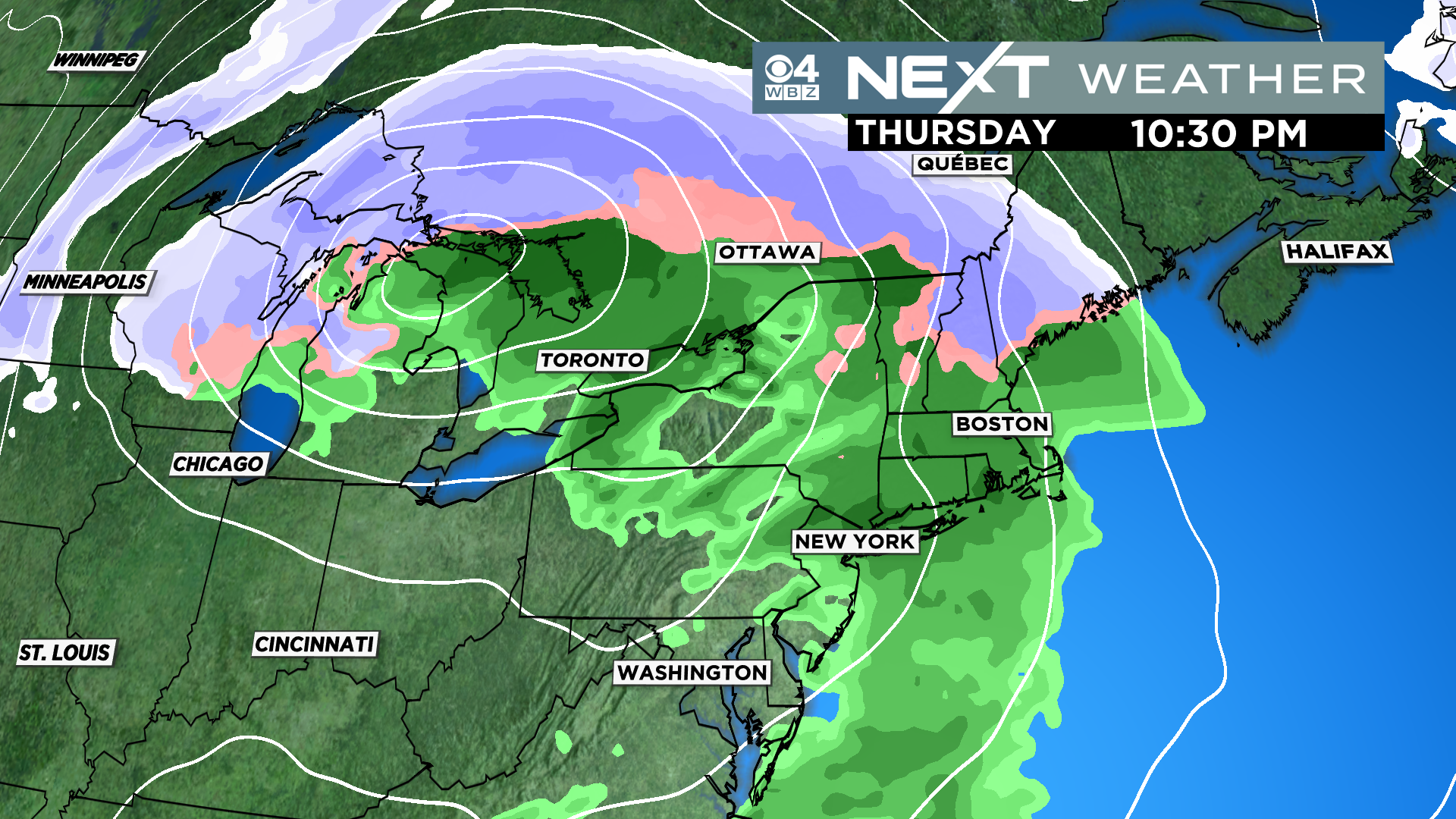
Storm #1 arrives later on Thursday and looks to be mainly rain.
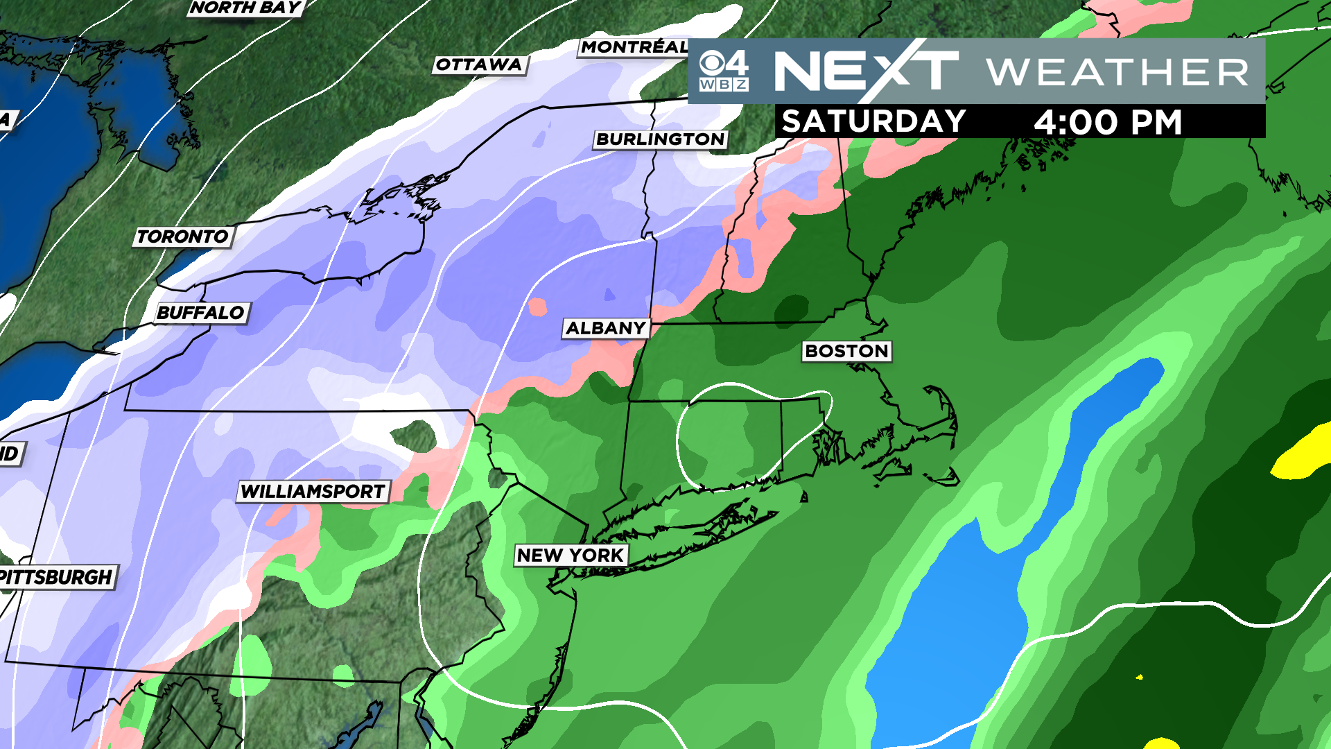
Storm #2 arrives Friday night. The track of this one may be a little more conducive to some form of wintry mix in parts of the area. Too early to tell just yet. But for now, I would plan on some sort of wet or stormy weather to start the Weekend.
One last thing…
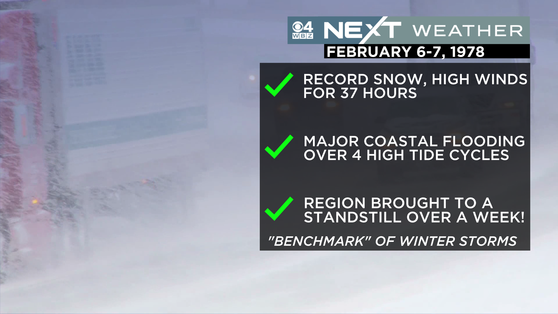
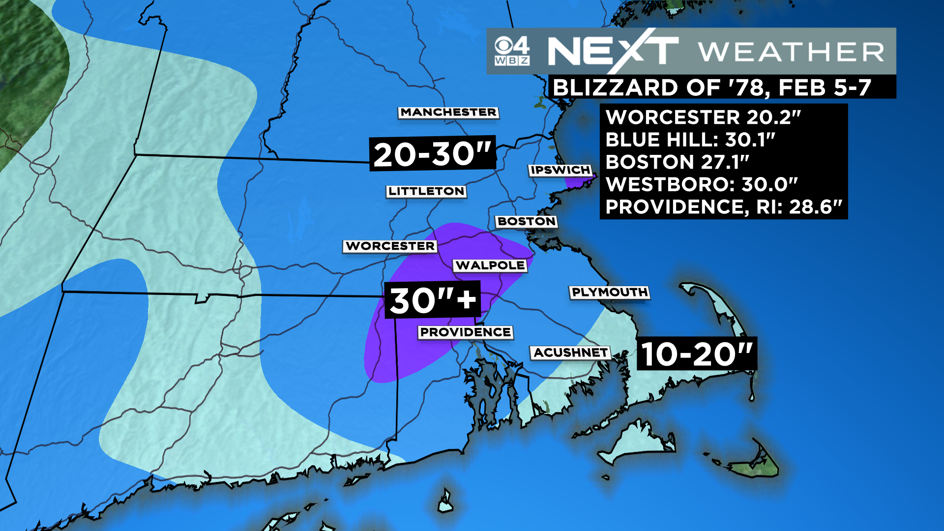
Today marks the 45th anniversary of our most famous storm, the Blizzard of ’78!
Amazing that to this day, the Blizzard of 1978 remains the benchmark for all New England storms. If you were here in 1978 or have family that were, you undoubtedly have a story to tell! Boston had 27.1″ of snow which, at the time, was a record.
Click here for Westford snow storm data and past totals or select “Winter Snowfall“ under “Pages” on the left hand side.
For more up to date forecast information follow me on Twitter (@terrywbz) or follow the WBZ weather team on Facebook, search WBZWeather
Reader Comments