


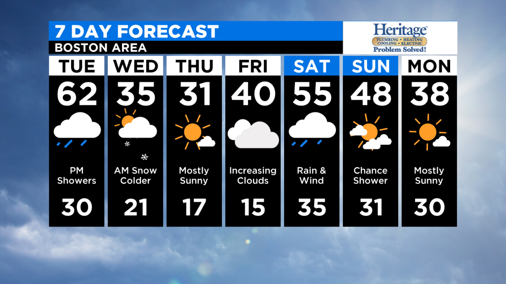
TUESDAY: Mild again with periods of PM rain, high near 60
WEDNESDAY: Temperatures drop sharply and there may be a few inches of snow early in the morning along with some icy spots, highs 30-35
THURSDAY: Mainly sunny and cold, low 30s
FRIDAY: Increasing clouds, high near 40
Hard to believe that snow is in the forecast with near record-high temperatures during the day on Tuesday! But alas, this is New England, the home of, “if you don’t like the weather, wait a minute.”
TIMELINE
Rain overspreads the area again Tuesday afternoon and remains fairly steady through the evening.
(WBZ-TV Graphic)
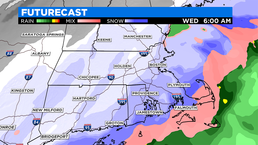
Later tonight, a frontal passage will switch the winds from south to north-northwest and the rain will gradually change over to snow.
(WBZ-TV Graphic)
Timing the rain to snow flip:
Western MA: 5-7 p.m.
Central MA: 9-11 p.m.
Southern NH, Eastern MA (north of Pike): 11 p.m.-1 a.m.
Southeastern MA: 1 a.m.-5 a.m.
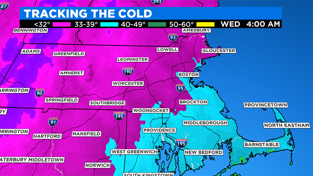
By dawn Wednesday, all of southern New England is near or below freezing and likely seeing some snowfall.
The snow is short-lived north and west of Boston, likely tapering mid-morning. The snow comes to an end in the Boston area around midday on Wednesday, and tapers over southeastern MA early in the afternoon.
HOW MUCH
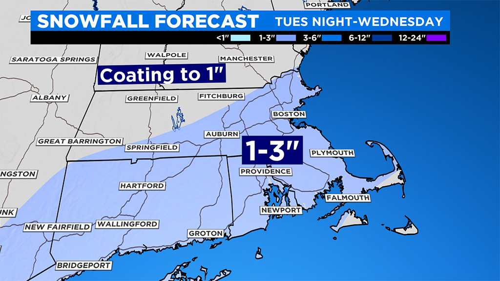
Snowfall amounts will be light, generally between 1-3 inches across southern New England (inside and southeast of I-495 belt). North and west of 495 will be on the low end this time, with just scattered coatings up to an inch.
(WBZ-TV Graphic)
There may be an isolated area or two that could reach 3-4 inches in a narrow band somewhere over southeastern MA.
SLIPPERY TRAVEL
Regardless of the amount of snowfall, any untreated roads will be slippery Wednesday morning with temperatures falling below freezing. Expect some weather related delays during the AM commute.
WHAT’S NEXT
Temperatures remain cold for the remainder of the week, generally in the 30s, nearing 40 by Friday.
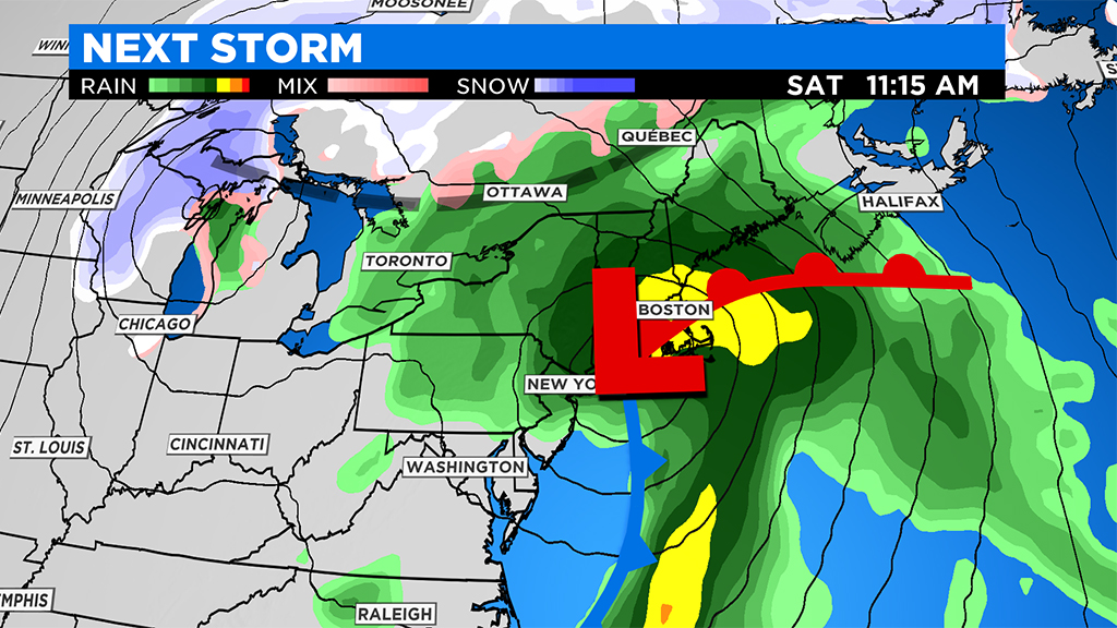
(WBZ-TV Graphic)
Our next storm comes at us from the south late on Friday. This will be another heavy rainmaker, with perhaps another inch or two of water on Saturday.
Click here for Westford snow storm data and past totals or select “Winter Snowfall“ under “Pages” on the left hand side.
For more up to date forecast information follow me on Twitter (@terrywbz) or follow the WBZ weather team on Facebook, search WBZWeather
Reader Comments