


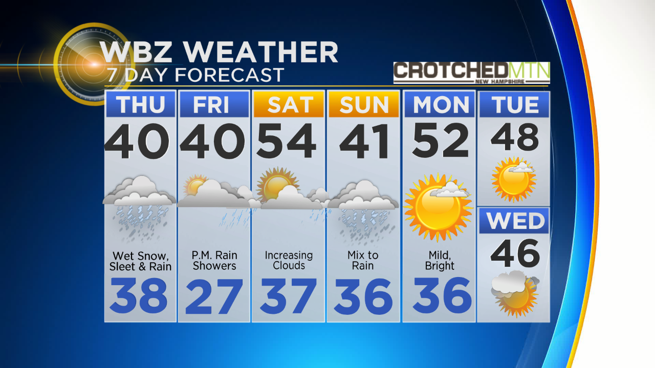
THURSDAY: Becoming mostly cloudy with a wintry mix in the afternoon and evening, some wet snow and cold rain…Coating to an inch or so possible, highs 35-40
FRIDAY: Mainly cloudy with some late day cold rain showers, near 40
SATURDAY: Partly sunny with increasing clouds late and some rain likely at night, highs 50-55
SUNDAY: Cloudy with periods of rain, high near 40
BOSTON (CBS) – From all-time record high temperatures to accumulating snowfall in less than 24 hours…only in New England. OK, well I may be exaggerating a bit, it can and does happen in other parts of the country, but let’s face it, we specialize in it. We invented the whole “if you don’t like the weather, wait a minute” phrase, in fact we tend to live by it. Just another classic episode of “As The Weather Turns” coming up Wednesday night and Thursday.

(WBZ-TV graphic)
If you got a chance to get outside today it almost felt unreal. It was as if you hopped in a time machine and transported to Memorial Day (minus the blooms on the trees and smell of burgers). Several all-time record high temperatures for the month of February were smashed…from Mount Washington, NH to Portland, Maine to Worcester, MA to Hartford, CT. And impressively, most of these records go back nearly 150 years, that is a pretty large sample size!

(WBZ-TV graphic)
Would you believe that 4 of the top 5 warmest days in February have now occurred in the last 2 years? (You may remember we have a very warm President’s Day week last year too).
Well, as fun as it’s been, it is just about time to jump back in our time machine and come back down to February as it was meant to be. We have some tremendous atmospheric changes on the way and a very active, wintry weather pattern over the next several days.

(WBZ-TV graphic)
Thursday…Storm #1
A rather slim band of precipitation moving quickly from west to east arrives around midday. By this time, temperatures will have already slid back into the 30s and much of this precipitation will arrive as snow! From about 11am-7pm a wintry mix will be falling across most of Southern New England. Getting the snow to accumulate will be a bit difficult given the ground is so warm. Most of the main roads will likely stay bare, but some minor accumulation (coating to an inch or two) is possible on the grass. Best chance of meeting or exceeding 2” would be in the higher elevations in northern Worcester county and especially in the Berkshires.

(WBZ-TV graphic)
Friday…Storm #2
Again, arriving around midday, this storm will be slightly milder than the Thursday event. For the majority of the area this will fall as a chilly rain Friday afternoon and Friday night, tapering off after midnight. Areas to watch for some light icing would be (again) the Worcester Hills, Berkshires and Greens and Whites up in New Hampshire and Vermont. Generally a quarter to half inch of rain, not a major storm by any means.

(WBZ-TV graphic)
Saturday night – Sunday…Storm #3
A “juicier” storm than the first two, this one will have a bit more of a punch. Precipitation will arrive around midnight Saturday night and continue through most of Sunday. While the majority of the storm will be rain, for the first several hours of the event (late Saturday night – early Sunday AM) there will be a wintry mix of precipitation. Still a bit early to call snow/ice amounts, but there could be a few to several inches of snow north and west of I-495 Saturday night. Best chance of seeing plowable, significant snowfall will be in Central and Northern New England, ski areas replenished! During Sunday morning, temperatures warm enough to turn the snow to an icy mix in areas well northwest of Boston and over to plain rain for most of Southern New England. From there, it is a chilly, raw, rainy Sunday…perhaps up to an inch of total precipitation.

(WBZ-TV graphic)
Looking Beyond…towards March
Things should quiet down a bit next week with a good deal of sunshine early to midweek and temperatures in the 40s and low 50s. Large scale atmospheric changes are going to take place as we head into early March. Without going into too much detail, a large block (high pressure) will form over Greenland, likely pushing much colder weather southward into the United States for a time. While it is too early to predict how much, if any, storminess we will have here in New England, winter is certainly far from over. As we have seen in the last few March’s, winter has a tendency to hang on here in New England…just when you think it’s over, well, it ain’t.

Click here for Westford snow storm data and past totals or select “Winter Snowfall“ under “Pages” on the left hand side.
For more up to date forecast information follow me on Twitter (@terrywbz) or follow the WBZ weather team on Facebook, search WBZWeather
Reader Comments