


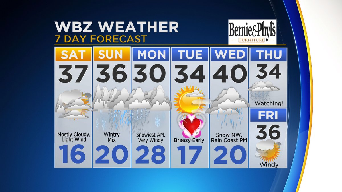
SATURDAY: Snow tapers off in the morning, around 3″ in Westford…some sun late in the day, highs in the 30s.
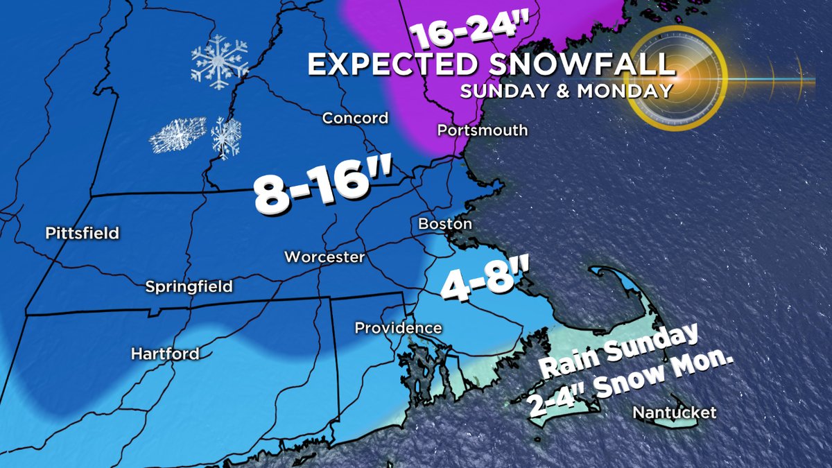
SUNDAY: Snow develops by Noon…steady and heavy at times through the afternoon and night…rain mixes in near the coastline but likely not in Westford.
MONDAY: Snow continues and the wind picks up significantly as the storm deepens just offshore…bands of snow through the day with wind gusts over 40mph at times, stronger at the coast. Total accumulation in Westford likely to be 12-18″ with blowing and drifting on Monday.
Click here for Westford snow storm data and past totals or select “Winter Snowfall“ under “Pages” on the left hand side.
For more up to date forecast information follow me on Twitter (@terrywbz) or follow the WBZ weather team on Facebook, search WBZWeather
Do you think warm(er) air will wrap around this system, penetrate all the way west to Westford, limiting our snow totals? What is second bombogenisis in four days?
Al
No I doubt it…I think Westford stays all snow with this one…solid 12-18″ likely. Not uncommon to get in one of these patterns and get 2 or 3 powerful storms bombing out in a row…this may not be the last one!
Oh I hope it’s not the last. I’ve been an amateur weather watcher for well over 50 years. Love this stuff.